GRAVÜR DÜNYASI
Digital Engraving Library
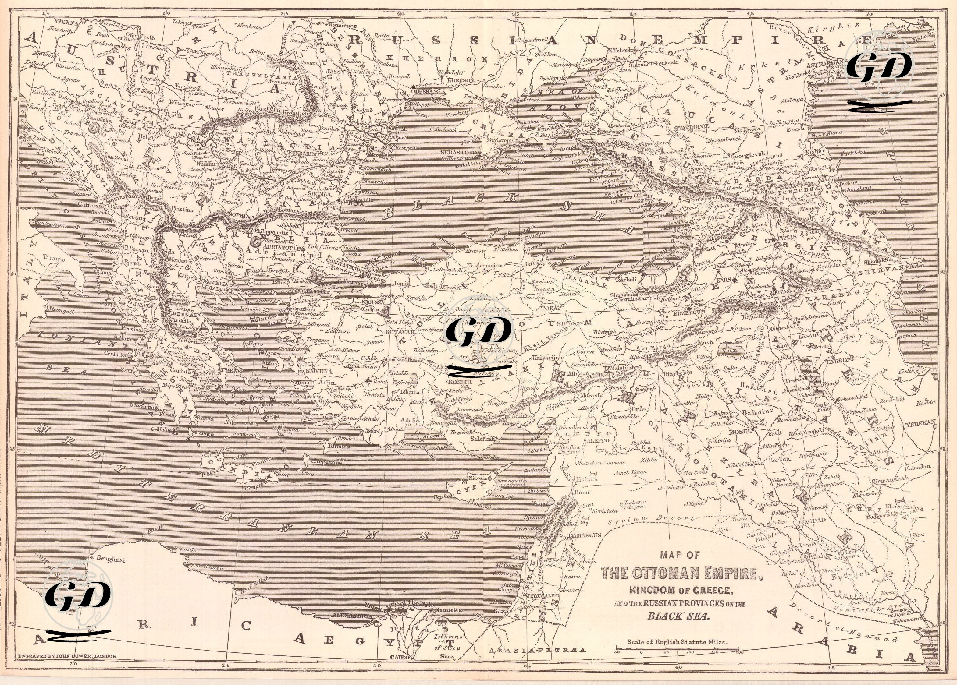
| Engraver | John James Dower (1825-1901) |
| Date | 1877 |
| Technique | Woodblock Engraving (Newspaper-Text on Reverse) |
| Category | Maps |
| Source | The İllustrated London News (April 21 1877) |
This map and the accompanying newspaper article were prepared to help understand the political atmosphere immediately before the 1877–1878 Ottoman–Russian War, the geographical and ethnic structure of the Ottoman Empire, and the crisis in Ottoman–Russian relations. The map shows the vast geography covered by the Ottoman Empire in the last quarter of the 19th century and the borders of neighboring powers. It covers a wide area from the Adriatic coast (Albania, Bosnia) in the west, to Iran and the Caspian Sea in the east, from the southern provinces of Russia and the Black Sea in the north, to the Arabian deserts, the Sinai Peninsula and Egypt in the south. The Black Sea and its surroundings, which were the focal point of Ottoman–Russian tension, are shown in detail, especially with strategic ports (Istanbul, Sevastopol, Batum, Trabzon, etc.) and river routes.