GRAVÜR DÜNYASI
Digital Engraving Library
| Date | 1907 |
| Technique | Chromolithograph |
| Category | Maps |
| Source | The London Geographical Institute, London; Published by The Amalgamated Press Ltd. |
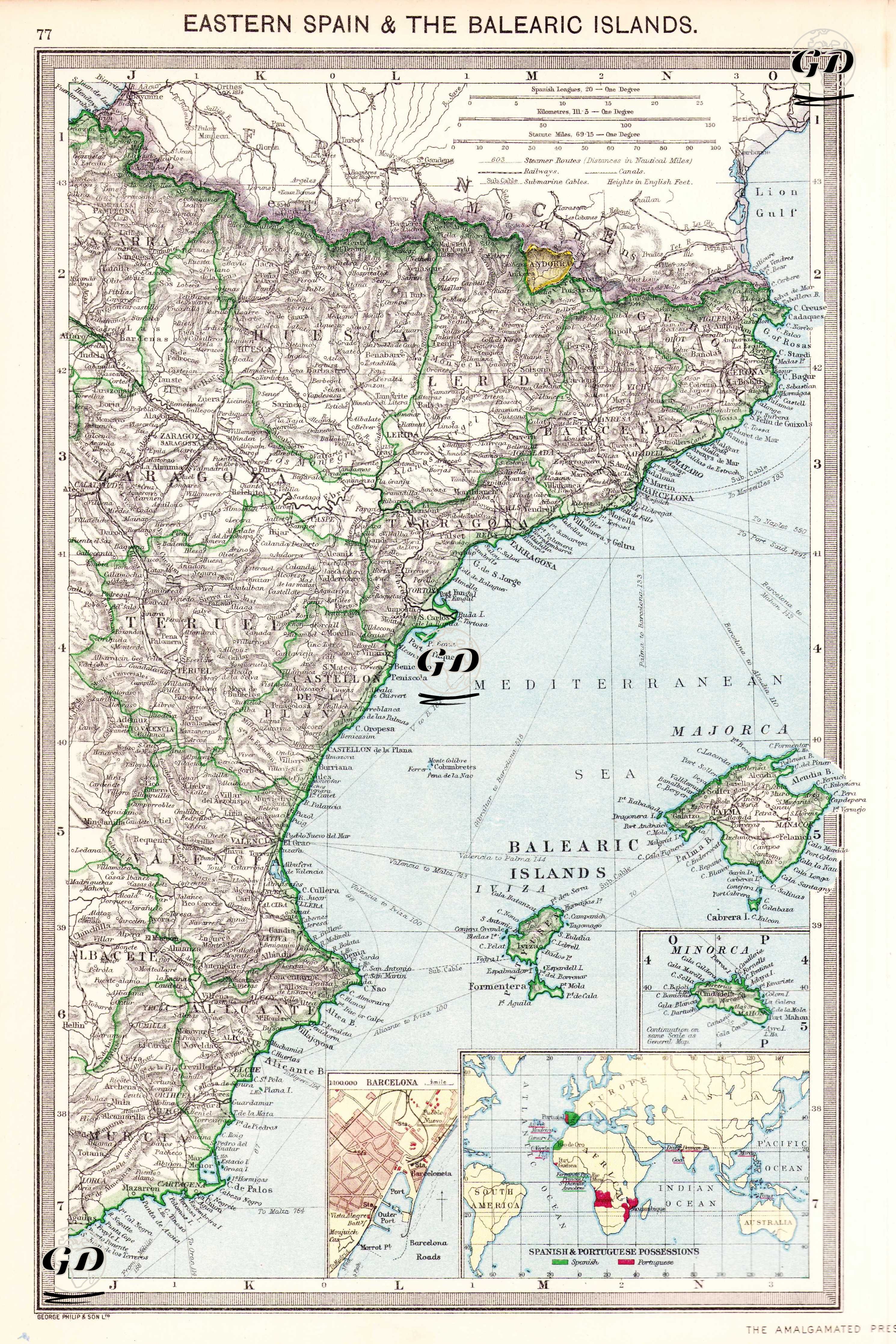
This map provides a detailed view of Eastern Spain and the Balearic Islands. The map's coverage extends from Barcelona in the north to the coast of Algeria in the south, while the Balearic Islands of Spain in the Mediterranean (Mallorca, Menorca, Ibiza, Formentera) are also included in the east. Valencia, Murcia and Catalonia, located on the eastern coastline of the Iberian Peninsula, are shown in detail. The city plan of Barcelona is in the upper right corner of the map, while the Spanish and Portuguese colonies and overseas territories are shown in small boxes in the upper left corner. Coastlines and important geographical points are carefully drawn, and political boundaries are highlighted in green.