GRAVÜR DÜNYASI
Digital Engraving Library
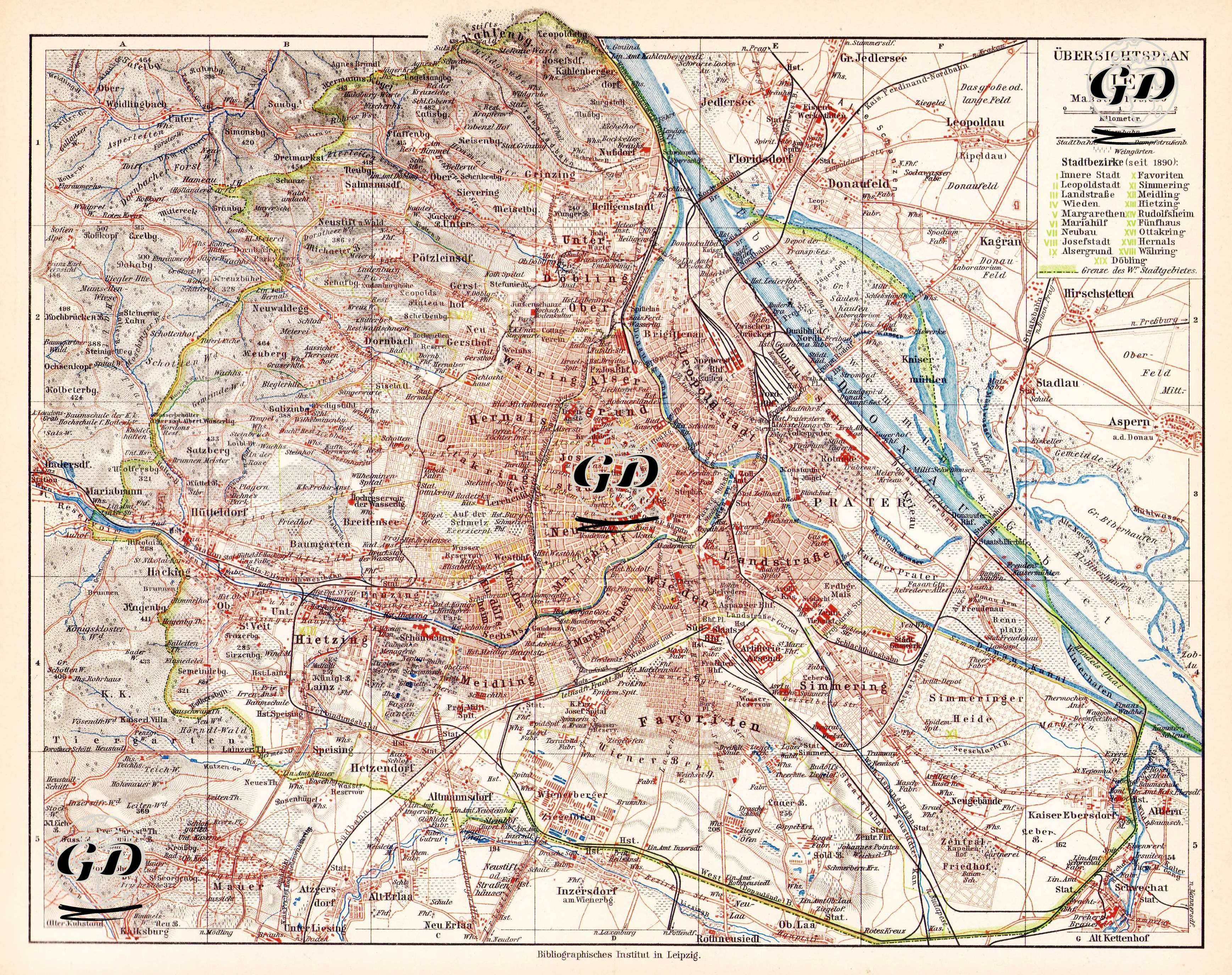
| Date | 1895 |
| Technique | Chromolithograph |
| Category | Maps |
| Source | Meyers Konversations-Lexikon, 5. Auflage - Bibliographisches Institut in Leipzig |
This map shows a detailed city plan of Vienna, the capital of Habsburg Austria in the late 19th century. The map is at a scale of 1:75,000. The inner districts of Vienna (especially Innere Stadt) are colored red, the suburbs (e.g. Favoriten, Floridsdorf, Ottakring, Simmering, Döbling) are colored, and a large metropolitan area extending beyond the city limits is shown. In the upper right corner, the 19 administrative districts (Bezirk) of Vienna at the end of the 19th century are listed by color. Notable structures on the map include: the Prater recreation area, the Donau (Danube River) and its tributaries (e.g. Donaukanal), railway lines (especially those to the west, southeast and north), and large parks and cemeteries. In addition, the transportation network, railway stations, tunnels, bridges and military installations are shown in detail, providing a wealth of information about the city's infrastructure and transportation planning of the period. This map is a valuable resource for research on historical geography, urban planning, transportation history and the socio-spatial structure of Habsburg-era Vienna.