GRAVÜR DÜNYASI
Digital Engraving Library
| Date | 1895 |
| Technique | Chromolithograph |
| Category | Maps |
| Source | Meyers Konversations-Lexikon, 5. Auflage - Bibliographisches Institut in Leipzig |
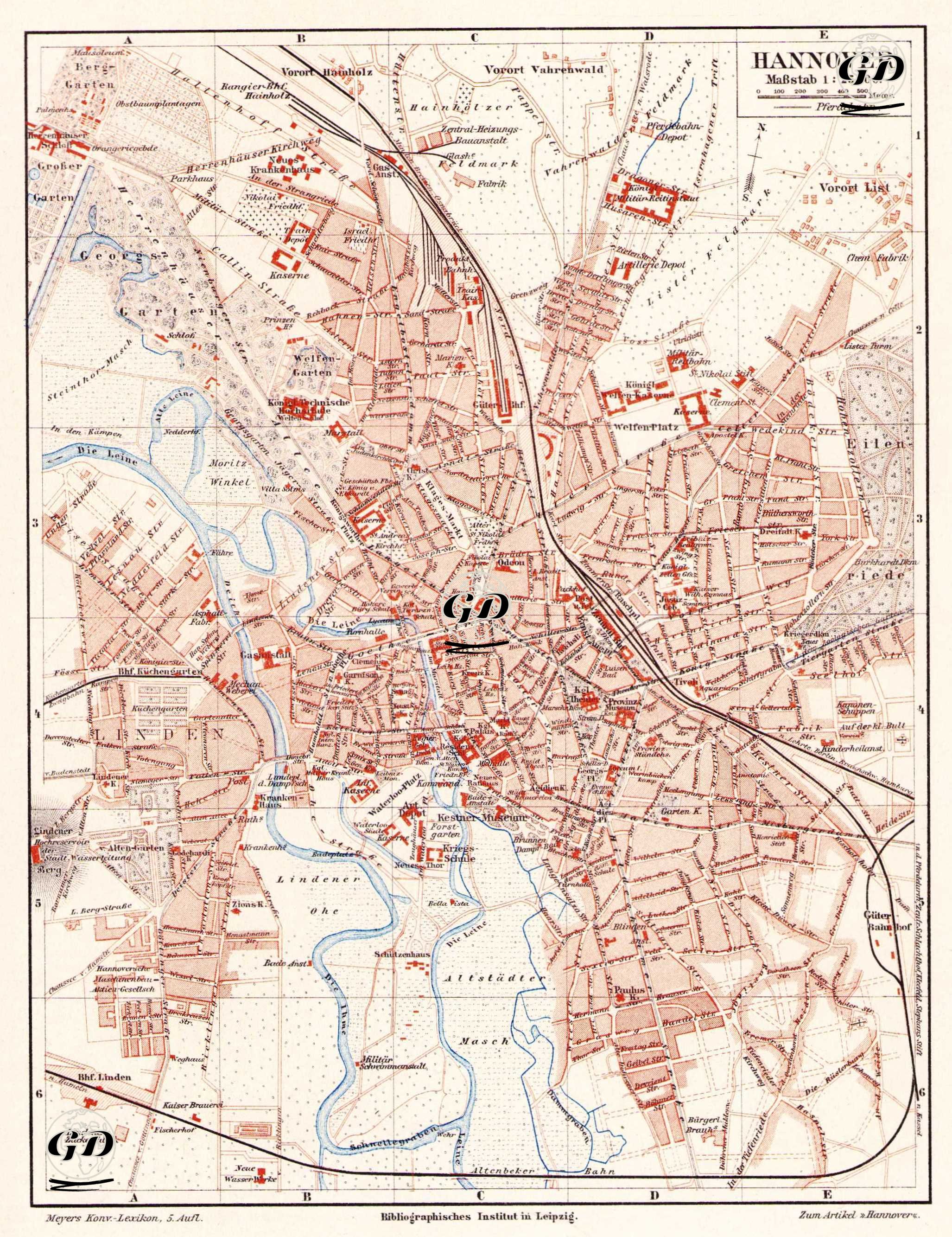
his map is a detailed city plan of the city of Hanover in Lower Saxony (Niedersachsen), Germany. The map is to a scale of 1:25,000, meaning that every 1 cm of the map corresponds to 250 meters in real life. The central structure of Hanover is shown in detail on the map, with important public buildings such as railway stations (e.g. Bhf Linden and Bhf Hannover), churches, school buildings, theaters, military barracks (e.g. Artillerie Kaserne) marked in red. The Leine River and city canals run as blue-toned waterways to the west and south of the map. The districts and neighborhoods ("Vorort" = suburbs) on the map are also noteworthy: Outlying residential areas such as Vorort Vahrenwald, Vorort List, Vorort Hainholz show the urbanization limits of the period and the growth directions of Hanover. The map also provides information on industrial areas, railways (Verkehrsbahn) and green areas (e.g. Eilenriede forest). This map is a valuable source for urban history, transport infrastructure, topography, urban planning and urban development in Germany in the late 19th century.