GRAVÜR DÜNYASI
Digital Engraving Library
| Artist | Alexandre Vuillemin (1812–1880) |
| Date | 1878 |
| Technique | Lithography-Colored |
| Category | Maps |
| Source | London: Virtue & Co. Limited. |
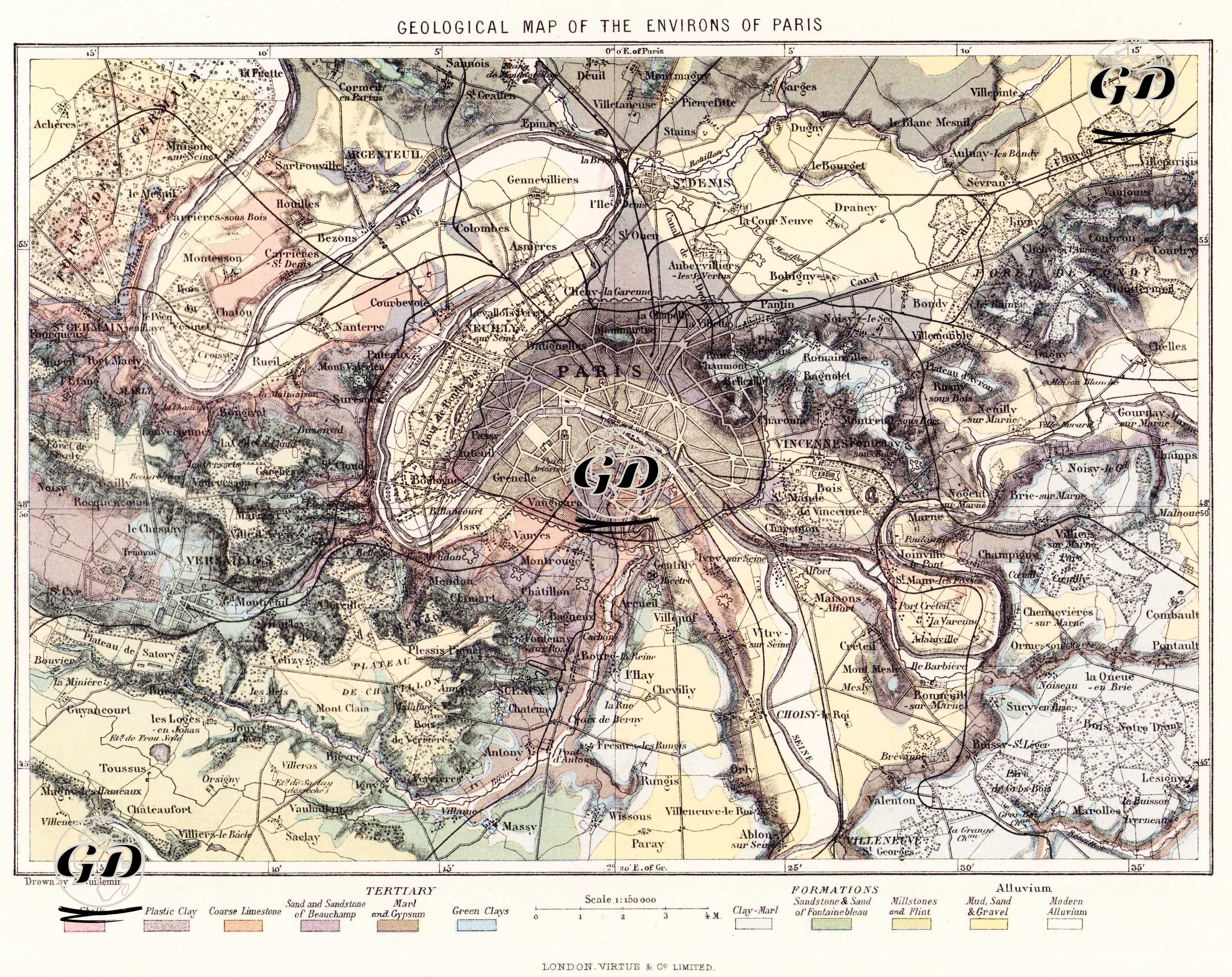
This map shows the geological structure of Paris and surrounding areas in a layered and color-coded format. The geological classification is indicated under the color codes and formations heading at the bottom of the map. The colors indicate different soil types such as chalk, plastic clay, sandstone and gravel, marble and gypsum, and modern alluvium. These soil types provide a detailed explanation of the geological layers underlying the different settlements around Paris. The map also schematically reflects the Seine River, which flows through the center of Paris, and the topographic formations surrounding it, as well as the elevation differences of the region. Many of the modern settlements are marked on the map: Versailles, Vincennes, Saint-Denis, Montmorency, Boulogne, Choisy-le-Roi, etc. Such maps were of great importance in terms of urban planning, mining, and engineering applications, especially in the 19th century. They were also used in geology education and natural resource research.