GRAVÜR DÜNYASI
Digital Engraving Library
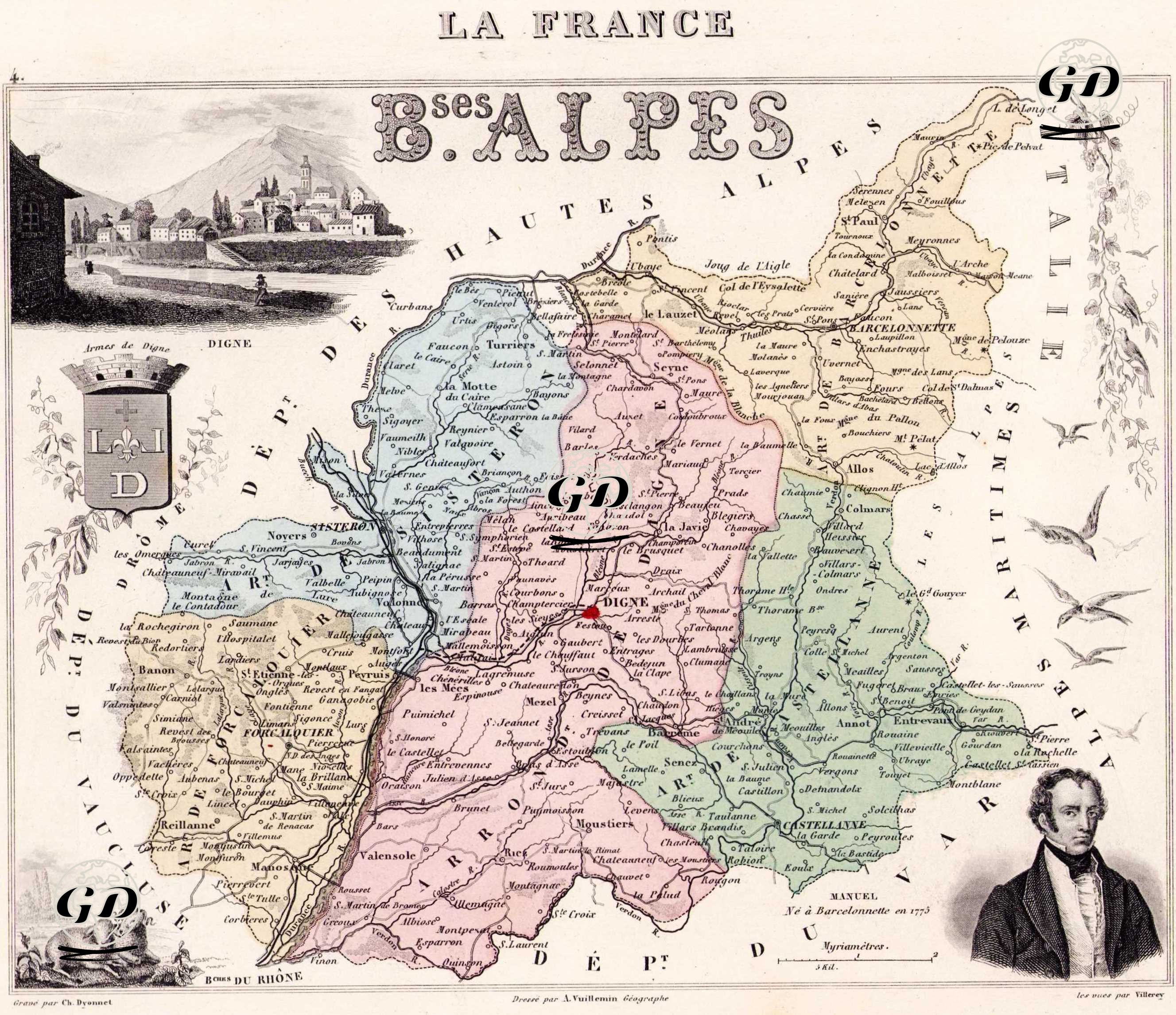
| Artist | Alexandre Vuillemin (1812–1880) |
| Engraver | Charles Dyonnet (1822-1880) |
| Date | 1858 |
| Technique | Steel Engraving-Original Hand Colored |
| Category | Maps |
| Source | La France et ses Colonies: Atlas illustré cent cartes dressées d’après les cartes de Cassini, du Dépot de la guerre, des Ponts-et-chaussées et de la Marine par Vuillemin. Texte redigé d’après les documents officiels et sur un plan entièrement nouveau. - Vuillemin, Atlas Départemental de la France, Paris |
This is an artistic and detailed regional map published in the 19th century showing the department of "Basses-Alpes" (now Alpes-de-Haute-Provence) in southeastern France. The title reads "La France – Bses Alpes" and the borders of "Hautes Alpes" are shown at the top of the map and "Italie – États Sardes" are shown on the right. The city of Digne, highlighted in red in the center of the map, is marked as the administrative center (préfecture) of the department. In the upper left corner there is a small view of the city of Digne, with the letters "L. D." and a lion figure from the Digne coat of arms just below. In the lower right corner there is a portrait of Emmanuel Joseph Sieyes (1748-1836), a French writer and clergyman born in Frejus. The map is not only geographical, but also artistic and cultural. Mountains, rivers, roads and commune borders are drawn in detail; The districts (arrondissement) are separated with different color tones. It is an atlas piece that reflects the administrative and natural geography of France in the 19th century and is also decorated with engraving art.