GRAVÜR DÜNYASI
Digital Engraving Library
| Artist | John Rapkin(1815-1876) |
| Engraver | John Rapkin (1815-1876) |
| Date | 1860 |
| Technique | Steel Engraving-Original Hand Colored |
| Category | Maps |
| Source | The Illustrated Atlas, and Modern History of the World - The London Printing and Publishing Company, London |
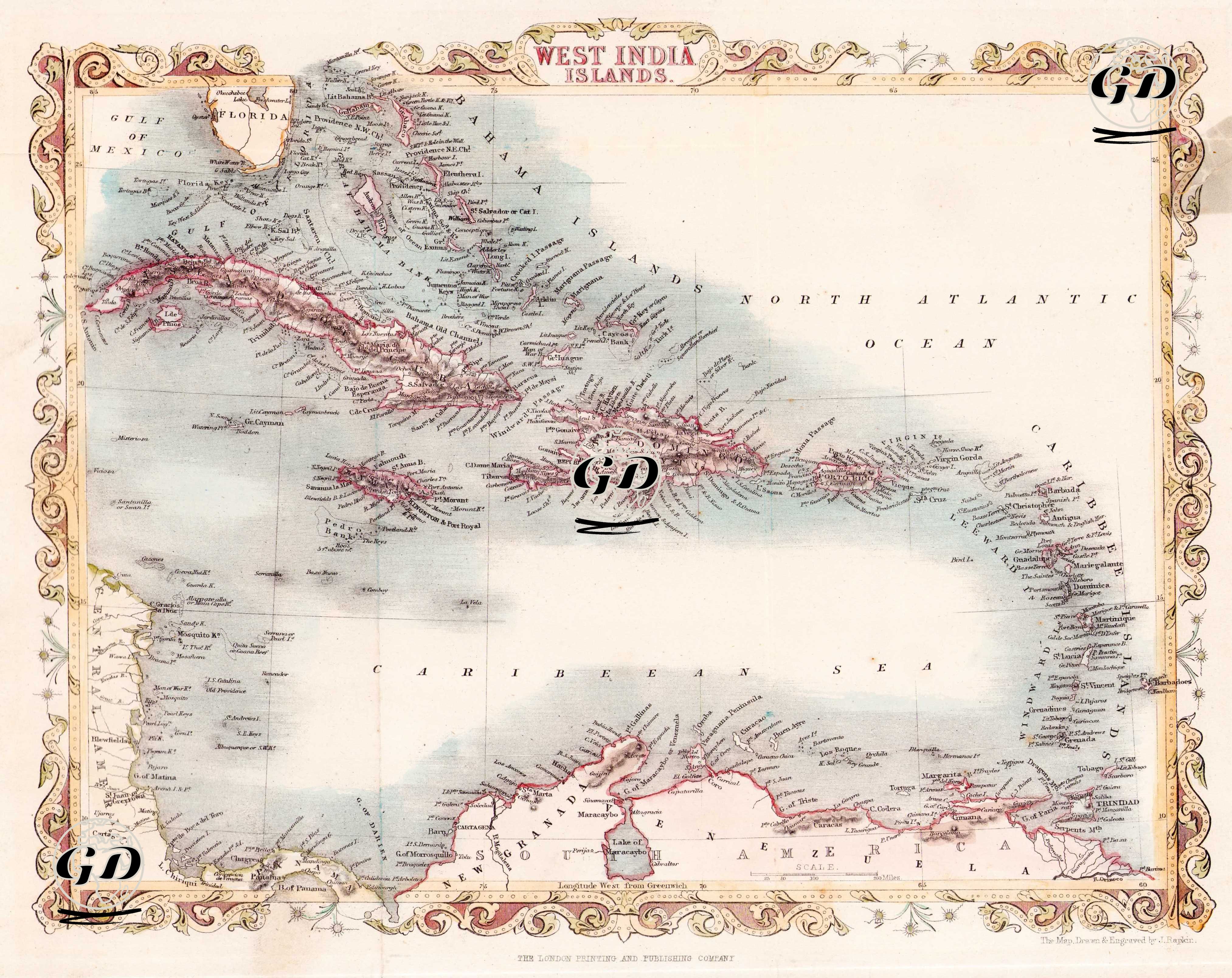
This mid-19th century map shows the Greater Antilles and Lesser Antilles in the Caribbean in detail. It includes large islands such as Cuba, Jamaica, Hispaniola (Haiti and the Dominican Republic), and Puerto Rico, as well as many smaller islands. The map also includes Florida from North America, and the coasts of Venezuela and Colombia from South America. Geographically, the locations of the islands in both the Caribbean Sea and the Atlantic Ocean are indicated with their names and important port cities; particularly, the settlement areas influenced by the colonial European powers (England, Spain, France, and the Netherlands) are emphasized. The map is a rich and aesthetic document reflecting the geographic-political structure of the Caribbean during the colonial era. The drawing style is typical of the ornamental atlas engraving movement that became popular in the mid-19th century.