GRAVÜR DÜNYASI
Digital Engraving Library
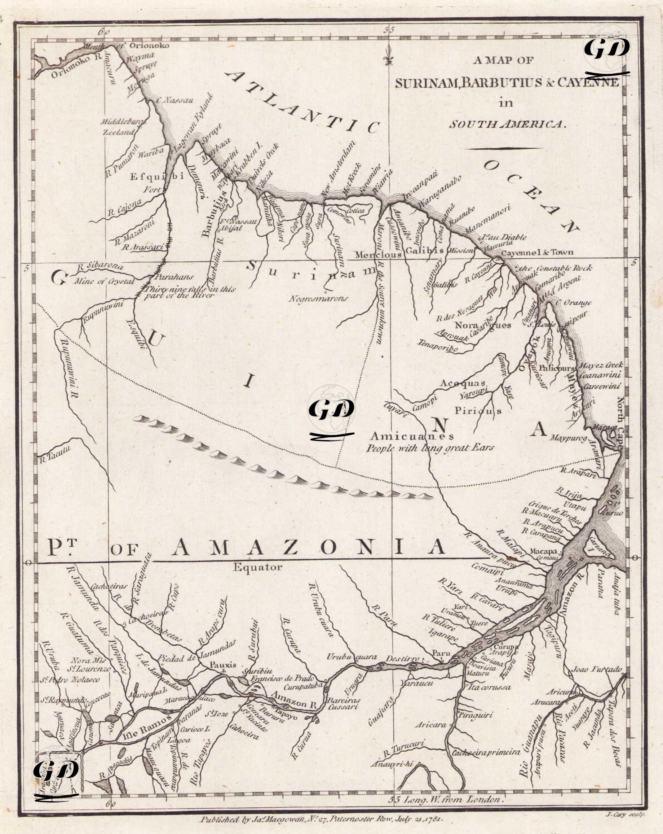
| Artist | John Cary (1754-1835) |
| Engraver | John Cary (1754-1835) |
| Date | 1781 |
| Technique | Copper Engraving |
| Category | Maps |
| Source | Published by Jas. Magowan, No. 27, Paternoster Row, July 21, 1781 |
This 18th-century map covers the northeastern regions of South America, including Suriname (former Dutch Guiana), Cayenne (French Guiana), Guyana, and parts of the Amazon Basin. It also includes the eastern branches of the Amazon River and the vast tropical forest area known as the "Pt of Amazonia" in the southern part of this geography. Ethnographic descriptions such as "Amicuanes - People with Long great Ears" also include periodic comments by European observers on indigenous communities. Markings such as "Mine of Crystal" also indicate the period's interest in natural resources. The map is an important example of the efforts of colonial powers of the period to map the rivers providing access to the interior, mineral resources, and areas where indigenous peoples lived.