GRAVÜR DÜNYASI
Digital Engraving Library
| Date | 1890's |
| Technique | Lithography-Colored |
| Category | Maps |
| Source | William Collins, Sons & Co.London & Glasgow |
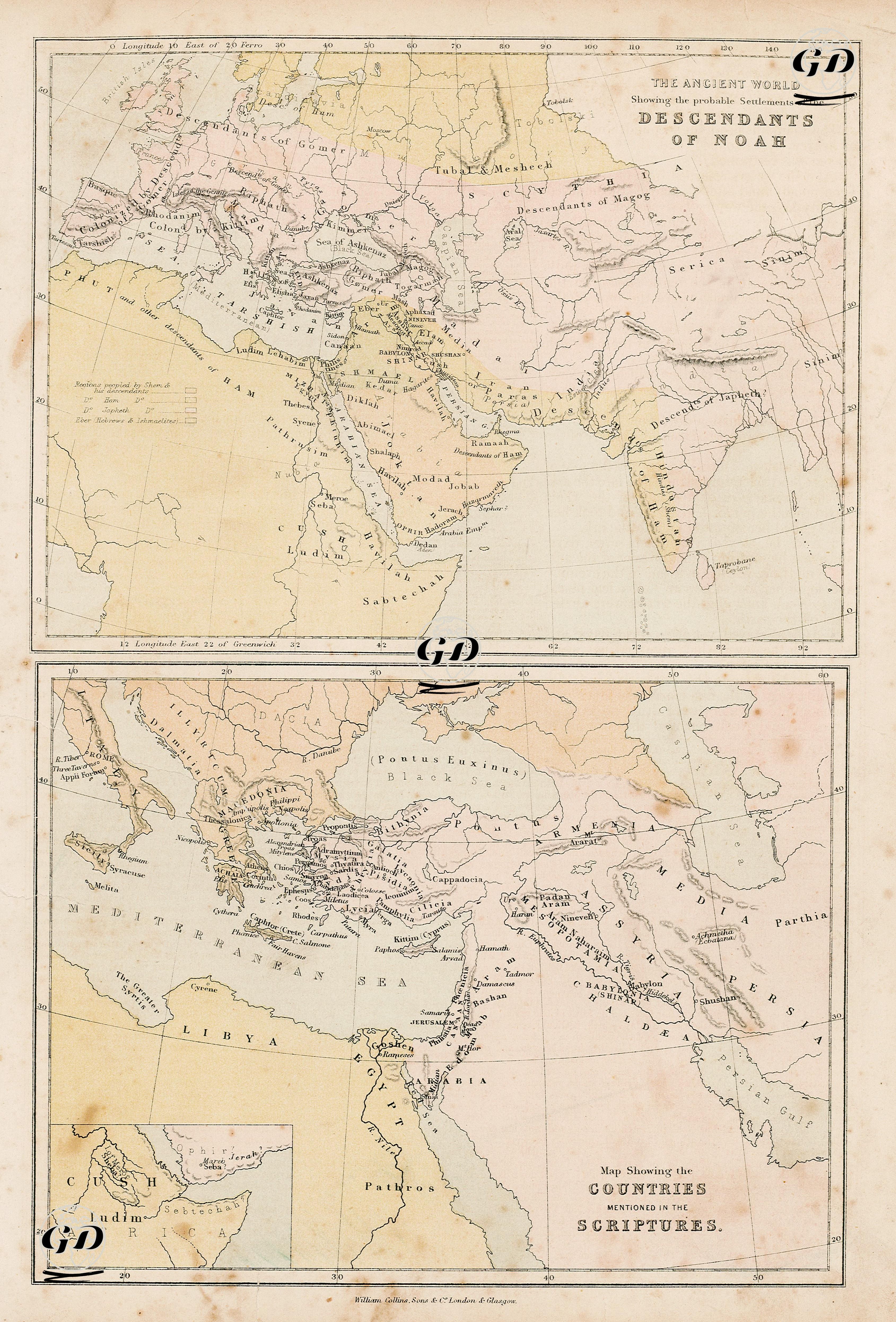
This double-panel map is a characteristic example of 19th-century Bible atlases published in the West, serving as a didactic and theological work that aims to place the narratives of the Holy Scriptures within a geographical context. The upper map illustrates the dispersion of the nations descended from Noah’s three sons—Shem, Ham, and Japheth—based on the “Table of Nations” in Genesis 10. According to this passage, the descendants of Japheth settled in Europe and northern Anatolia, the line of Shem occupied Mesopotamia, Iran, and the Arabian Peninsula, while Ham’s descendants were located in Egypt, Canaan, and parts of North and East Africa. The lower map, titled “Map Showing the Countries Mentioned in the Scriptures,” presents the geographical equivalents of the cities, regions, and civilizations referenced throughout the Old and New Testaments. It details countries and territories frequently mentioned in the sacred texts—such as Palestine, Canaan, Egypt, Assyria, Babylon, Phoenicia, Edom, Moab, and Aram—while also marking major theological, political, and cultural centers including Jerusalem, Damascus, Nineveh, Shushan, Tarsus, Ephesus, Rome, and Athens. A small inset map in the lower-left corner serves as a complementary feature, depicting the Ethiopia-centered land of “Kush,” including regions such as Havilah, Shur, Seba, and Raamah. Together, these two maps reflect 19th-century European interpretations of sacred history—both theological and ethnographic—as seen through the lens of biblical geography. While their scientific accuracy may be questioned today in light of modern historical and archaeological scholarship, these maps remain valuable for understanding the Western religious worldview, missionary strategies, and the religious-topographic imagination of their time.