GRAVÜR DÜNYASI
Digital Engraving Library
| Artist | Robert Walker |
| Engraver | Robert Walker |
| Date | 1815 |
| Technique | Copper Engraving |
| Category | Maps |
| Source | Published By Alexander Cumming in Leeds |
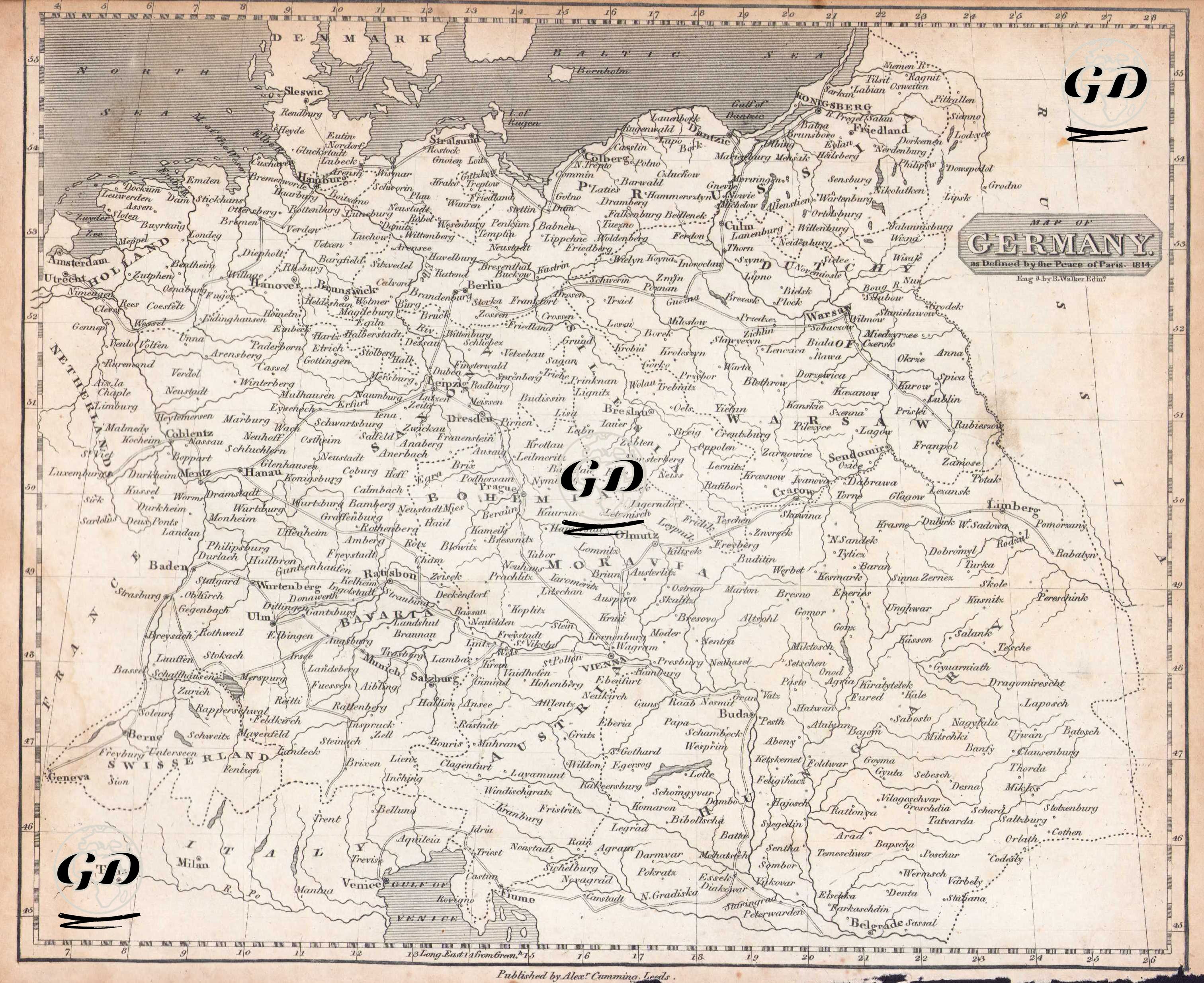
This map is a political map showing the borders of Germany according to the Treaty of Paris of 1815 and has the title "Germany as Defined by the Peace of Paris 1815" in the upper right corner. However, the map is directly related to the Congress of Vienna process, which reshaped Europe after the Napoleonic Wars. At the Congress of Vienna (June 1815), 39 German states were brought together to form the German Confederation (Deutscher Bund). The aim of this confederation was to provide common defense against French expansion and to create a kind of union among the German states. The Main States Included in the German Confederation; Prussia, Austria (with German-speaking lands), Kingdom of Bavaria, Kingdom of Saxony, Kingdom of Württemberg, Baden, Hessen, Nassau, Hanover, Holstein, Mecklenburg, etc. The borders of the German Confederation extended to the west of Poland in the east, to the French border in the west, to Switzerland and Austria in the south, and to Denmark in the north. This makes it clear that the map represents the period of the German Confederation, which was the legacy of the Holy Roman Empire. This engraving, which reflects the process of reshaping the borders of Europe, also depicts the fragmented structure of Germany before unification and the political disarray that would continue until the mid-19th century. It is a valuable document for those interested in European history and cartography.