GRAVÜR DÜNYASI
Digital Engraving Library
| Artist | John Rapkin(1815-1876) |
| Engraver | John Rapkin (1815-1876) |
| Date | 1860 |
| Technique | Steel engraving |
| Category | Maps |
| Source | The Illustrated Atlas, and Modern History of the World (The maps were re-issued by the London Printing and Publishing Co. London and New York in 1860.) |
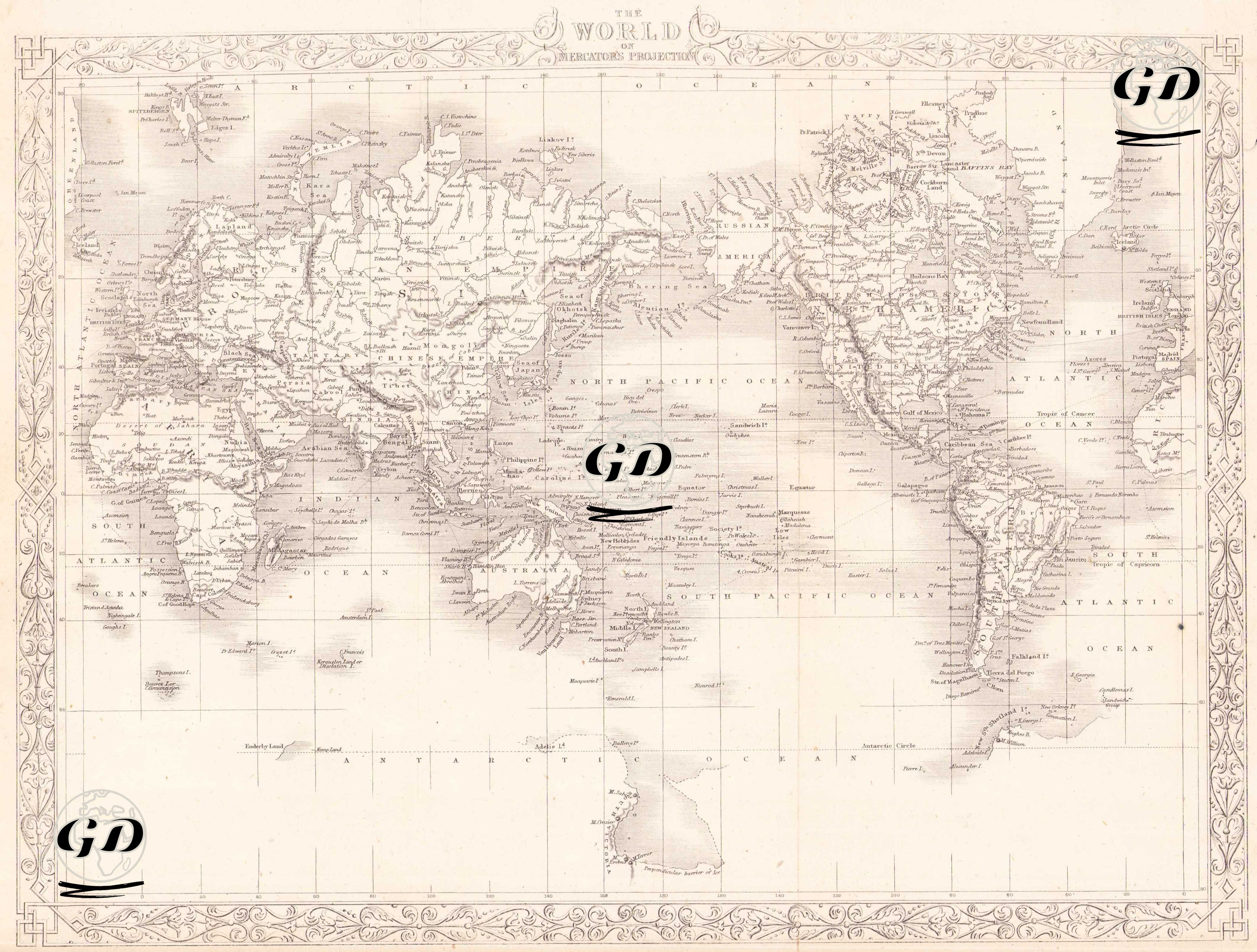
his world map is defined with the title "The World on Mercator's Projection" at the top and was drawn in the mid-19th century. This map reflects a world view focused on seafaring and exploration using the Mercator projection (a plane map projection developed by Flemish cartographer Gerardus Mercator in 1569 and used especially in navigation because it facilitates route drawing) that was widespread at the time. The map reflects the European-centered world perception of the period and the maritime-focused information system of the British Empire. While the continents, countries and major cities are shown in detail, it is observed that more intensive information is given especially in regions such as Europe, North America and Western Asia. On the other hand, information is more limited in areas such as the interior of Africa, the Amazon forest and the center of Australia, which indicates the level of exploration of the period. The richly ornamented borders surrounding the map give the map both an aesthetic and periodic character.