GRAVÜR DÜNYASI
Digital Engraving Library
| Artist | John Rapkin(1815-1876) |
| Engraver | John Rapkin (1815-1876) |
| Date | 1850's |
| Technique | Steel engraving |
| Category | Maps |
| Source | The Illustrated Atlas, and Modern History of the World |
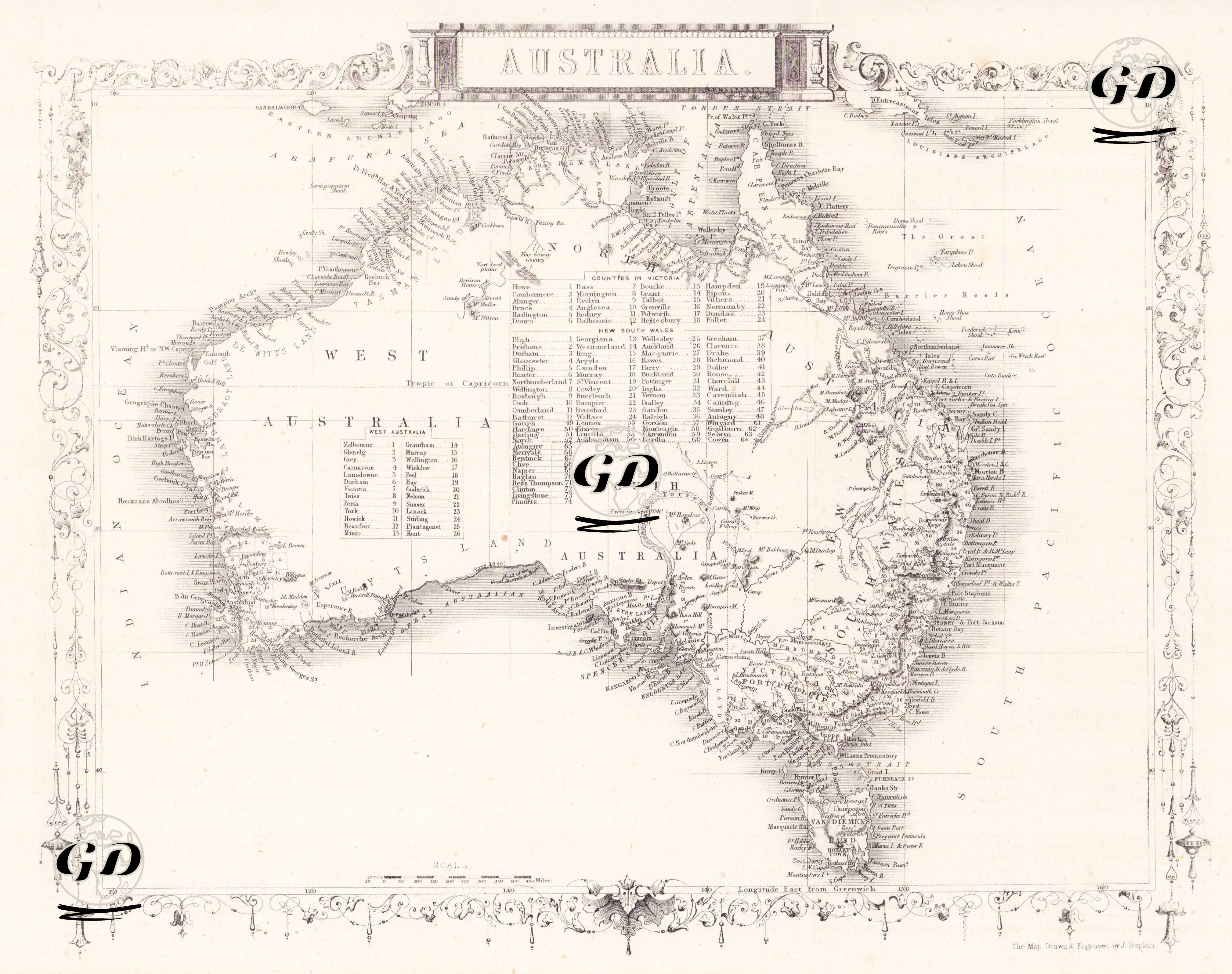
The map reflects the geographical knowledge of the Australian continent during the colonial period, showing basic regional divisions such as New South Wales, South Australia, Western Australia and Van Diemen's Land (today Tasmania). At the same time, the list of "counties" in these states is detailed in a table in the middle of the map. While the map provides detailed settlement names, especially along the coastline, the lack of geographical information in the interior regions is striking. This situation shows that European cartographers of the period had limited knowledge of the interior of Australia and that the map documents a geography "in the process of discovery". This work, which also draws attention with its decorative border decorations, is both an aesthetic and historical document. It is an important document in terms of showing the structure of Australia before it became a unified federation.