GRAVÜR DÜNYASI
Digital Engraving Library
| Artist | John Rapkin(1815-1876) |
| Engraver | John Rapkin (1815-1876) |
| Date | 1850's |
| Technique | Steel engraving |
| Category | Maps |
| Source | The Illustrated Atlas, and Modern History of the World |
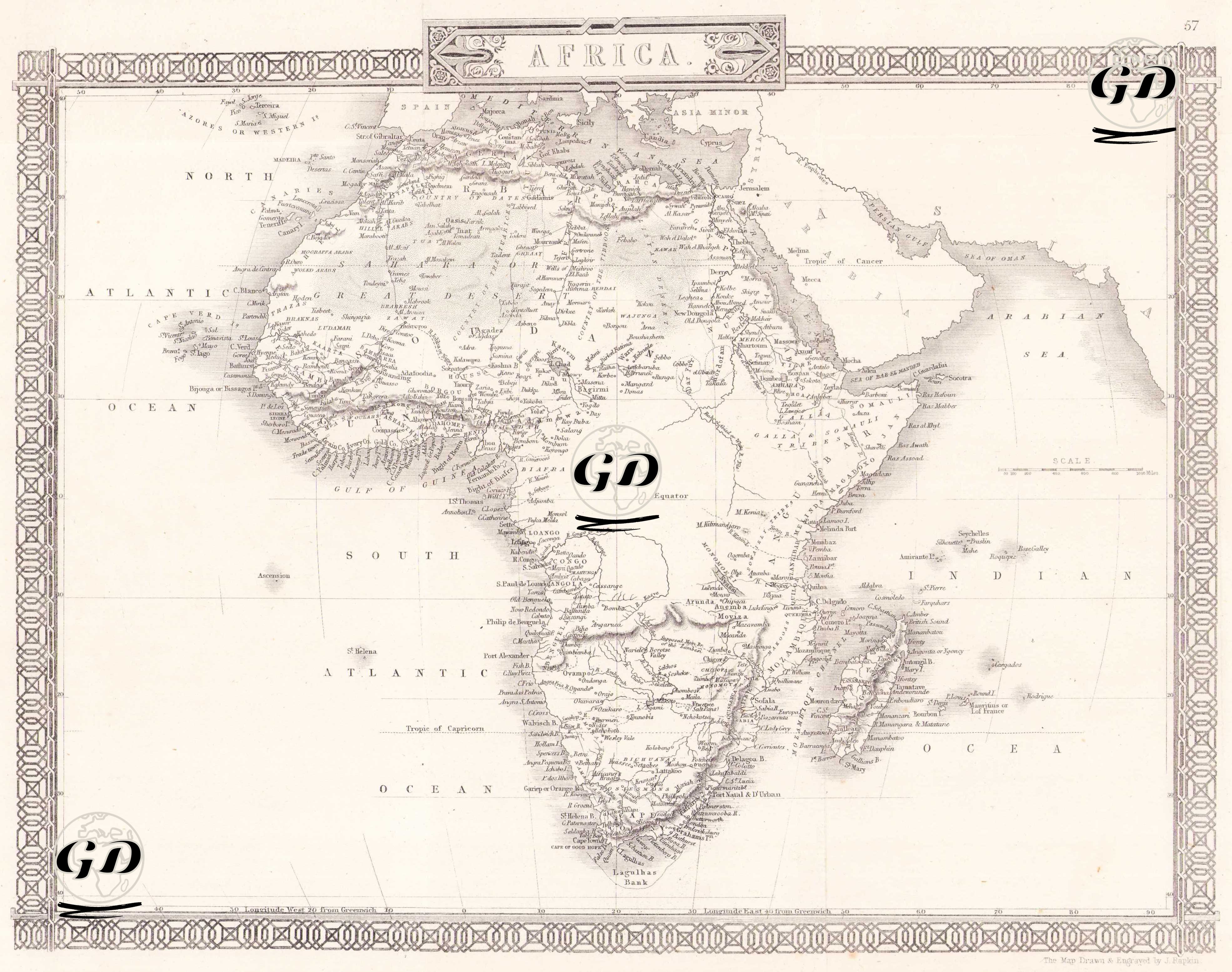
The map reflects the general geographical appearance of the African continent, especially during the period when European colonial interest increased, and especially the coastal regions and major river systems are detailed. Although the term "Unexplored Regions" is not directly written on the map, the sparseness of place names, the vagueness of borders and geographical gaps, especially in Central Africa (today's Congo, South Sudan, the Central African Republic), show that these regions were still undiscovered and unmapped at that time, and therefore European colonialism had not yet fully penetrated the interior of the continent. Geographically, the map covers the entire continent, from the trade centers on the west coast of Africa to the shores of Zanzibar in the east, from Libya and Egypt under Ottoman influence in the north to the regions under Portuguese and Dutch influence in the south. The map highlights the names of local kingdoms such as "Ashantee", "Yoruba" and "Benin" in West Africa, as well as regions such as Congo, Zambezi and Abyssinia. On the East African coast, ports known for seafaring and trade are noteworthy.