GRAVÜR DÜNYASI
Digital Engraving Library
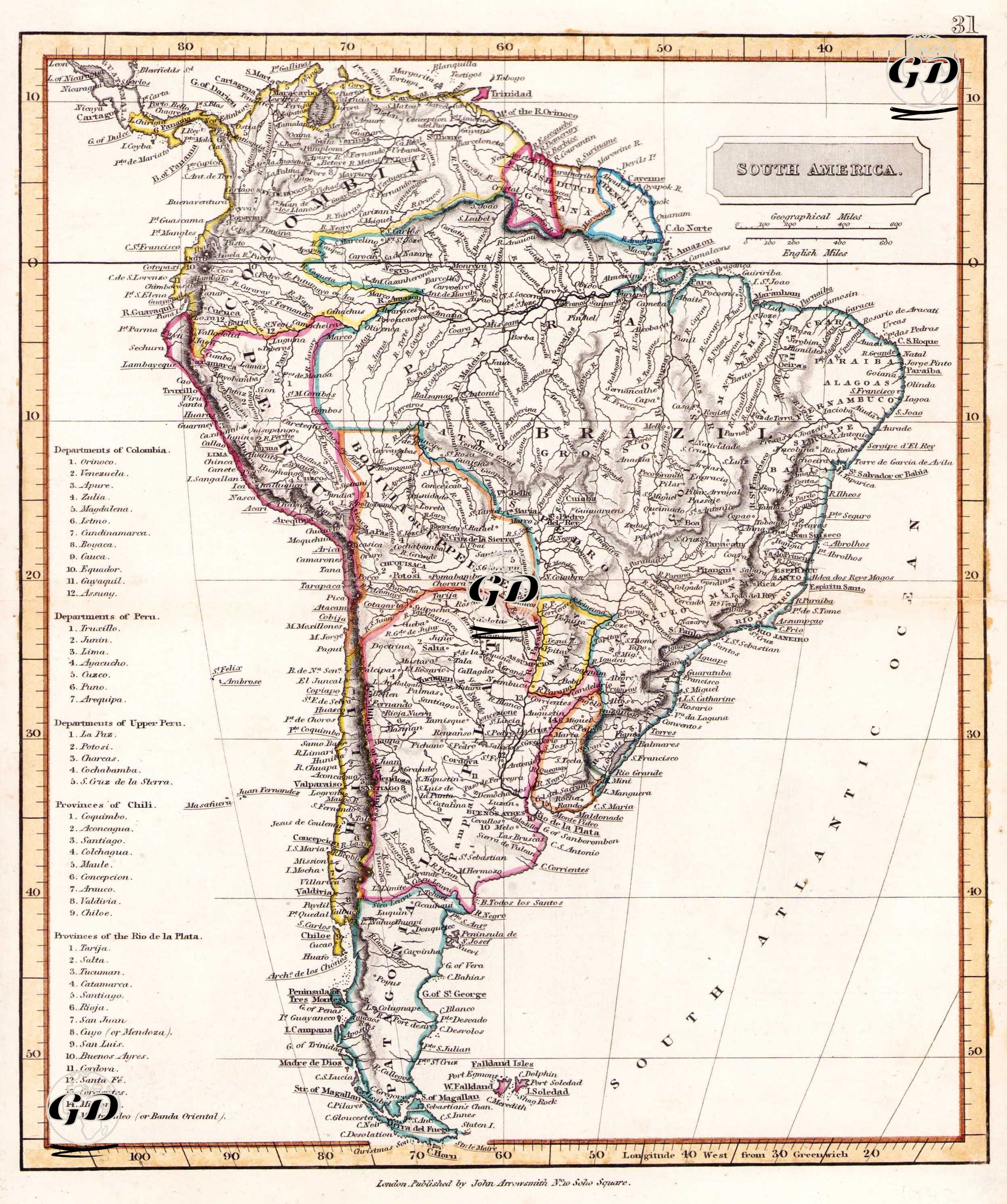
| Artist | John Arrowsmith (1790-1873) |
| Date | 1842 |
| Technique | Copper Engraving-Original Hand Colored |
| Category | Maps |
| Source | A Comparative Atlas of Ancient and Modern Geography, for the Use of Schools. Compiled from Original Authorities and containing the latest Discoveries by John Arrowsmith. - London, Published by John Arrowsmith, No.10 Soho Square |
This map was published in London in 1842 by John Arrowsmith and reflects the political, geographical and administrative situation of the South American continent in the first half of the 19th century. The map is a document documenting the borders and internal divisions of the new republics that emerged after Latin America was liberated from Spanish colonialism. The list on the left side of the map sheds light on the administrative structure of the young nation-states by showing in detail the departments and states in the regions of Colombia, Peru, Upper Peru (Bolivia), Chile and Rio de la Plata. While the new political structures that emerged after the dissolution of Gran Colombia can be traced on the map, Brazil was defined as an Empire with its independence declared in 1822. Countries such as Argentina, Uruguay, Paraguay and Chile are presented as structures that have not yet fully stabilized their borders and are shaped by internal conflicts and regional disputes. Important geographical regions such as the Amazon Basin, the Andes, Patagonia and Gran Chaco are depicted in detail on the map; coastal cities, rivers and mountain ranges are carefully processed. In this context, this map from 1842 is not only a geopolitical document but also a source reflecting the development of national borders, economic centers and administrative divisions of post-colonial South America.