GRAVÜR DÜNYASI
Digital Engraving Library
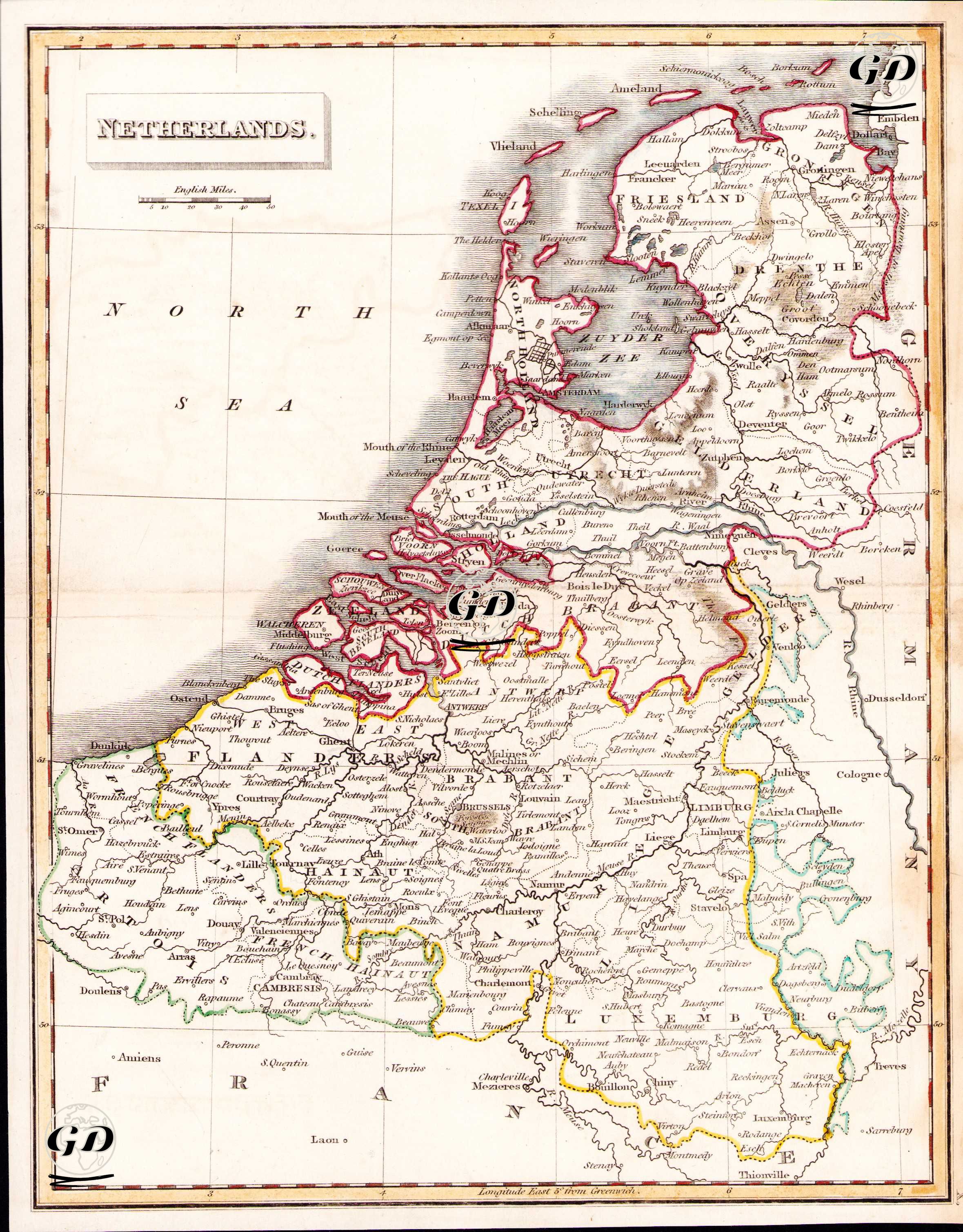
| Artist | J.C.Russell |
| Engraver | J.C.Russell |
| Date | 1822 |
| Technique | Copper Engraving-Original Hand Colored |
| Category | Maps |
The map shows in detail the political unity and geographical structure of the United Kingdom of the Netherlands, which was established after the Congress of Vienna in 1815, during a period when Europe was being reorganized after the Napoleonic Wars, and which would last until the Belgian Revolution in 1830. The map covers not only today's Netherlands, but also Belgium, which had not yet gained its independence, Luxembourg, the northeast of France, and the western borders of Germany. Historical regions such as North and South Holland, Brabant, Flanders, Liège, and Namur are clearly demarcated; port cities such as Amsterdam, Rotterdam, and Antwerp, as well as natural waterways such as the Rhine River and the Zuider Zee, are detailed.