GRAVÜR DÜNYASI
Digital Engraving Library
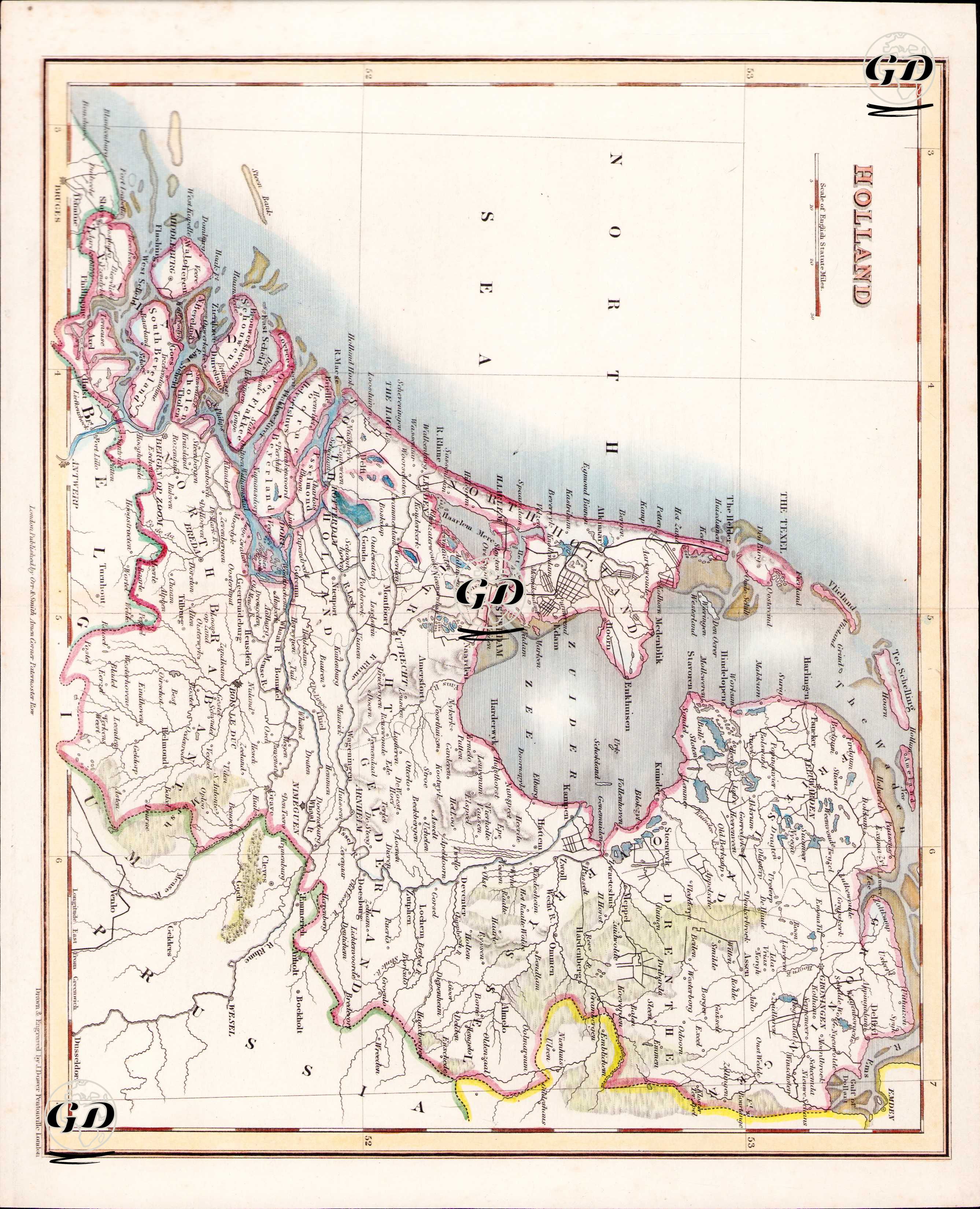
| Artist | John Crane Dower (1791-1847) |
| Engraver | John Crane Dower (1791-1847) |
| Date | 1832 |
| Technique | Copper Engraving-Original Hand Colored |
| Category | Maps |
| Source | A General Descriptive Atlas Of The Earth, Containing Separate Maps Of The Various Countries And States, From Original Drawings By John Dower and W.M. Higgins - London, Published by Orr & Smith Amen Corner Paternoster Row |
This map shows the current territory of the Kingdom of the Netherlands after the United Kingdom of the Netherlands declared independence in 1830, i.e. after Belgium declared its independence. In the north; Friesland, Groningen, in the south; Zeeland, Brabant, in the east; Overijssel on the German border, Gelderland and in the west; the North Sea and Texel Island. The geography of the Netherlands is read especially through low-lying lands, coastal lagoons, marshlands and man-made channels. The inland sea shown as Zuyder Zee (Zuiderzee) on the map was closed with the Afsluitdijk dam in the 20th century and turned into Lake IJsselmeer. The large river systems in the west of the country (especially the Rhine (Rijn), Maas (Meuse) and Schelde) are of economic and strategic importance. While cities such as Amsterdam, Rotterdam, Utrecht and The Hague stand out for their trade routes and port connections, the map also reflects the military fortification systems and water management infrastructure (dykes, polders, winding river branches) of the period.