GRAVÜR DÜNYASI
Digital Engraving Library
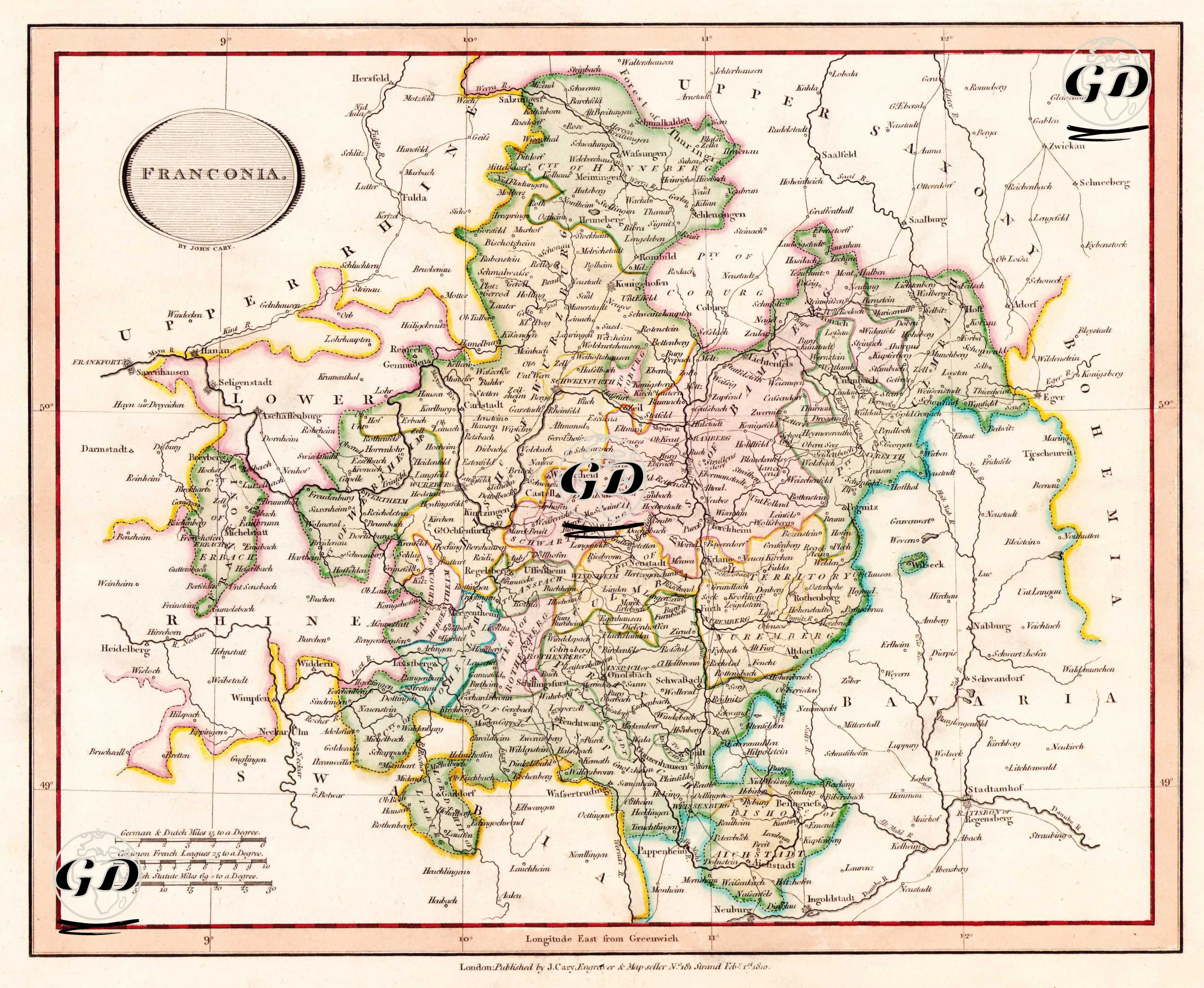
| Artist | John Cary (1754-1835) |
| Engraver | John Cary (1754-1835) |
| Date | 1810 |
| Technique | Copper Engraving-Original Hand Colored |
| Category | Maps |
| Source | Cary's New Universal Atlas, containing distinct maps of all the principal states and kingdoms throughout the World. From the latest and best authorities extant - London: Published by J. Cary, Engraver & Map-seller, No. 181 Strand, Feb. 1 1810 |
The map shows Franconia, one of the major administrative and cultural regions of the Holy Roman Empire. This region includes the northern part of present-day Bavaria and parts of the states of Hesse, Baden-Württemberg and Thuringia. Since the Middle Ages, Franconia has been politically fragmented, consisting of religious centres (especially the Bishoprics of Bamberg and Würzburg), independent cities (such as Nuremberg) and small duchies. The map charts the topography of the Franconian plateau in detail, starting from the Rhine and following the Main and Regnitz rivers. The region was of great geopolitical importance in the early 19th century, with its important centres influenced by the Reformation, the intertwining of Catholic and Protestant administrations and trade routes. The map also documents the borders of Franconia before its integration into the Kingdom of Bavaria.