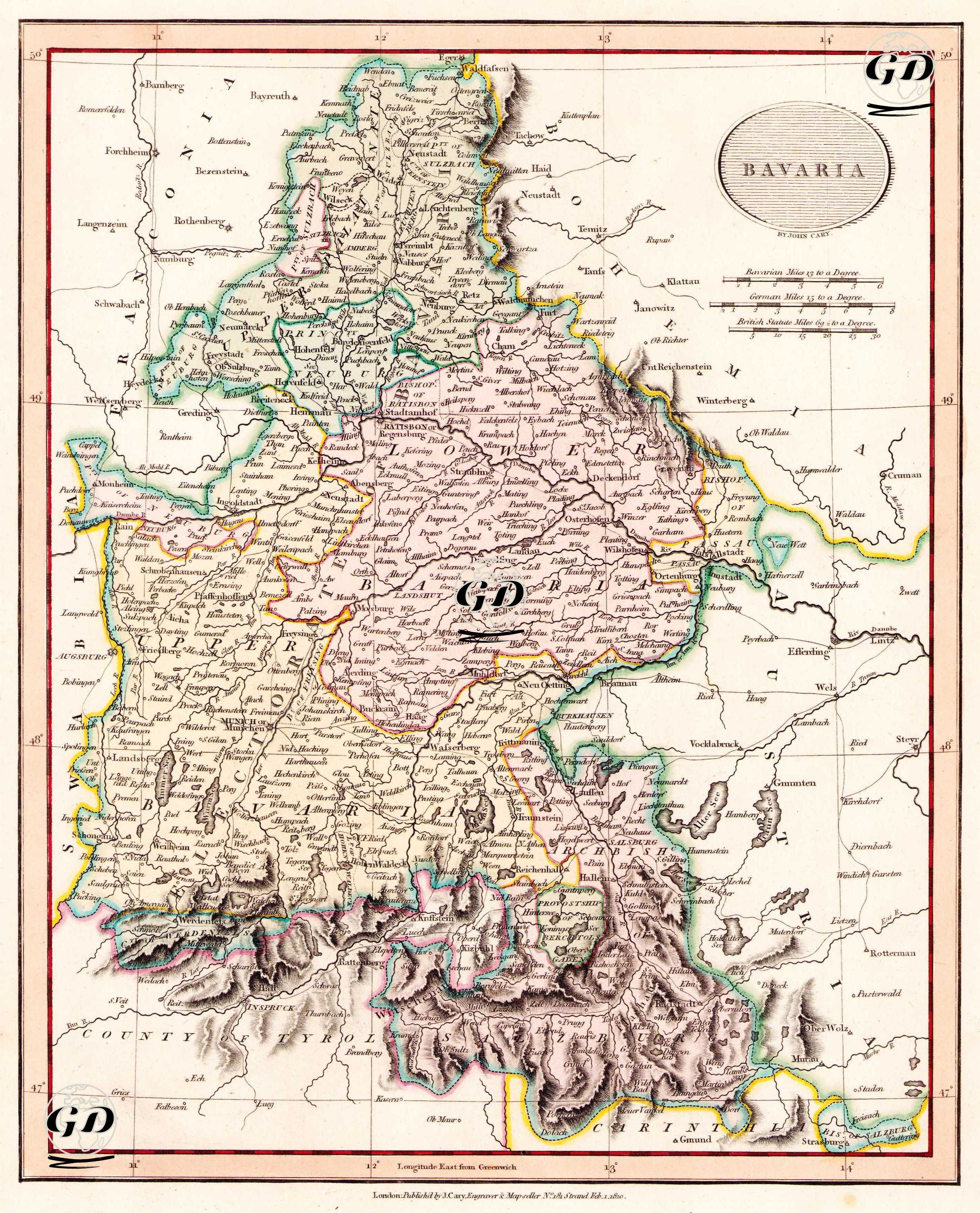
GRAVÜR DÜNYASI
Digital Engraving Library
| Artist | John Cary (1754-1835) |
| Engraver | John Cary (1754-1835) |
| Date | 1810 |
| Technique | Copper Engraving-Original Hand Colored |
| Category | Maps |
| Source | Cary's New Universal Atlas, containing distinct maps of all the principal states and kingdoms throughout the World. From the latest and best authorities extant - London: Published by J. Cary, Engraver & Map-seller, No. 181 Strand, Feb. 1 1810 |
This map shows in detail the Kingdom of Bavaria, one of the important members of the fragmented political structure of Germany at the beginning of the 19th century. The Kingdom of Bavaria, founded after the dissolution of the Holy Roman Empire in 1806, had adopted a pro-French position under the influence of Napoleon. The map draws the administrative structure, inland regions and borders of Bavaria during this period, and reveals its geographical relationship with neighboring regions such as Austria, Württemberg and Tyrol. Natural features such as the southern foothills of the Alps, the plains along the Danube and the Bohemian Forest on the eastern border are clearly depicted. The map is also a visual document reflecting the strategic importance of Bavaria at the time and the reshaping of the political balance in Europe after Napoleon.