GRAVÜR DÜNYASI
Digital Engraving Library
| Artist | John Cary (1754-1835) |
| Engraver | John Cary (1754-1835) |
| Date | 1809 |
| Technique | Copper Engraving-Original Hand Colored |
| Category | Maps |
| Source | Cary's New Universal Atlas, containing distinct maps of all the principal states and kingdoms throughout the World. From the latest and best authorities extant - London: Published by J. Cary, Engraver & Map-seller, Strand, May 1st 1809 |
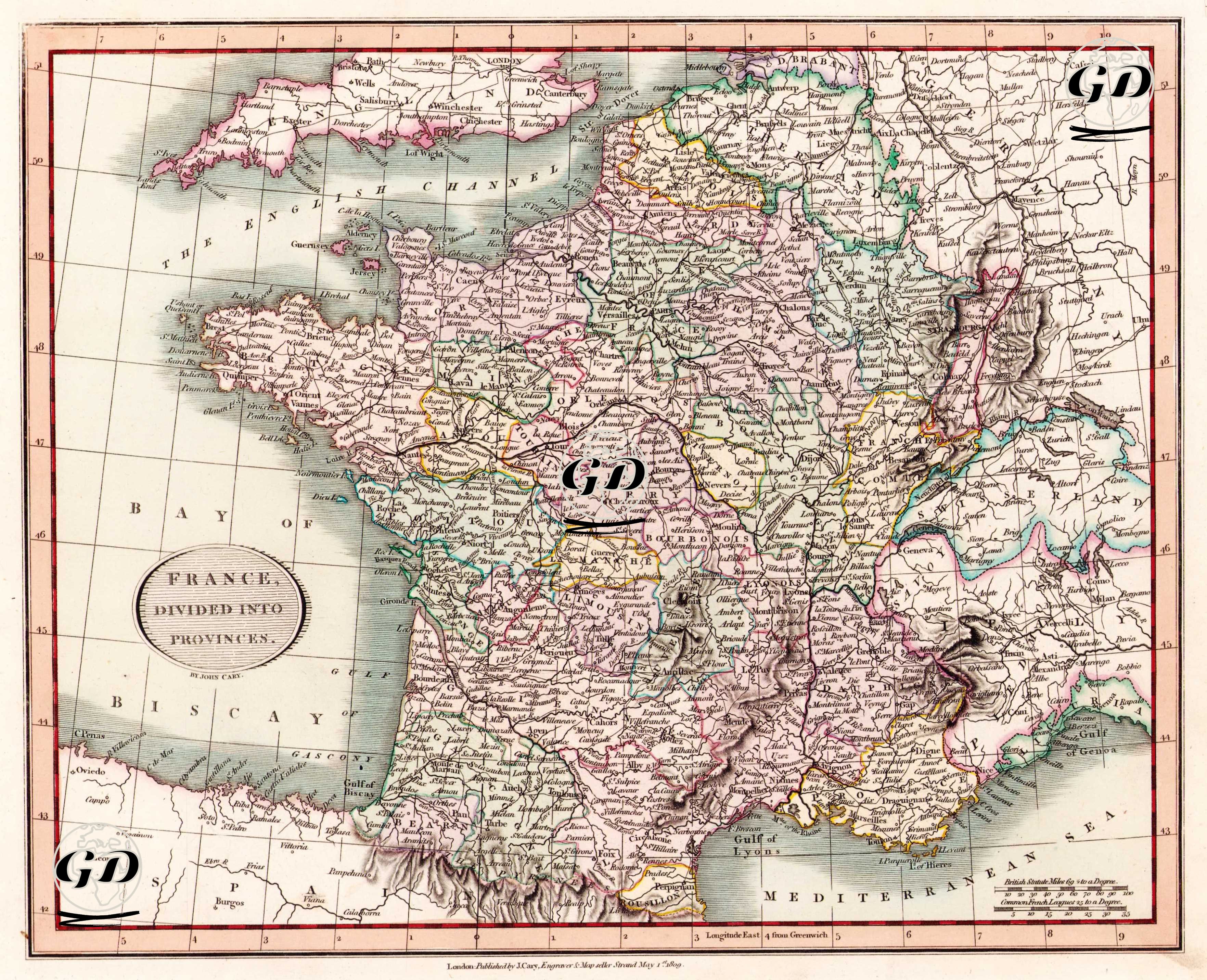
This 1809 map, titled "France, Divided into Provinces," is a detailed engraving by the renowned English cartographer John Cary. Organized according to the old provincial system, which reflected the administrative structure before the French Revolution, it depicts the historical geography before the modern "departmental" system that emerged after the Revolution. The map documents the traditional regional organization of the French monarchy. The map depicts the territory of France within numerous colored borders, each color representing a different province. Prominent regions include Normandie, Brittany, Champagne, Burgundy, Guyenne, Gascony, Languedoc, Provence, Dauphiné, Lyonnais, Orléans, Île-de-France, Picardy, Alsace, and Lorraine, among others. The borders of these regions reflect the administrative and cultural distinctions dating back to feudal times. Regions such as Normandy and Picardie in the north, Alsace-Lorraine in the east, Provence and Languedoc in the south, and Brittany in the west are particularly notable for their historical autonomy, regional languages, traditions, and noble-ruled structures. The "Bay of Biscay" in the lower left and "Mediterranean Sea" in the lower right of the map indicate France's maritime location. The southern coast of England is also shown at the top of the map, separated by the "English Channel." The borders of Switzerland, Germany, and Italy are partially visible on the eastern edge of the map. Topographically, the map carefully depicts mountain ranges, rivers, and major valleys. For example, mountainous regions such as the Alps, Pyrenees, and Central Massif (Massif Central) are highlighted using shading, while rivers such as the Seine, Loire, Rhone, and Garonne are traced in detail.