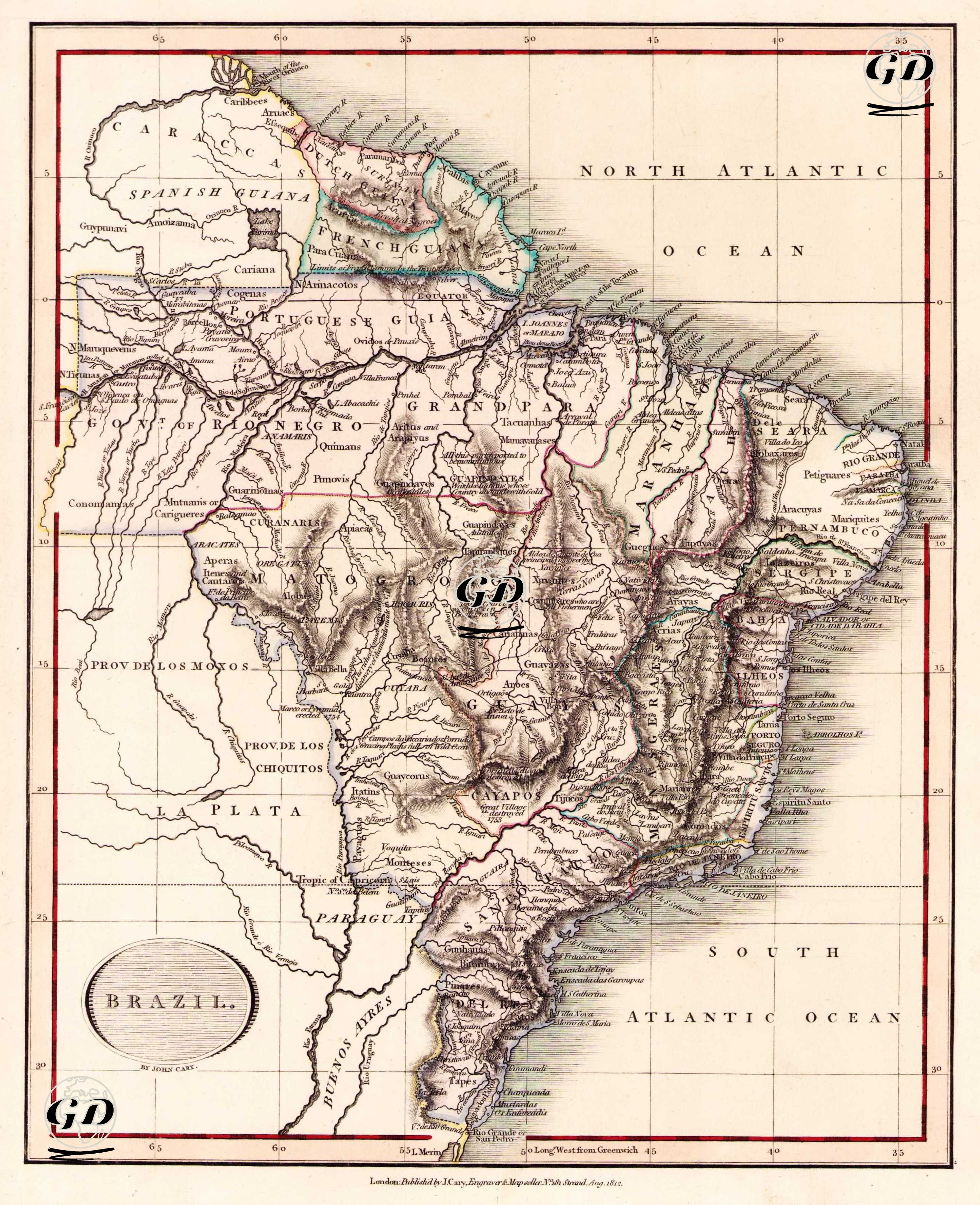
GRAVÜR DÜNYASI
Digital Engraving Library
| Artist | John Cary (1754-1835) |
| Engraver | John Cary (1754-1835) |
| Date | 1812 |
| Technique | Copper Engraving-Original Hand Colored |
| Category | Maps |
| Source | Cary's New Universal Atlas, containing distinct maps of all the principal states and kingdoms throughout the World. From the latest and best authorities extant - London: Published by J. Cary, Engraver & Map-seller, No. 181 Strand, Aug 1812. |
This early 19th century map, by John Cary in 1812, shows the regions of La Plata, Paraguay and Guyana in South America, along with Brazil. In 1808, after Napoleon invaded Portugal, the Portuguese Royal Family moved to Brazil, a Portuguese colony, with the support of England. This map is one of the earliest and most politically charged maps published in Europe after the Portuguese throne moved to Brazil. Rio de Janeiro, as the temporary capital of the Portuguese administration, is particularly emphasized on the map. This map was prepared from a British perspective, and the Rio de la Plata region was particularly detailed due to England's commercial interests. The map clearly marks colonial borders, major rivers such as the Amazon, and important regions such as the Rio Negro, Grand Para and Pernambuco.