GRAVÜR DÜNYASI
Digital Engraving Library
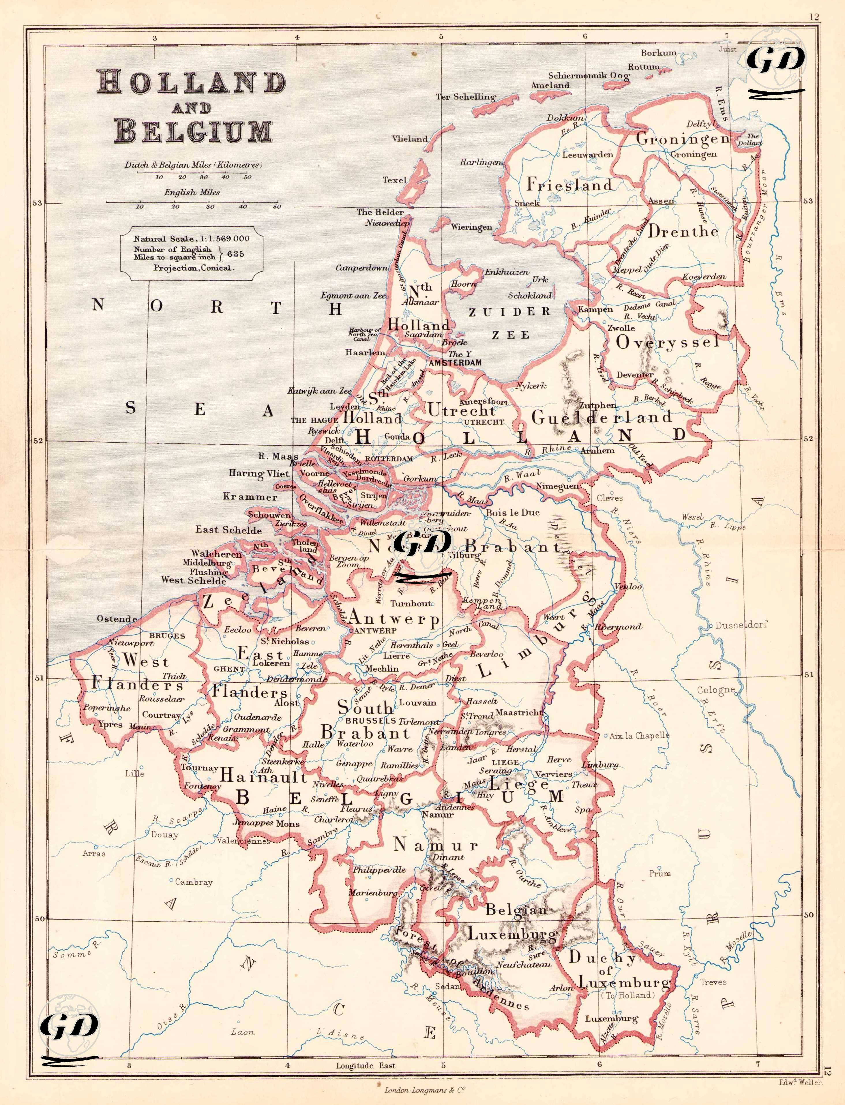
| Engraver | Edward Weller (1819-1884) |
| Date | 1874 |
| Technique | Steel Engraving-Original Hand Colored |
| Category | Maps |
| Source | The Public Schools Atlas of Modern Geography in 31 Maps. Exhibiting Clearly the More Important Physical Features of the Countries Delineated and Noting All the Chief Places of Historical, Commercial, or Social Interest; Rev. George Butler - London: Longmans & Co. |
This detailed 19th century map shows the political divisions of the Netherlands and Belgium at a scale of 1:1,569,000 and in a conical projection. The Zuiderzee lake in the Netherlands is in the centre. It is shown as it was before it was artificially converted into the IJsselmeer in the 20th century. Major cities such as Amsterdam, The Hague, Rotterdam and Utrecht are clearly shown. Provinces are marked with names such as "North Holland", "South Holland", "Friesland" and "Groningen". Belgium is divided into provinces such as "East Flanders", "West Flanders", "Brabant", "Namur", "Liège" and "Luxemburg". Important cities include Brussels (Brussels), Antwerp (Antwerp), Ghent (Ghent), Bruges (Bruges), Namur and Liege. Luxembourg is labelled on the map as "Duchy of Luxemburg". It is shown as both a province of Belgium and an independent duchy, with separate borders. This reflects the division of the borders following the Treaty of London in 1839.