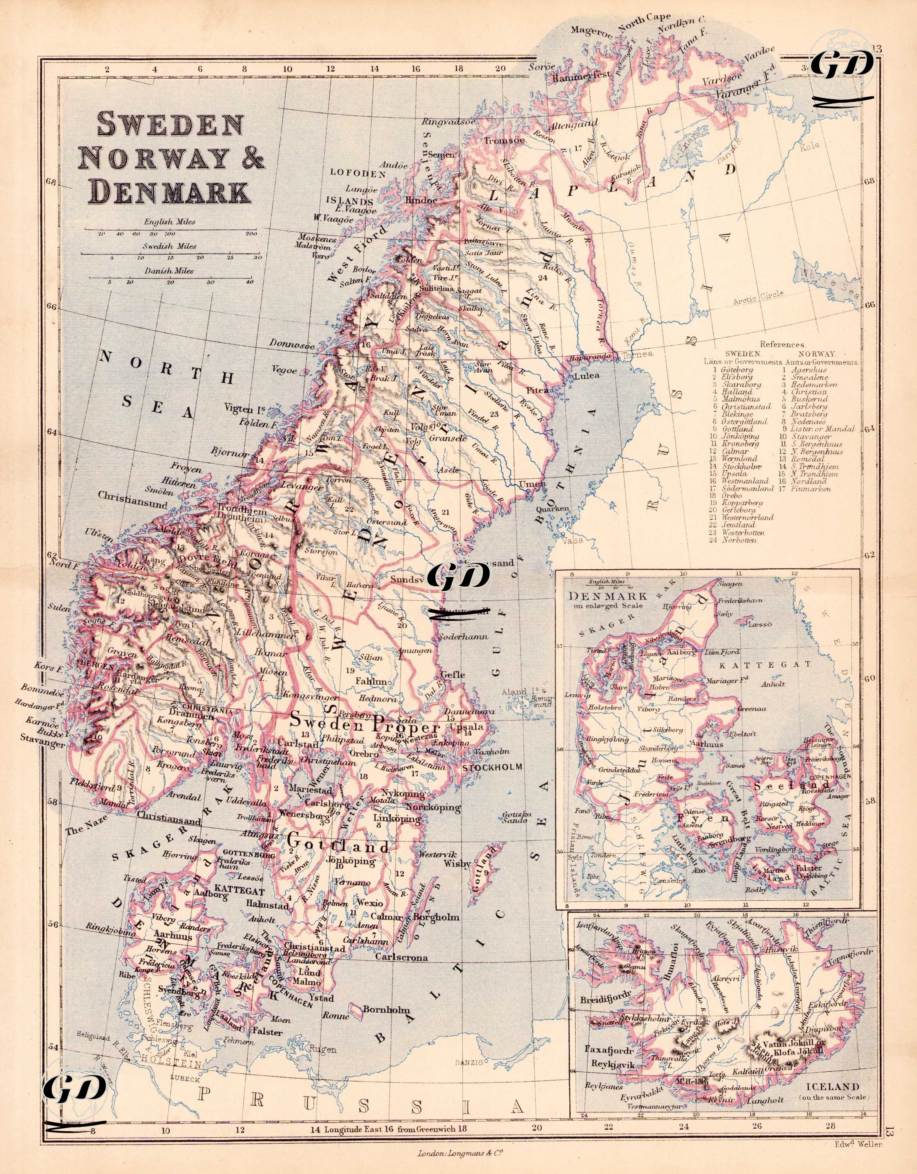
GRAVÜR DÜNYASI
Digital Engraving Library
| Engraver | Edward Weller (1819-1884) |
| Date | 1874 |
| Technique | Steel Engraving-Original Hand Colored |
| Category | Maps |
| Source | The Public Schools Atlas of Modern Geography in 31 Maps. Exhibiting Clearly the More Important Physical Features of the Countries Delineated and Noting All the Chief Places of Historical, Commercial, or Social Interest; Rev. George Butler - London: Longmans & Co. |
This 19th-century political and geographic map of Scandinavia includes detailed regional divisions and key cities in Sweden, Norway, Denmark, and Iceland. Insets show Denmark and Iceland separately. The map is notable for its clear depiction of mountain ranges, coastlines, and water routes in Northern Europe.