GRAVÜR DÜNYASI
Digital Engraving Library
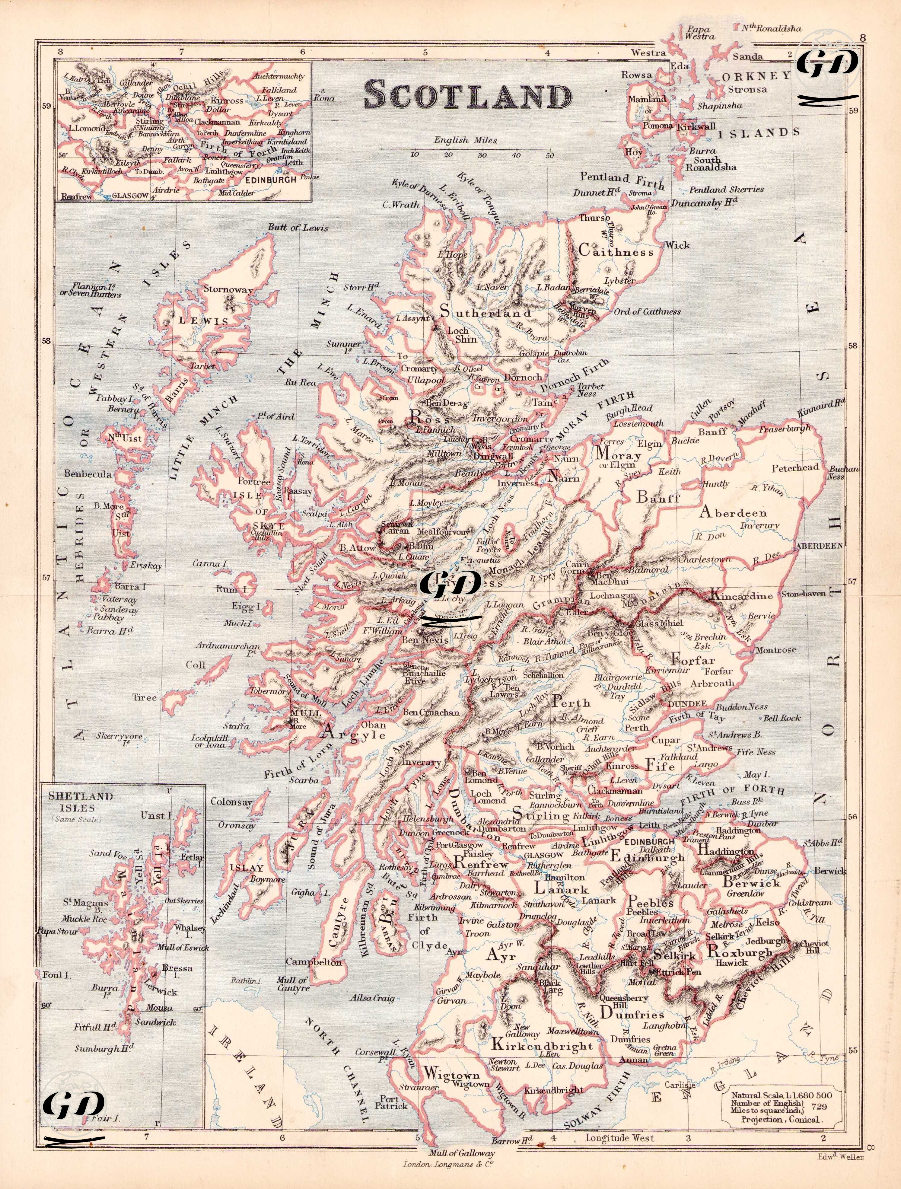
| Engraver | Edward Weller (1819-1884) |
| Date | 1874 |
| Technique | Steel Engraving-Original Hand Colored |
| Category | Maps |
| Source | The Public Schools Atlas of Modern Geography in 31 Maps. Exhibiting Clearly the More Important Physical Features of the Countries Delineated and Noting All the Chief Places of Historical, Commercial, or Social Interest; Rev. George Butler - London: Longmans & Co. |
This 19th century map of Scotland shows the county boundaries, principal cities and towns, rivers, lochs and highlands in detail at a scale of 1:1,660,500 and in a conical projection. The map shows in detail the traditional 33 counties (shires) that made up Scotland at the time. It also includes small inset maps of Shetland and the Orkney Islands.