GRAVÜR DÜNYASI
Digital Engraving Library
| Engraver | John Bartholomew & Co. |
| Date | 1890's |
| Technique | Lithography-Colored |
| Category | Maps |
| Source | London, John Murray, Albemarle Street |
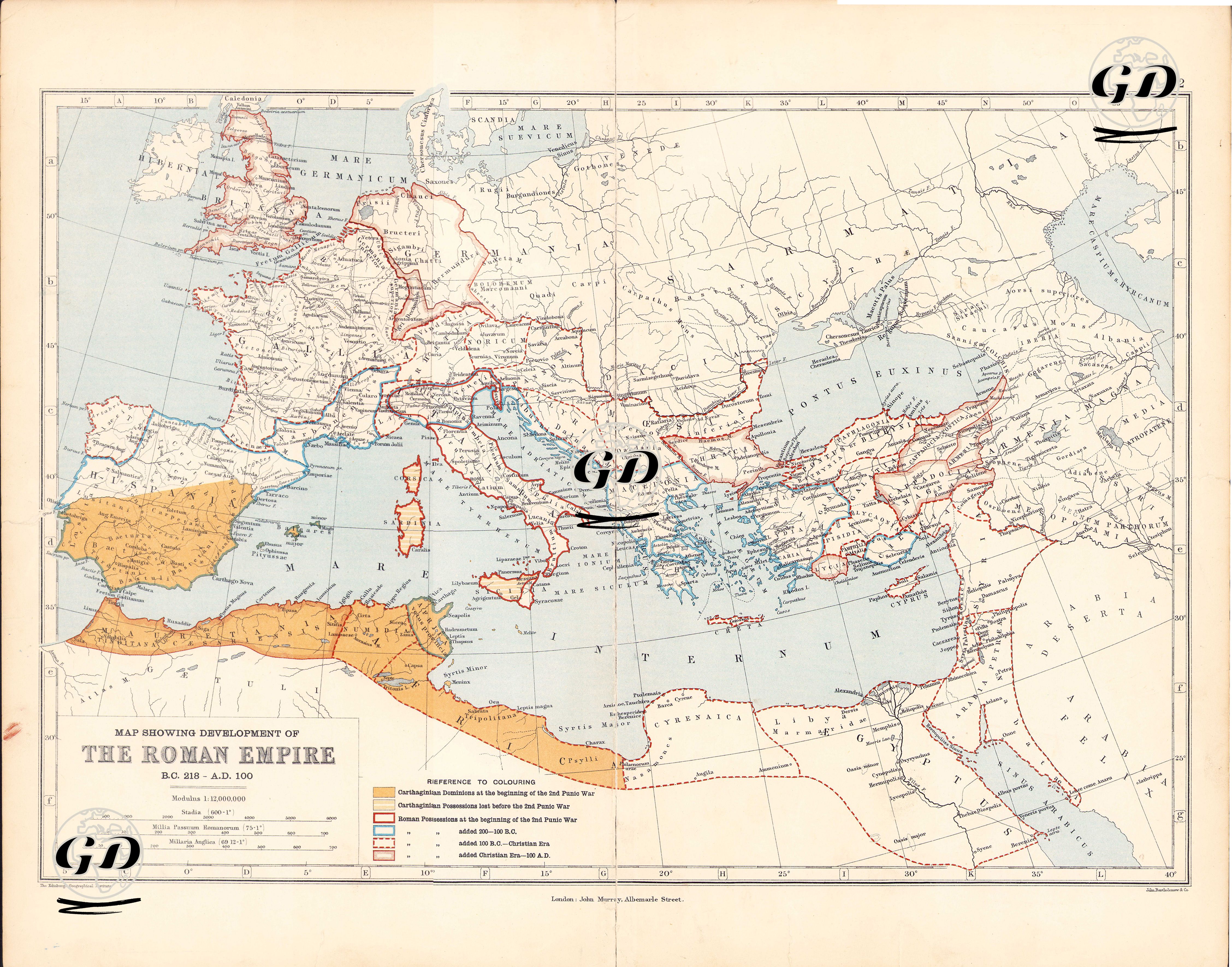
This map is a color-coded historical cartographic study that documents the expansion of the Roman Empire over nearly three centuries, from the beginning of the Second Punic War in 218 BC to 100 AD. This map presents a geographical and chronological framework of how Rome established an empire around the Mediterranean. The color codes used on the map are categorized as follows: shades of orange represent the territory of the Carthaginians before 218 BC (II Punic War) (Tunisia, Libya and southern Spain); areas outlined in red represent the territory held by Rome as of 218 BC (II Punic War); dark yellow areas represent the territory controlled by Carthage during the Punic Wars against Rome; areas colored in blue represent the territories annexed to Roman territory by 146 BC; and areas shaded in red represent the territories annexed up to 100 AD. This map reveals not only military and political expansion, but also how Rome established its dominance of a “Mare Nostrum” (Our Sea) around the Mediterranean. Large parts of Hispania, Gallia and Britannia to the west; Asia Minor (Anatolia), Syria and Judea to the east; and Numidia, Cyrenaica and Egypt in North Africa to the south are shown in detail. Ancient cities – such as Rome, Carthage, Alexandria, Antioch, Athens and Ephesus – are also marked as cultural and administrative centres of the period.