GRAVÜR DÜNYASI
Digital Engraving Library
| Artist | Edward Weller (1819-1884) |
| Engraver | Edward Weller (1819-1884) |
| Date | 1874 |
| Technique | Steel Engraving-Original Hand Colored |
| Category | Maps |
| Source | The Public Schools Atlas of Modern Geography in 31 Maps. Exhibiting Clearly the More Important Physical Features of the Countries Delineated and Noting All the Chief Places of Historical, Commercial, or Social Interest; Rev. George Butler - London: Longmans & Co. |
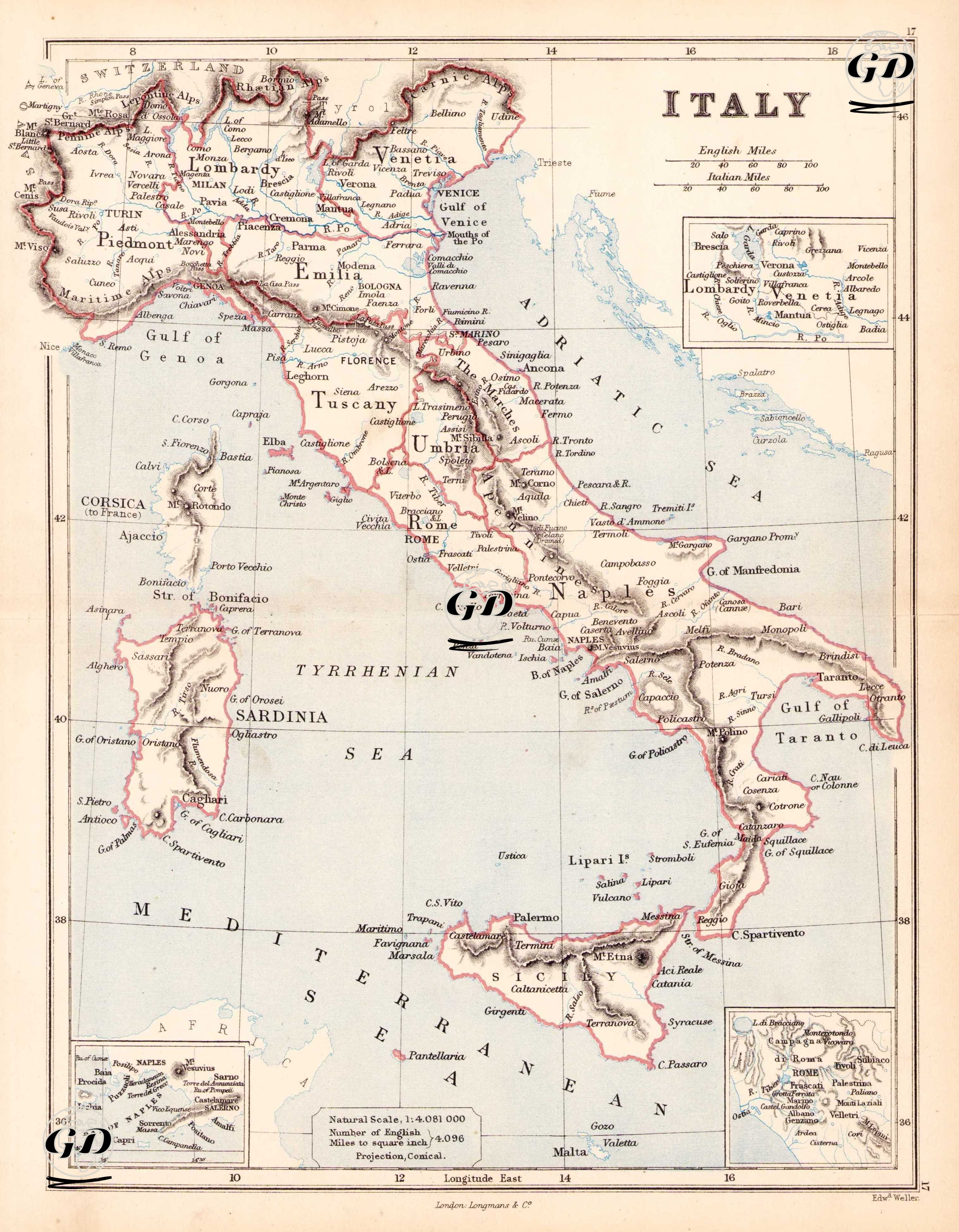
This map, drawn by Edward Weller in 1874, depicts the geographic and political landscape of the Italian peninsula in the mid-19th century. Two small insets are located in the upper right and lower left corners of the map; one focuses on the "Lombardy & Venice" region, the other on Naples and its surrounding area. The scale is given in the lower margin as "Natural Scale 1:4,081,000." A dual scaling line, in both English and Italian miles, is also located at the top of the map. The map clearly delineates Italy's major geographical regions—Piedmont, Lombardy, Venetia, Tuscany, Umbria, Rome, Naples, Calabria, Sicily, and Sardinia—with clear boundaries. City names are detailed to include both major and minor settlements, with particular emphasis on major cities such as Rome, Naples, Milan, Turin, Palermo, and Venice. The map also includes important geographic elements (e.g., volcanic islands and gulfs such as the "Gulf of Venice," "Gulf of Taranto," "Mt. Etna," "Stromboli," and "Lipari Is."), thus serving as both a political and physical map. In addition to the mainland, islands such as Sardinia, Sicily, Elba, Lipari, Ponza, and Ischia are also drawn and named in detail.