GRAVÜR DÜNYASI
Digital Engraving Library
| Artist | Sidney Hall (1788-1831) |
| Engraver | Sidney Hall (1788-1831) |
| Date | 1826 |
| Technique | Copper Engraving-Original Hand Colored |
| Category | Maps |
| Source | A New General Atlas - London, Published by Longman, Rees, Orme, Brown, & Green, Paternoster Row, 1826 |
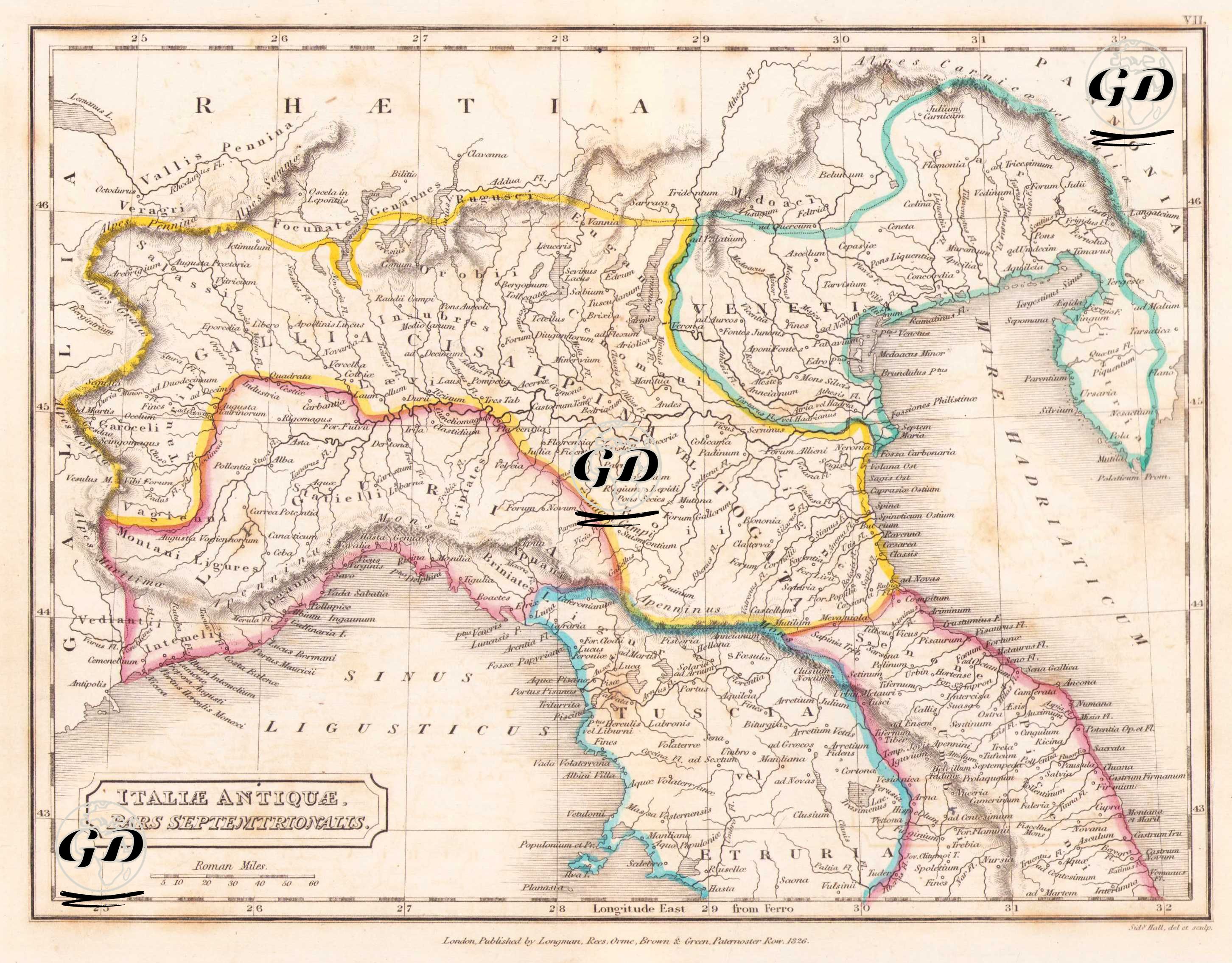
This map, titled "Italiae Antiquae Pars Septentrionalis" (Northern Part of Ancient Italy), was published in London in 1826 by Longman, Rees, Orme, Brown & Green, and engraved by Sidney Hall. The map was prepared to detail the political and geographic structure of Northern Italy during the Roman period. Colored borders indicate ancient settlements and administrative districts inhabited by pre-Roman and Roman-era peoples. Regions such as Liguria, Cisalpina Gallia, Venetia, Raetia, and Etruria are clearly delineated. The Padus (Po) River is prominently displayed on the map, and the dense urbanization and roads surrounding this river underscore Rome's influence on the region. The map covers the area from the Adriatic coast to the Alps, and important ancient city centers such as Mediolanum (Milan), Verona, Placentia, Patavium (Padova), and Aquileia are marked. Roman roads and trade routes are depicted in fine detail, while river systems and mountain ranges are depicted with topographic reliefs. The "Roman Mile" scale in the lower left corner indicates the distance measurement system and serves as an academic reference map prepared in accordance with classical ancient sources. The map is also invaluable for studying the provincial structures established in northern Italy during the reign of Augustus, which defined the boundaries of imperial administration.