GRAVÜR DÜNYASI
Digital Engraving Library
| Artist | Sidney Hall (1788-1831) |
| Engraver | Sidney Hall (1788-1831) |
| Date | 1826 |
| Technique | Copper Engraving-Original Hand Colored |
| Category | Maps |
| Source | A New General Atlas - London, Published by Longman, Rees, Orme, Brown, & Green, Paternoster Row, 1826 |
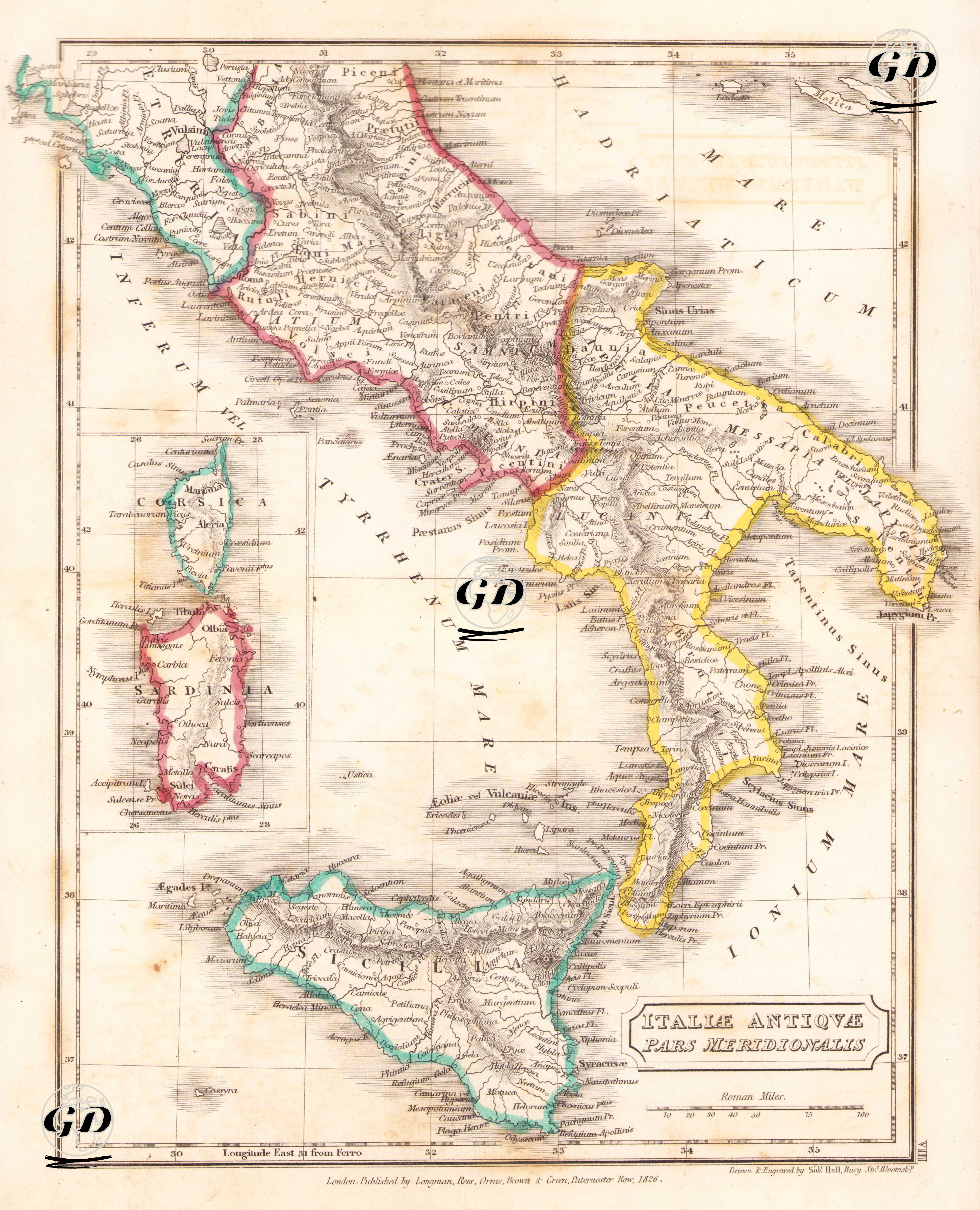
This map, titled "Italiae Antiquae Pars Meridionalis" (Southern Part of Ancient Italy), was published in London in 1826 by the publishing house Longman, Rees, Orme, Brown & Green and engraved by Sidney Hall, one of the leading engravers of the period. This cartographic work, based on the geographic layout of the ancient Roman period, was designed to cover a large portion of present-day southern Italy. Among the regions marked with colored borders on the map are important ancient regions inhabited by pre-Roman peoples such as Samnium, Lucania, and Bruttium. The islands of Sicily (Sicilia), Sardinia (Sardinia), and Corsica are also detailed. The title box at the bottom of the map indicates a scale of "Roman Miles," indicating that the map was designed in accordance with classical Roman geography. Latin sea names such as Tyrrhenum Mare (Tyrrhenian Sea), Ionium Mare (Ionian Sea) and Adriaticum Mare (Adriatic Sea) reveal that the work remains faithful to classical terminology. Ancient cities, mountain ranges, rivers, and coastal details are meticulously depicted using fine engraving techniques, clearly depicting cities such as Capua, Tarentum, Rhegium, Crotona, Neapolis (Naples), and Brundisium. On the island of Sicily, city centers such as Syracusae (Syracuse), Agrigentum, and Panormus (Palermo) are meticulously rendered.