GRAVÜR DÜNYASI
Digital Engraving Library
| Date | 1850's |
| Technique | Steel Engraving |
| Category | Maps |
| Source | A Fullarton & Co. London And Edinburgh |
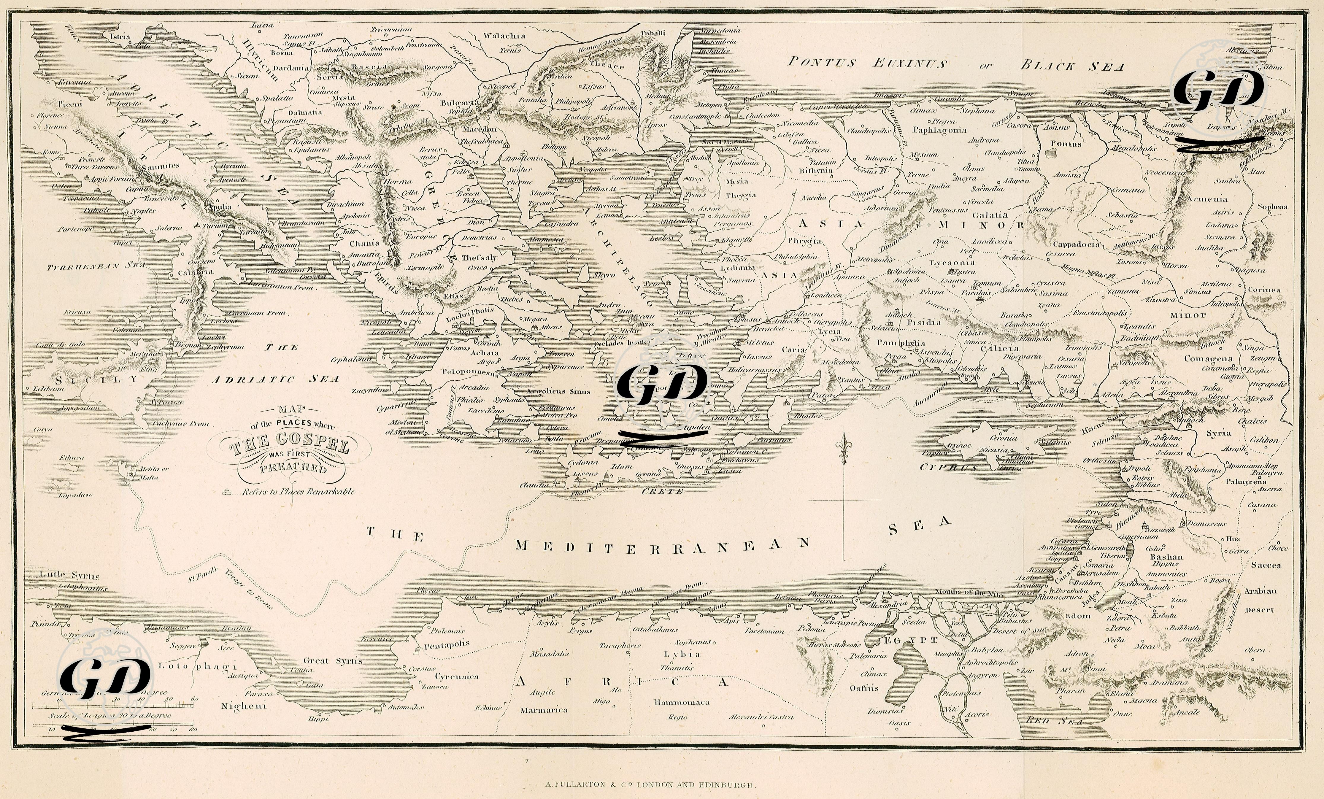
This map is a biblical geography study documenting the spread of Christianity during its first century, based primarily on the Acts of the Apostles in the New Testament. It illustrates in geographical detail the locations where the Gospel was first preached and the initial missionary journeys of early Christian figures, especially Saint Paul and the other apostles. The map highlights the cities in Asia Minor where Paul delivered his sermons, including Ephesus, Smyrna, Pergamos, Laodicea, Tarsus, Iconium, Antioch in Pisidia, Derbe, and Lystra. In Greece and the Balkans, cities such as Philippi, Thessalonica, Berea, Athens, and Corinth are shown as key centers where Paul established the first Christian communities in Europe. Cities like Antioch (Antakya), Jerusalem, Damascus, Tyre, Sidon, and Caesarea are presented as the primary launch points of apostolic missions and early Christian congregations. Islands in the Mediterranean, including Cyprus, Crete, and Rhodes, are marked as important stops in early missionary activity. Likewise, Alexandria in Egypt and Cyrene in North Africa are depicted as major Hellenistic centers, serving as cradles of Jewish-Christian cultural interaction. The map integrates topographical details, Roman provincial borders, and ancient roads, offering an instructive framework that connects the history of early Christianity with both the political and physical geography of the Roman world. As such, this map is not only a religious reference but also a visual representation of cultural, social, and political narratives. It stands as a valuable resource for biblical archaeology and classical antiquity studies.