GRAVÜR DÜNYASI
Digital Engraving Library
| Artist | J. & C.Walker (Active 1820-95) |
| Engraver | J. & C.Walker (Active 1820-1895) |
| Date | 1846 |
| Technique | Steel Engraving |
| Category | Maps |
| Source | Published By John Murray, Albemarle Street, London Jan.1846 |
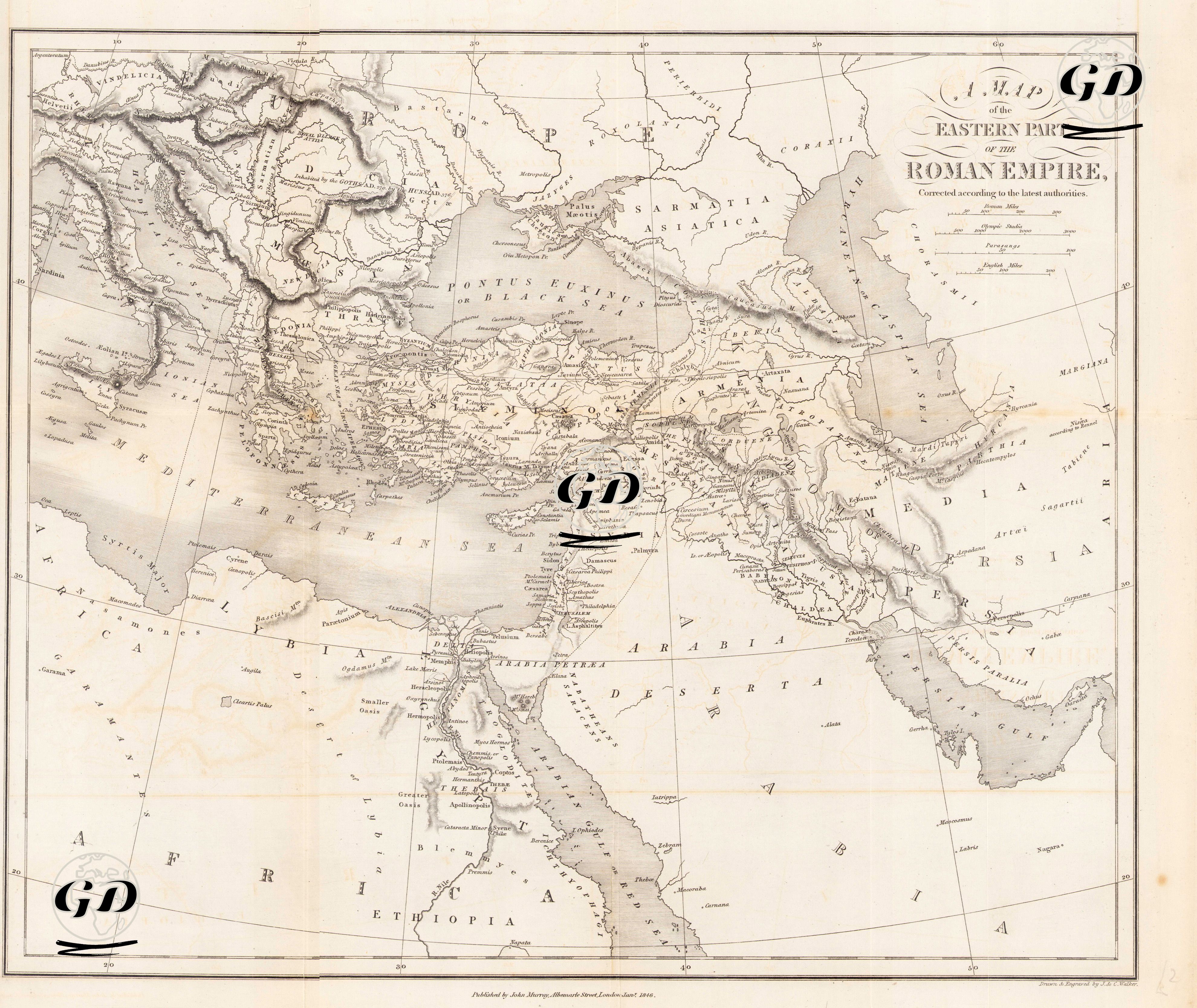
This map is a detailed classical antique representation of the eastern provinces of the Roman Empire, most likely dating to the 2nd century AD, during the reigns of Emperor Trajan (AD 98–117) and Emperor Hadrian (AD 117–138)—the period when Rome reached its greatest territorial extent. The engraving was published in 1828 by John Murray, based on the scholarly authorities of the time. While outlining the eastern boundaries of the Roman Empire, the map exhibits a high level of administrative and geographical detail. Key regions are clearly delineated, including Asia Minor (Asia, Galatia, Bithynia, Cappadocia), the Levant (Syria, Judea, Phoenicia), Mesopotamia (Assyria, Mesopotamia, Babylonia), the Iranian Plateau (Media, Persia), and Egypt (Aegyptus, Thebais). Important ancient cities such as Ephesus, Antioch, Tarsus, Jerusalem, Alexandria, Babylon, and Nineveh are carefully marked in accordance with the Roman provincial system. Lesser Armenia, The Five Provinces and Adiabene, the region on the eastern border of the Empire that served as a bridge between the Roman, Jewish and Parthian worlds, are also shown on the map. This map not only illustrates geographical boundaries but also reflects the administrative structure of Rome and the network of cities connected by military and trade routes. Centered on the Mediterranean world, it visualizes the scope of Roman expansion eastward, facilitated by the secure roads and trade networks of the Pax Romana (Roman Peace). The map refers to the Black Sea as “Pontus Euxinus”, presents Mesopotamia in remarkable detail, and includes the entire Nile Valley, making it a valuable resource for both classical historiography and ancient geographical studies.