GRAVÜR DÜNYASI
Digital Engraving Library
| Artist | Sidney Hall (1788-1831) |
| Engraver | Sidney Hall (1788-1831) |
| Date | 1826 |
| Technique | Copper Engraving-Original Hand Colored |
| Category | Maps |
| Source | Published by Longman, Rees, Orme, Brown & Green, London, 1826 - Engraved for William Smith's Classical Atlas |
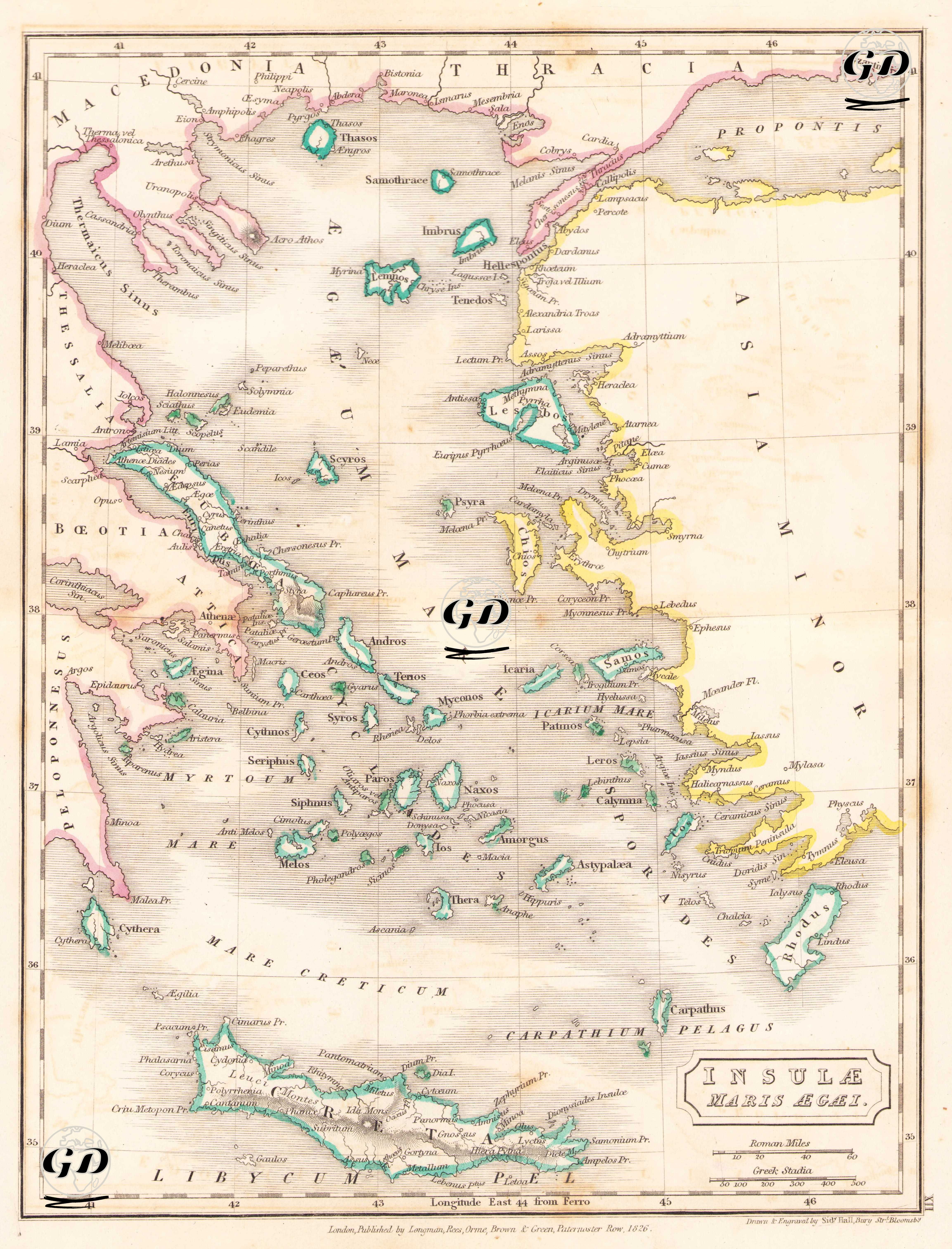
This map, titled "Insulae Maris Aegaei - Islands of the Aegean Sea," was prepared in 1826 to show the Aegean Sea and its surrounding island system based on the geography of classical antiquity. The map, which was engraved using copper engraving by Sydney Hall and hand-colored at the time of printing, was prepared according to ancient cartographic standards, as units of measurement such as "Roman Mile" and "Greek Stadia" are used. The focus of the map is the Aegean Sea (Ægæum Mare) and the surrounding Greek mainland, the coasts of Western Anatolia, and the island of Crete. All islands known from the classical era, such as the Cyclades (Naxos, Delos, Paros, Ios, Andros, etc.), the Sporades, the Dodecanese (Twelve Islands), and the North Aegean Islands (Thasos, Samothrace, Lemnos, Imbros, Tenedos), are shown in detail. Pergamus (Bergama), located on the Anatolian coast, Ancient cities such as Ephesus (Efes), Smyrna (Izmir), Halicarnassus (Bodrum), Cnidus (Knidos), and Miletus (Miletus) are shown in their Latinized forms and arranged along the coastline. The Propontis (Sea of Marmara) and the Hellespont (Dardanelles) are also shown in the upper right corner of the map. The Peloponnese Peninsula, located in the lower left corner of the map, and the Attica region to its north represent the centers of classical Greek civilization: Sparta, Corinthus, Athens, Argos, and so on. This map is a classic example of the systematic processing of ancient geography in 19th-century Europe. Place names derived from ancient Greek, Roman, and Hellenistic geographic texts have been chosen with both philological and historical-topographical care. The map's purpose is not merely to provide physical location information, but to provide a spatial reference for a reader knowledgeable about ancient mythology, history, and trade routes.