GRAVÜR DÜNYASI
Digital Engraving Library
| Date | 1912 |
| Technique | Chromolithograph |
| Category | Maps |
| Source | Brockhaus' Konversations-Lexikon, 14. Auflage - F.A. Brockhaus’ Geogr.-artist. Anstalt, Leipzig |
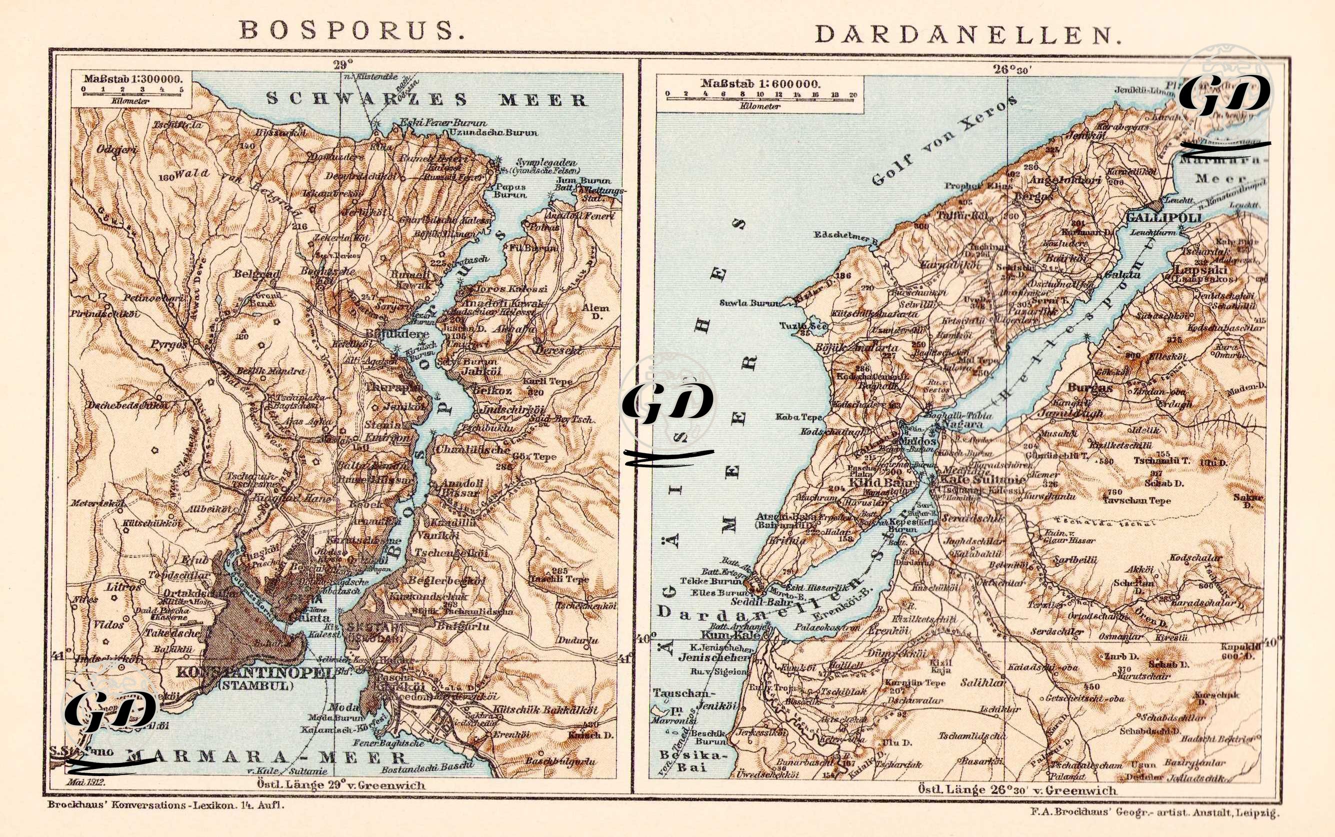
This image is from the 14th edition of Brochaus Konversations-Lexikon, published in Germany in the late 19th century. It is a special double-panel presentation consisting of two separate maps. The left panel shows the Bosphorus (Bosporus), and the right panel shows the Dardanelles (Dardanelles). Both straits are treated not only as geographical chokepoints but also as the geopolitical heart of the Ottoman Empire. Therefore, the maps were prepared for military, maritime, and political map reading. The Bosphorus map in the left panel (scale 1:300,000) depicts in detail both shores of the Bosphorus, which flows from the Black Sea to the Sea of Marmara. Riva and Kilyos are marked in the north, and central settlements such as Topkapı Palace, Galata, Üsküdar, and Kadıköy are marked in the south. Districts such as Bebek, Beşiktaş, Çengelköy, Beylerbeyi, Kuzguncuk, Arnavutköy, Tarabya, and Kanlıca are shown in detail, with their palaces, waterside residences, lighthouses, forts, and roads along the coast clearly depicted. Currents in the Bosphorus, coastal curves, transportation links, and even underwater depth profiles are carefully drawn. The map also functions as a topographic plan that includes the center of the city known as Constantinople (Stambul). The Dardanellen (Dardanelles) map (scale 1:600,000) on the right panel presents the geography of this strategic waterway connecting the Sea of Marmara and the Aegean Sea. Critical settlements such as the Gallipoli Peninsula and Gallipoli (Gelibolu) to the north and Kilitbahir, Seddülbahir, Kumkale, Erenköy and Tenedos (Bozcaada) to the south are highlighted. The map is extremely functional, especially in terms of naval defense strategies, with elements such as coastal artillery bastions, fortresses, military roads, high-altitude hills and sea depths. This passage, which the Ottoman navy and the European powers closely followed during this period, was of great importance within the context of the Eastern Question, especially in the last quarter of the 19th century. The German place names used in both maps reflect the orientalist perspective of the European cartographers who prepared the map; The level of detail demonstrates the maps' suitability not only for travel or encyclopedic purposes but also for geopolitical analysis. This map was published in Brockhaus Konversations-Lexikon, a German encyclopedia published under various names between 1789 and 2009.