GRAVÜR DÜNYASI
Digital Engraving Library
| Date | 1895 |
| Technique | Chromolithograph |
| Category | Maps |
| Source | Brockhaus' Konversations-Lexikon, 14. Auflage - F.A. Brockhaus’ Geogr.-artist. Anstalt, Leipzig |
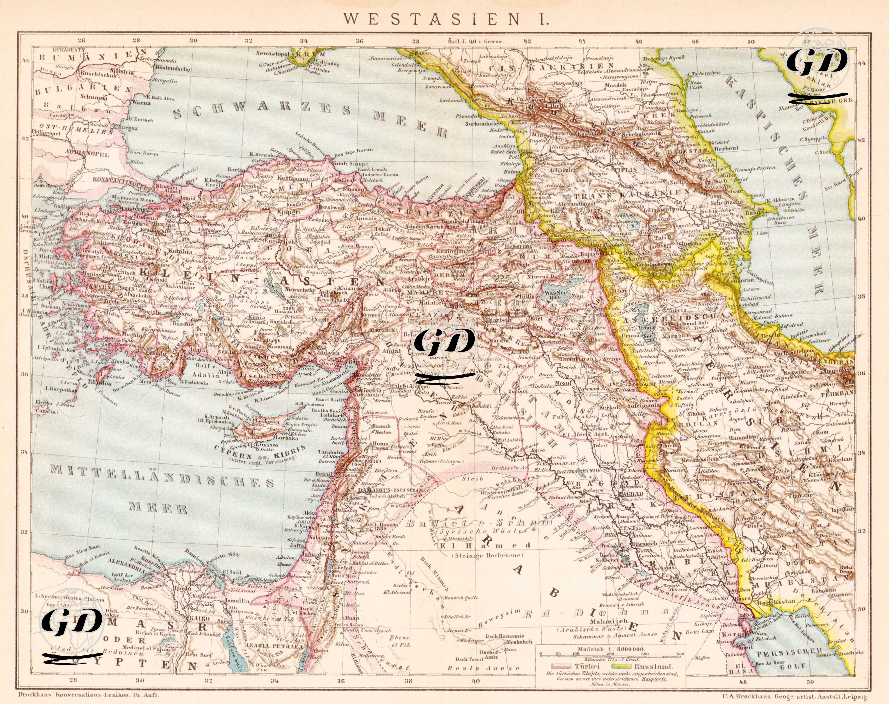
This 1895 map, published in the 14th edition of Brockhaus Konversations-Lexikon by the F.A. Brockhaus publishing house in Leipzig, Germany, depicts the Ottoman Empire's Asian territories, Iran, the South Caucasus, and the northern part of the Arabian Peninsula under the title "Western Asia I" (Westasien I). The map's title is in German and was published as part of encyclopedic and geographical publications aimed primarily at a German-speaking audience. The map's focal point is Anatolia, and the geographical area defined here by the phrase "Asia Minor" (Kleinasian) extends from Istanbul and the Aegean coast in the west to the Lake Van basin in the east. Syria and Palestine lie to the south; Persia (Iran) and Transcaucasia (Trans-Caspian Turkestan) lie to the east; and the Caucasus and the Schwarzes Meer (Black Sea) lie to the north. Important Ottoman cities such as Jerusalem, Aleppo, Damascus, Mosul, and Baghdad are carefully mapped, and the Mesopotamian valley (in present-day Iraq) is also labeled with ancient names such as "Babylonian" and "Mesopotamian." Egypt ("Aegypten" on the map) is also located in the lower left corner, indicating the Khedivate period under nominal Ottoman rule. The map details depict mountain ranges as three-dimensional with shading techniques, and illustrate administrative divisions with colored border lines. Numerous elements, such as rivers, lakes, major trade routes, and port cities, are meticulously rendered. The map's publication, Brockhaus Enzyklopadie, is a German encyclopedia published under various names between 1789 and 2009.