GRAVÜR DÜNYASI
Digital Engraving Library
| Date | 1895 |
| Technique | Chromolithograph |
| Category | Maps |
| Source | Meyers Konversations-Lexikon, Bibliographisches Institut, Leipzig - Bibliographisches Institut in Leipzig |
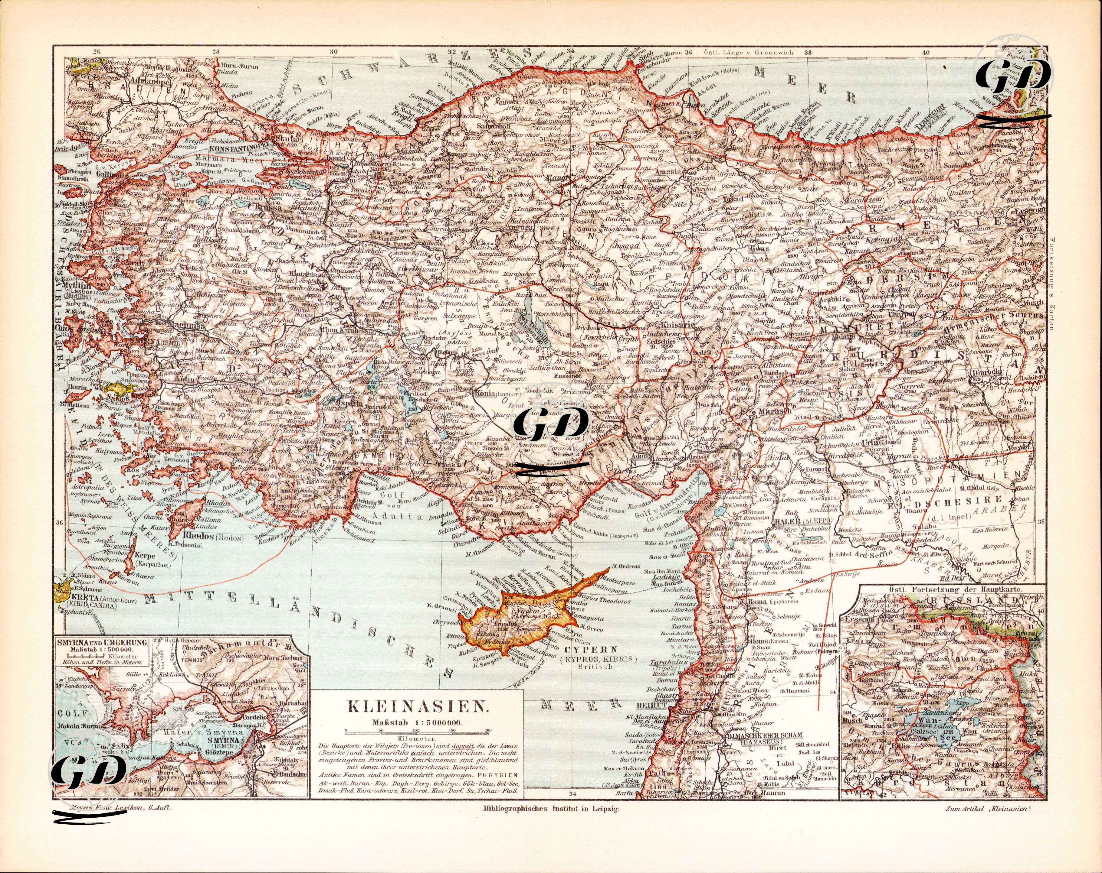
This map is a high-resolution physical and political map published in the Meyers Konversations-Lexikon atlas series by the Bibliographisches Institut in Leipzig, Germany, in the late 19th century. It shows the Anatolian peninsula, also known as "Asia Minor" (Kleinasian), in detail. The legend at the bottom explains that the map has been colored specifically to highlight elevation differences, while also meticulously detailing settlements, rivers, roads, and administrative borders. A scale of 1:5,000,000 is used. The map centers on the Ottoman Empire's most important Asian territory, namely Anatolia, and also includes the island of Cyprus (referred to as Cypern on the map), the Syrian coast, northern Mesopotamia, the eastern part of Armenia, and a small portion of Thrace encompassing Istanbul. Particularly, the situation of Cyprus after it came under British rule in 1878 was carefully described under the title “Cypern (Cyprus, Kibris, Britisch)”. The map features Istanbul (Constantinople) as its center, and detailed routes leading from it to various Anatolian cities. Ancient settlements on the Aegean coast, such as Smyrna (Izmir), Ephesus (Efes), and Rhodes (Rhodos), are shown with both classical and modern names. The inset map of Smyrna and its surroundings in the lower left corner shows the Gulf of Izmir and surrounding settlements at a large scale, emphasizing the strategic and commercial importance of this port city. Similarly, the small map in the lower right corner shows the continuation of the Caucasus region at the upper eastern border of the map. This map also reveals the Ottoman administrative structure at the level of provinces, sanjaks, and districts. The red administrative borders and German place names reflect the stylistic characteristics of 19th-century German cartography. Meyers Konversations-Lexikon, in which this map was published, is one of the most respected and widely used encyclopedias in Germany, published from 1839 to 1984.