GRAVÜR DÜNYASI
Digital Engraving Library
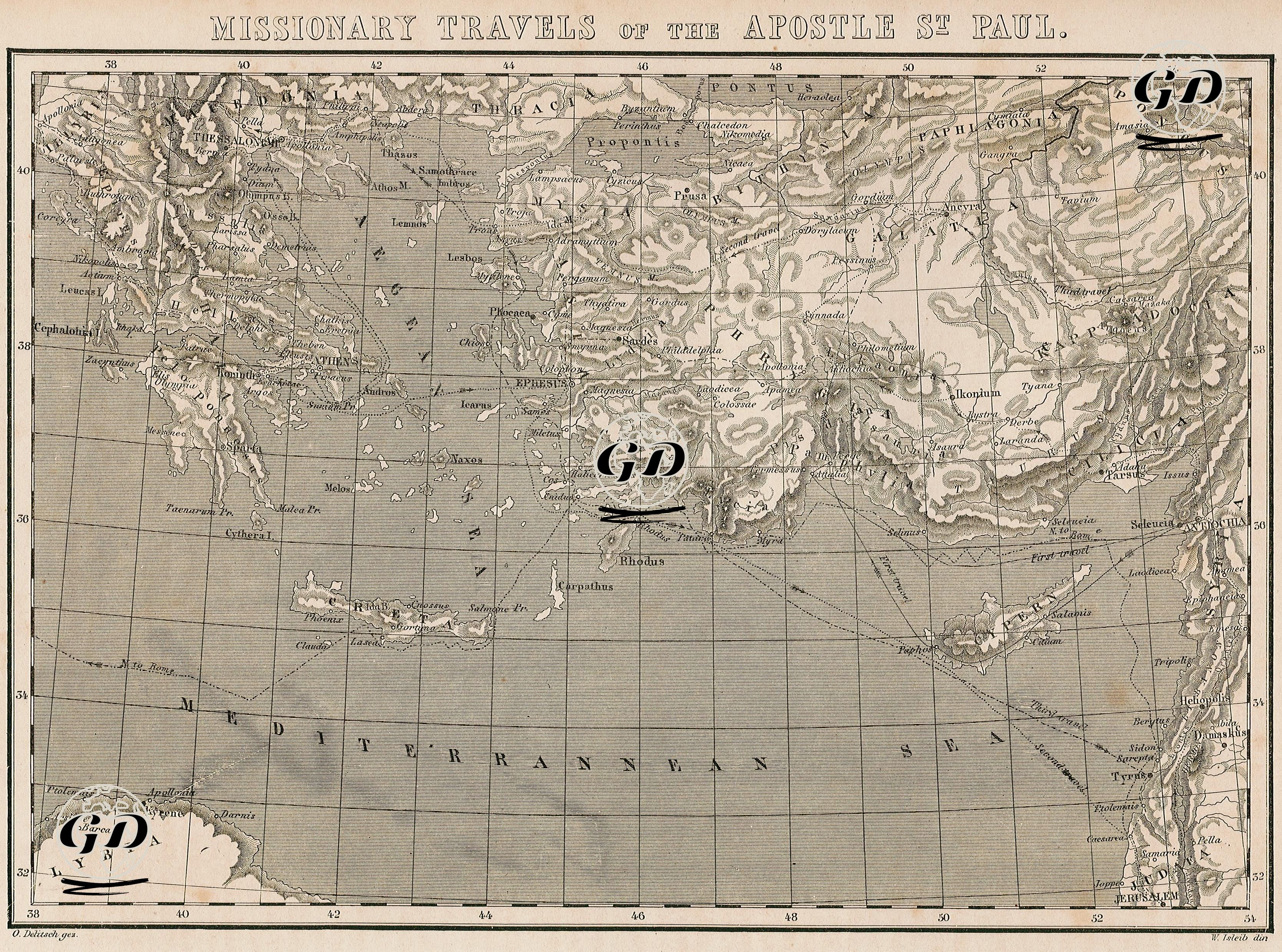
| Artist | Otto Delitsch (1821-1882) |
| Engraver | W.Isleib |
| Date | 1860's |
| Technique | Steel Engraving |
| Category | Maps |
This map is a detailed representation of the missionary journeys of Saint Paul, who played a vital role in the history of Christianity. It depicts, with great precision, the routes of Paul’s first, second, and third missionary journeys through Asia Minor, Greece, Cyprus, and the Levant region (modern-day Syria and Palestine), as well as his voyage as a prisoner from Jerusalem to Rome. Ancient cities such as Ephesus, Corinth, Philippi, Thessalonica, Derbe, Lystra, Antioch (Antakya), Seleucia, Rhodes, Patara, and the Cypriot cities of Salamis and Paphos are clearly marked on the map. Another noteworthy feature is the inclusion of Roman provincial names—such as Pamphylia, Lycia, Pisidia, Galatia, and Cappadocia—which reflect the territorial divisions of the Roman Empire at the time. This makes the map not only a theological reference but also a valuable resource for the study of ancient Roman historiography. Geographic details such as mountain ranges, rivers, islands, and ancient port cities are rendered using relief drawing techniques, enhancing the visual and topographic clarity of the map. In this context, the map serves as both a source of ancient geographical knowledge and a kind of travelogue for the early history of Christianity. The map visually and historically traces how Paul spread his teachings across different regions of the Roman Empire. It also highlights the concentration of early Christian communities in Western Asia Minor, underscoring Anatolia’s central importance in the development of early Christianity.