GRAVÜR DÜNYASI
Digital Engraving Library
| Artist | John Rapkin(1815-1876) |
| Engraver | John Rapkin (1815-1876) |
| Date | 1850's |
| Technique | Steel Engraving |
| Category | Maps |
| Source | The Illustrated Atlas, and Modern History of the World |
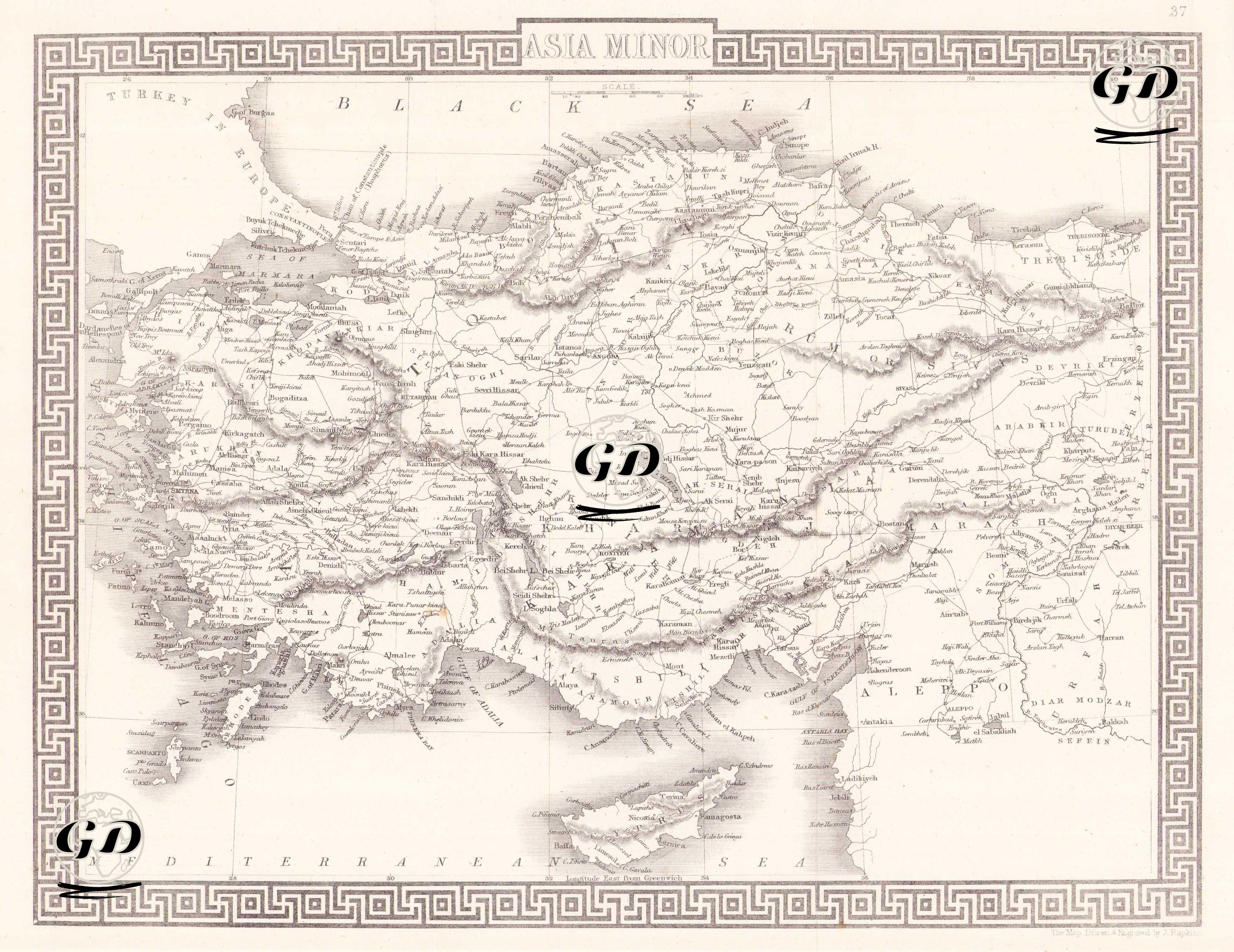
This map, published in the 1850s, is a woodcut historical geography map detailing the Anatolian peninsula, referred to as "Asia Minor" in its title. The map encompasses the western and central parts of the Ottoman Empire's Asian territories, with the Black Sea and Mediterranean clearly marked on the map, and various mountain ranges, rivers, and lakes inland are depicted in detail. Geographical designations were Latinized or adapted to Anglo-Saxon phonetics, as was common in Western cartography of the time. For example, Izmir is called "Smyrna," Konya "Iconium," Kayseri "Caesarea," Diyarbakır "Diarbekir," Gaziantep "Aintab," and Antalya "Adalia." The Greek key motif used in the map's frame reflects classical influences and the aesthetic sensibilities of 19th-century Europe.