GRAVÜR DÜNYASI
Digital Engraving Library
| Artist | Luigi Zuccoli (1815-1876) |
| Engraver | Luigi Zuccoli (1815-1876) |
| Date | 1840's |
| Technique | Copper Engraving |
| Category | Maps |
| Source | Milano Presso Luigi Zucoli Sotto il Coperto dei Figini |
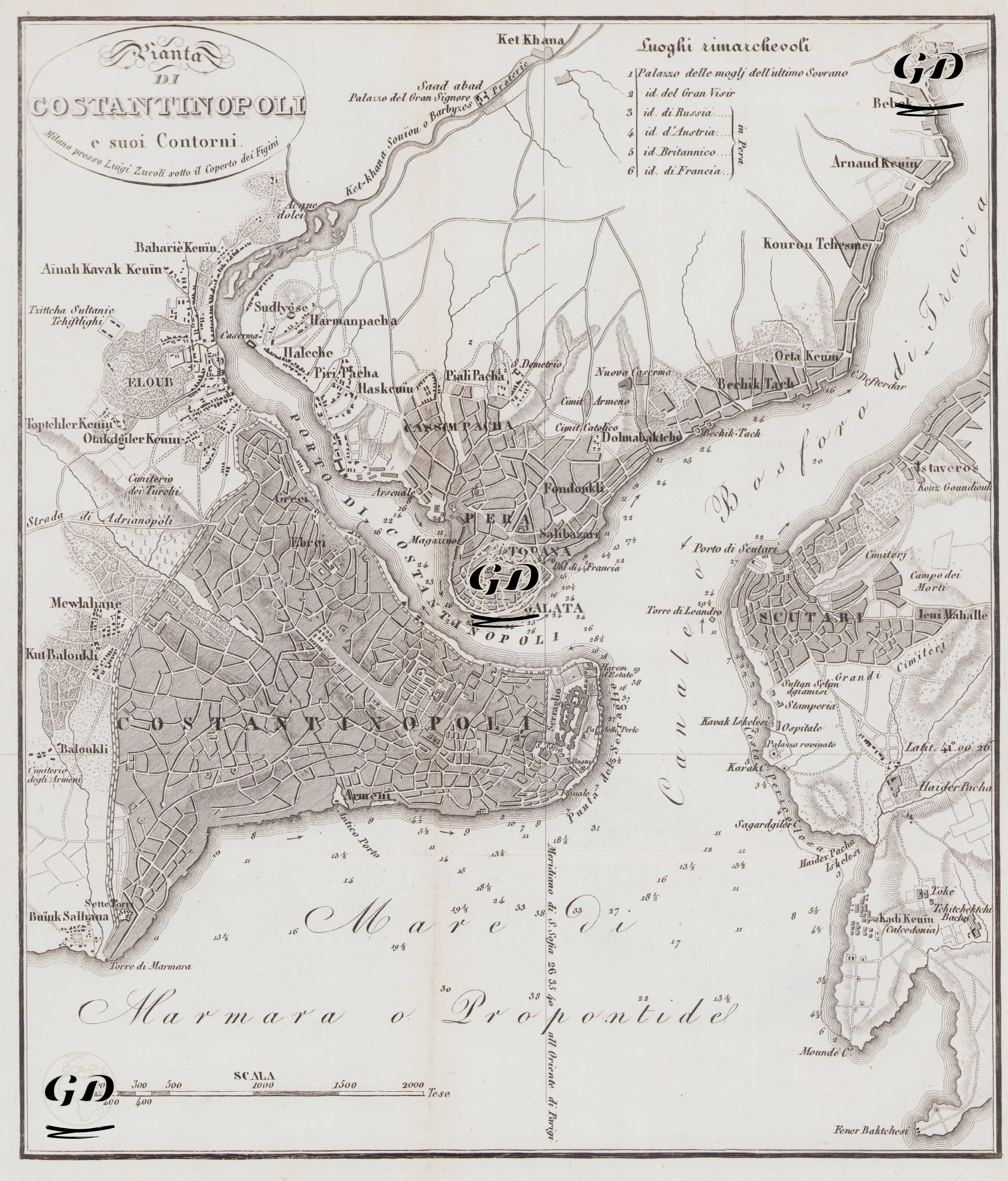
This 1840 map, titled "Plan of Istanbul and Its Surroundings," was prepared by the Italian painter and engraver Luigi Zuccoli (1815-1876). Created using copperplate engraving, the map's language is also Italian. Therefore, this map was prepared to provide the Italian public with a detailed overview of both the topographic and urban layout of the Ottoman capital and to provide visual information about eastern cities within the European cartography of the period. It focuses particularly on the period's European-centric diplomatic structures, important palaces and mansions, and the urban neighborhood layout. The legend titled "Notable Places" (Luoghi rimarchevoli) in the upper left corner lists some of the important structures marked on the map. These include the palace of the last Ottoman sultans, the Grand Vizier's mansion, and the embassy buildings of Russia, Austria, Britain, and France. It is specifically noted that all of these embassies were located in the Pera district. The map includes important areas such as the Historical Peninsula, Galata-Pera, the Bosphorus shores and Üsküdar-Kadıköy. Structures such as Topkapı Palace, Hagia Sophia, and the Sultanahmet Mosque have been carefully crafted; at the same time, embassy buildings and diplomatic missions have been emphasized as integral parts of the city's geography.