GRAVÜR DÜNYASI
Digital Engraving Library
| Date | 1890's |
| Technique | Chromolithograph |
| Category | Maps |
| Source | Brockhaus' Konversations-Lexikon, 14. Auflage - P.A. Brockhaus' Geogr.-artist. Anstalt, Leipzig |
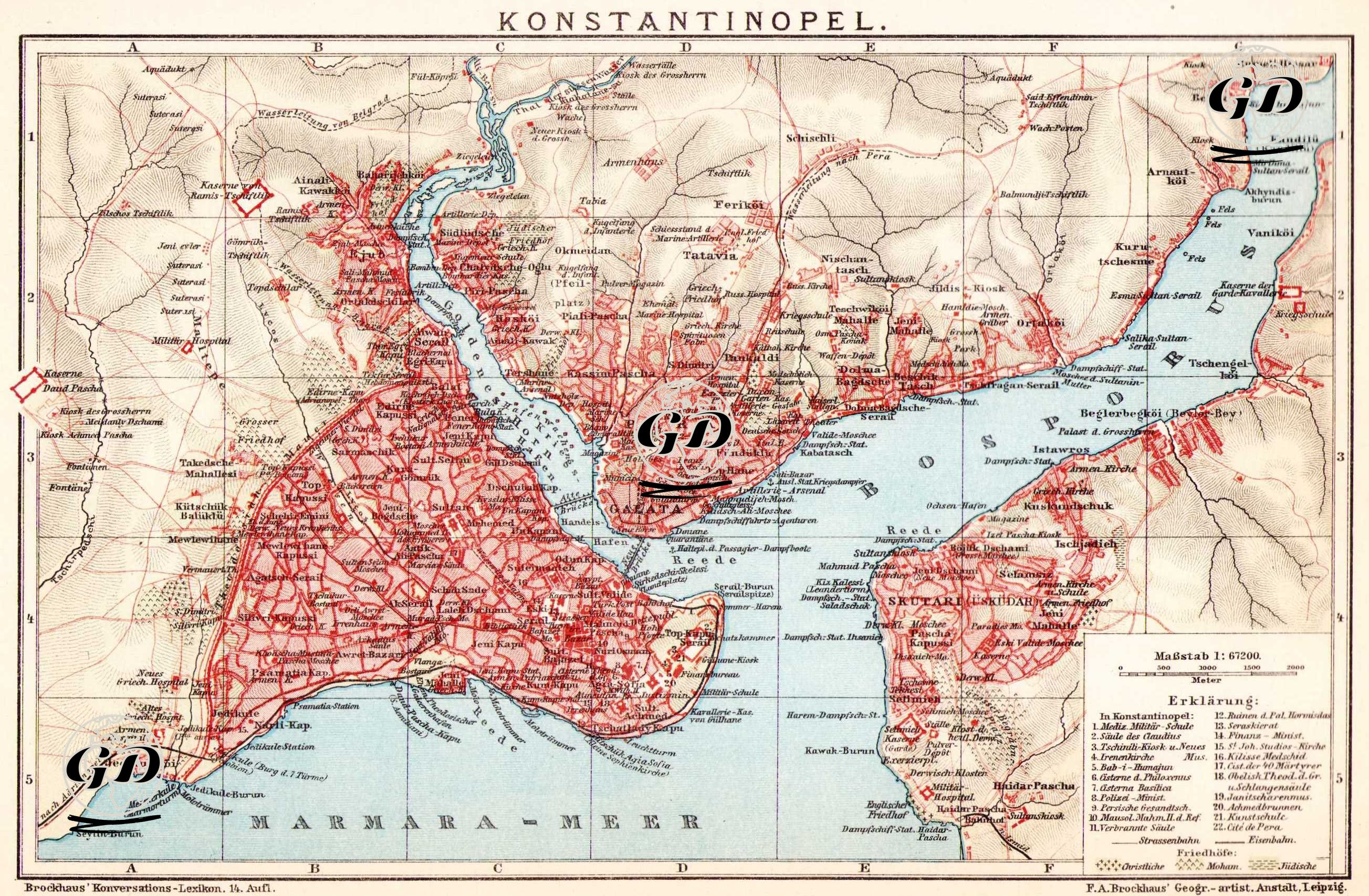
This map, from the 14th edition of Brockhaus Konversations-Lexikon, published in the 1890s, was prepared using colored lithography printed in Leipzig. The map, at a scale of 1:67,200, aims to introduce German readers to the Ottoman capital's urban organization by depicting both its geographical location and its main transportation and residential infrastructure in a multilayered manner. The city, situated within the triangle of the Sea of Marmara, the Golden Horn, and the Bosphorus, clearly depicts the Historical Peninsula, Pera/Galata, Eyüp, Üsküdar, and Kadıköy districts. The "Erklarung" table in the lower right corner of the map lists the city's major buildings, palaces, mosques, churches, and hospitals: Hagia Sophia, Topkapı Palace, the Sultanahmet Mosque, the Galata Tower, the Taksim Barracks, the Seraskerlik building, and the German Hospital. Furthermore, ferry terminals, tram routes, and railway stations (such as connections to Haydarpaşa and Sirkeci) that cross the continent are clearly included on the map. Neighborhoods such as Beykoz, Kandilli, and Vaniköy are located in the northeastern part of the Bosphorus, while peripheral settlements such as Bakırköy (Makriköy), Yeşilköy (San Stefano), and Ayastefanos are also included in the west. This map was published in Brockhaus Konversations-Lexikon, a German encyclopedia published under various names between 1789 and 2009.