GRAVÜR DÜNYASI
Digital Engraving Library
| Date | 1895 |
| Technique | Chromolithograph |
| Category | Maps |
| Source | Meyers Konversations-Lexikon, Bibliographisches Institut, Leipzig-Bibliographisches Institut in Leipzig |
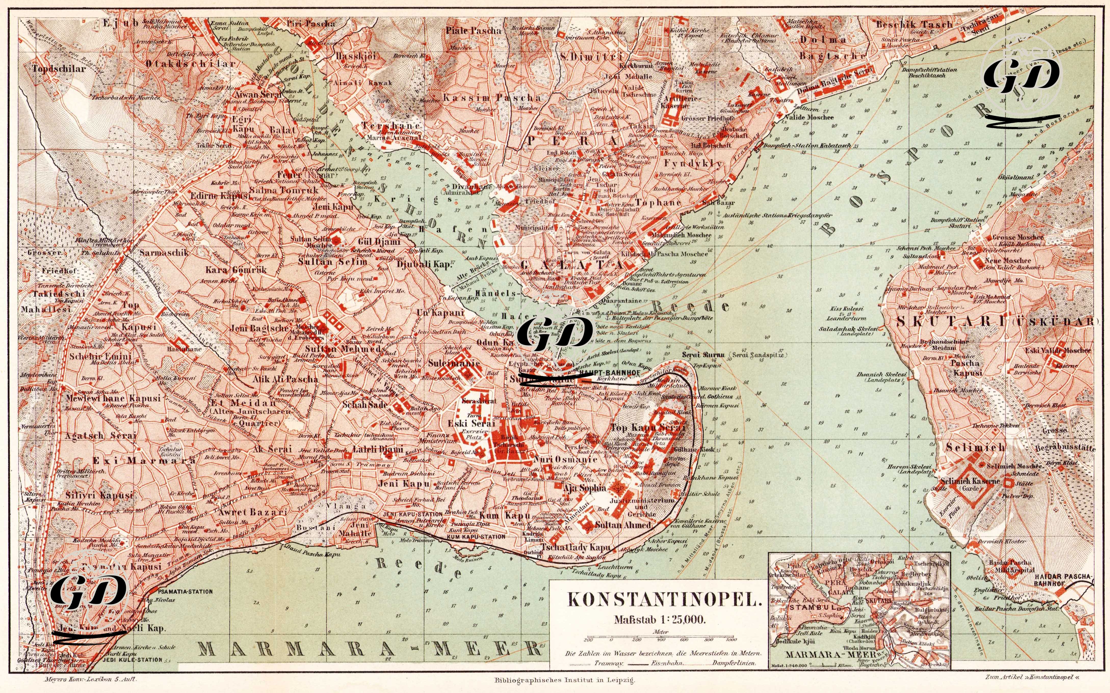
This map, dated 1895 and originally a German-language city plan published by the Bibliographisches Institut in Leipzig, presents Istanbul's late Ottoman geography, landmarks, and transportation infrastructure in great detail. The map is also in German. This colorful map, prepared at a scale of 1:25,000, shows in detail the historical peninsula (Stambul), Galata-Pera (Beyoğlu), and Üsküdar (Skutari), the three main settlements surrounding the Bosphorus, the Golden Horn, and the Sea of Marmara. The map includes city walls, gates (Yedikule, Silivri, and Edirne Kapı), main streets, squares, mosques (Hagia Sophia, Sultanahmet, and Süleymaniye), Topkapı Palace, the Grand Bazaar, train stations (Sirkeci and Haydarpaşa), tram lines, ferry piers, and port structures. In the Galata district, the German Protestant Church, the Tünel district, and the Taksim area are prominently displayed, while on the Üsküdar side, the Valide Mosque, Ayazma Mosque, and military facilities are highlighted. The small inset map in the lower right corner shows Istanbul's location on the Marmara coast. Coastal depths are given in meters, with figures in the water, indicating that the map was used not only for urban navigation but also for port and maritime navigation. Meyers Konversations-Lexikon, in which this map was published, is one of the most respected and widely used encyclopedias in Germany, published from 1839 to 1984.