GRAVÜR DÜNYASI
Digital Engraving Library
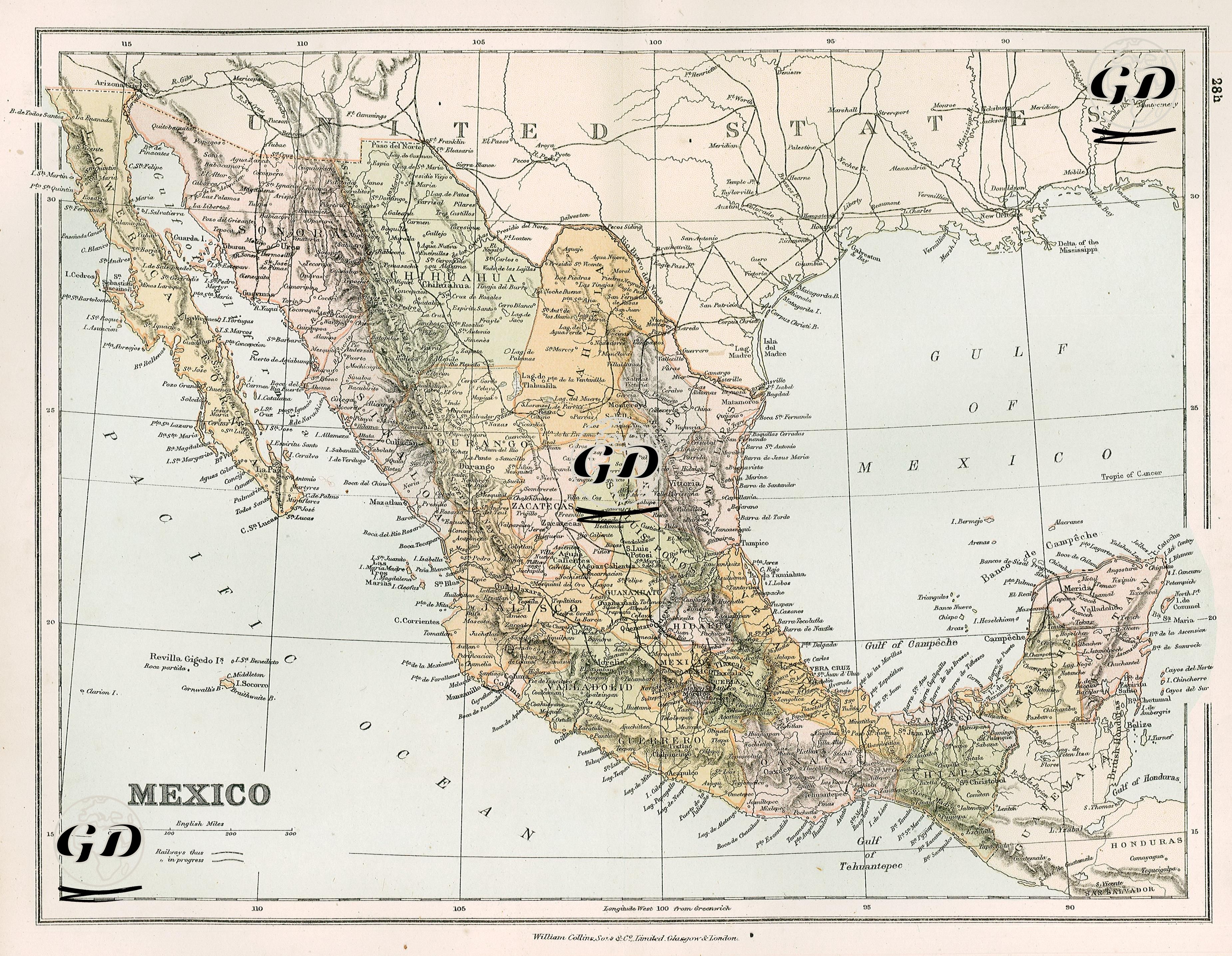
| Date | 1878 |
| Technique | Lithography-Colored |
| Category | Maps |
| Source | The Collegiate Atlas - William Collins Sons & Co. Limited, Glasgow & London |
This map dated 1878 shows Mexico's geography, state boundaries, major cities, and natural features in detail. Both sea routes and land routes are detailed, and mountain ranges and river systems are shown with topographic shading. It covers the region stretching from the United States border in the north to the Guatemala and Honduras borders in the south. It is bordered by the Gulf of Mexico to the east and the Pacific Ocean to the west. The map clearly reflects Mexico's state structure in the 19th century. Major states of present-day Mexico, such as Sonora, Chihuahua, Durango, Zacatecas, Jalisco, Guanajuato, Puebla, Oaxaca, Chiapas, Yucatan, Campeche, Tabasco, Veracruz, and Tamaulipas, are identified on the map. State borders are distinguished by different shades of color. The capital, Mexico City, is presented as the central point of the map, with road networks concentrated in the center; railroads and highways extending from there to the various state capitals are shown. The map carefully depicts mountain ranges such as the Sierra Madre Occidental and Sierra Madre Oriental. The Baja California Peninsula in the west is shown in particular detail, and ports such as La Paz, Loreto, and San Jose del Cabo are marked. Similarly, the Yucatán Peninsula in the east is presented in geographical detail, with important centers such as Merida, Campeche, and Valladolid identified. Coastal inlets such as the Gulf of Tehuantepec and the Gulf of Campeche are also named. The inclusion of the Isthmus of Tehuantepec on the map, in particular, indicates its strategic value as an alternative offshore transit point before the Panama Canal. Furthermore, Mexico's western offshore islands, such as the Revilla Gigedo Islands, are also shown at the bottom of the map.