GRAVÜR DÜNYASI
Digital Engraving Library
| Artist | John James Dower (1825-1901) |
| Engraver | John James Dower (1825-1901) |
| Date | 1870's |
| Technique | Steel Engraving (Text on Reverse) |
| Category | Maps |
| Source | Drawn&Engraved By John Dower 108 Fleet Street E.C. |
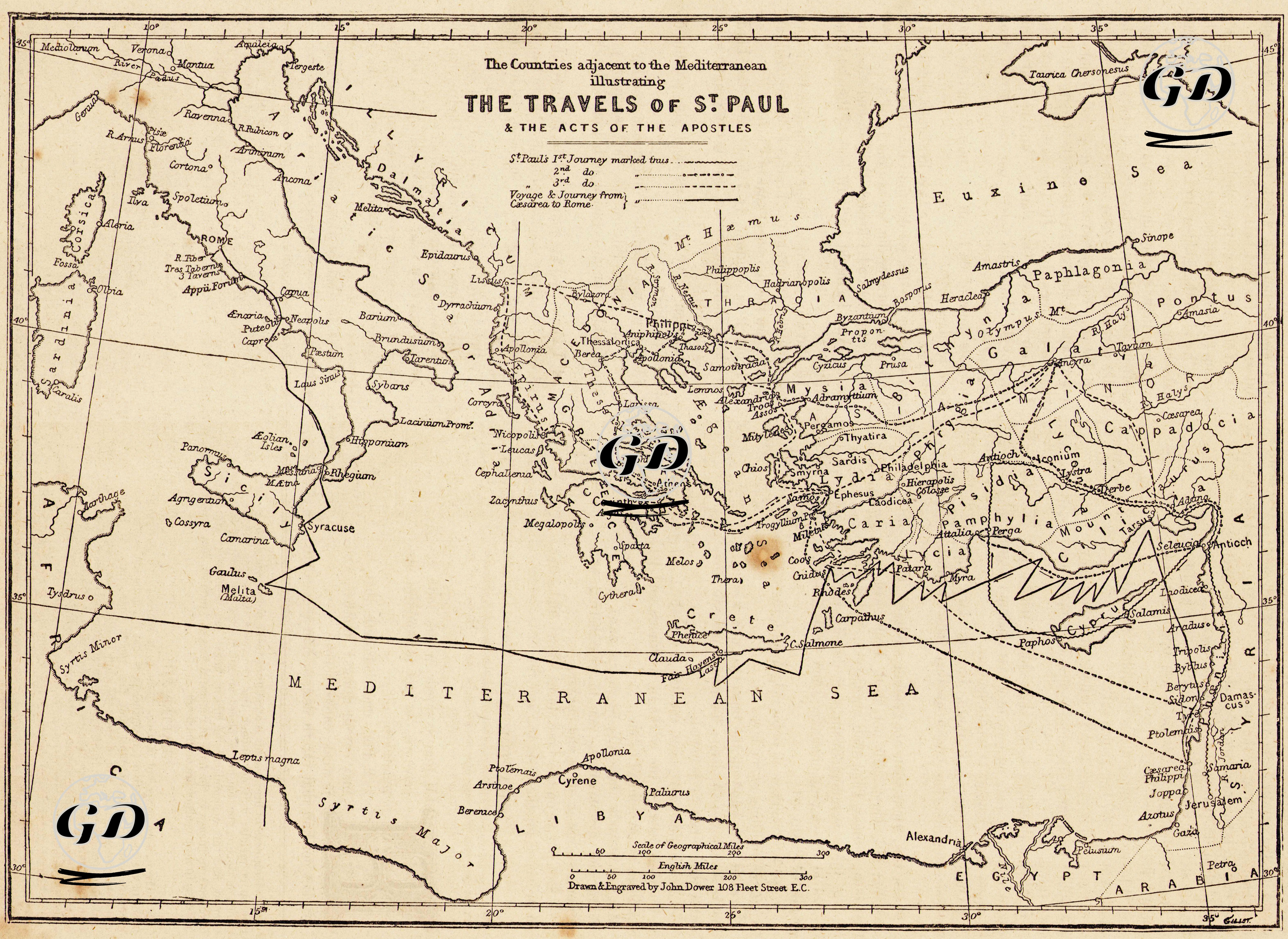
This map geographically illustrates the journeys of Saint Paul, a central figure in Christian history, as well as the events described in the Acts of the Apostles in the New Testament. It covers the countries surrounding the Mediterranean Basin, and distinguishes between the routes of Paul's first (--- line), second (… line), and third (— • line) missionary journeys, along with his voyage as a prisoner from Jerusalem to Rome (indicated by a zigzag arrow).The map details a wide geographical region—from Italy to Asia Minor, and from Greece to Cyprus and the lands of Palestine. It marks significant ancient cities where Paul preached or established Christian communities, including Rome, Corinth, Athens, Ephesus, Antioch, Tarsus, Philippi, Thessalonica, Derbe, Lystra, Iconium, and the Cypriot cities of Salamis and Paphos. One of the most striking features of the map is its clear representation of both land and sea routes, allowing the viewer to trace the paths of Paul's travels with precision. The episode in which Paul survives a shipwreck and reaches the island of Malta is also prominently highlighted as a key part of his Mediterranean journey. This map serves not only as a visual guide for researchers exploring the geographical context of biblical narratives, but also as a powerful illustration of the territorial spread of early Christian missionary activity.