GRAVÜR DÜNYASI
Digital Engraving Library
| Date | 1878 |
| Technique | Lithography-Colored |
| Category | Maps |
| Source | The Collegiate Atlas - William Collins Sons & Co. Limited, Glasgow & London |
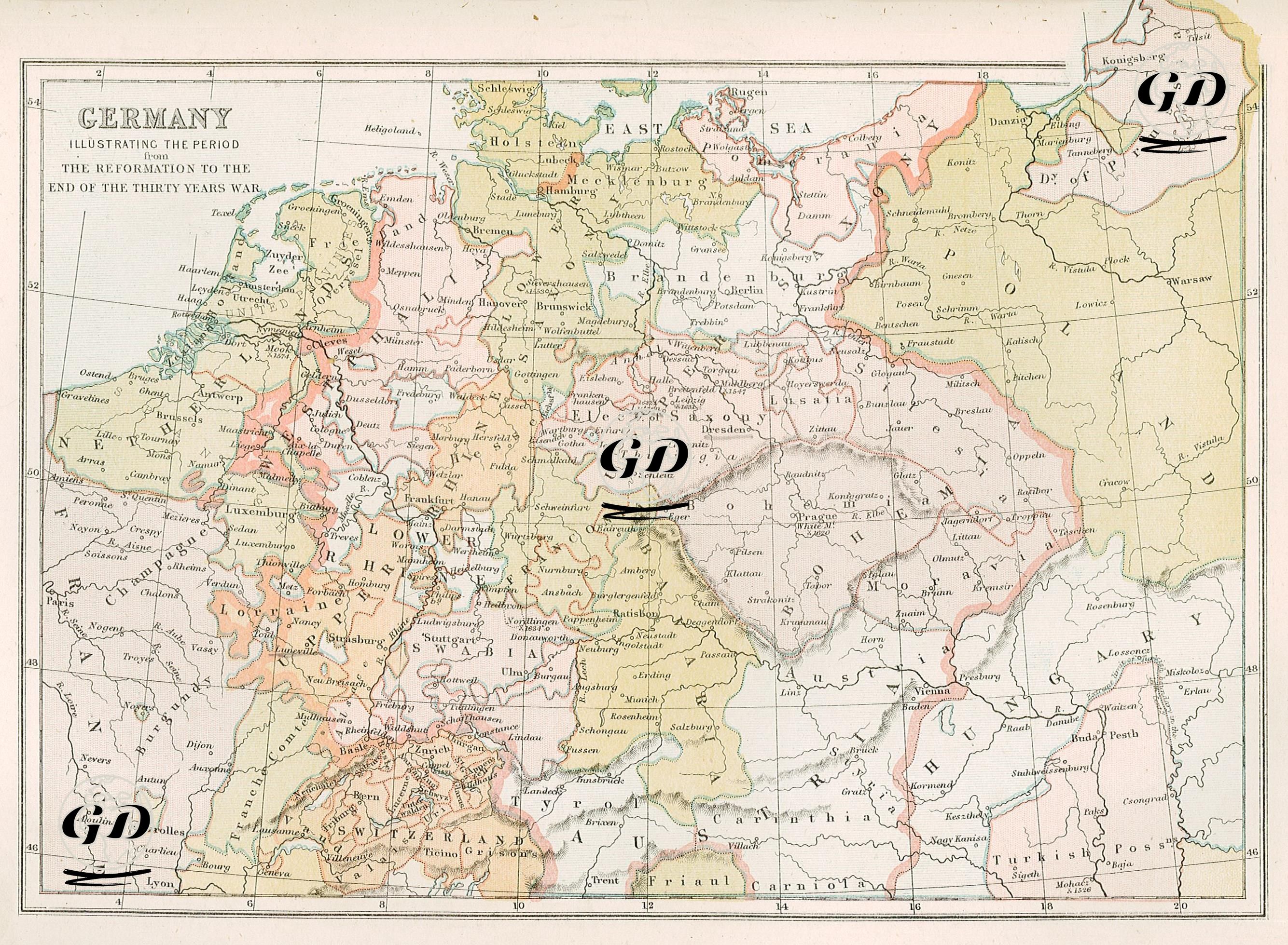
This map visualizes a period of profound religious and political transformation in Germany, particularly from the Reformation (1517) to the end of the Thirty Years' War in 1648. The map depicts Germany not as a modern nation-state, but as a feudal mosaic composed of numerous independent or semi-independent principalities, duchies, bishoprics, city-states, and autonomous regions. Among these are major principalities such as Brandenburg, Saxony, Bavaria, Hesse, Württemberg, the Palatinate, and Bohemia, as well as autonomous cities such as Hamburg, Bremen, Lübeck, and Frankfurt. Larger regional associations such as the "Low Rhenish," "Upper Saxon," and "Franconian Circle" or Imperial Departments (Reichskreise) can also be identified. This structure demonstrates that the Holy Roman Empire was a "political organism" held together by scattered and loose ties rather than a centralized state. It also reveals the extent to which religious divisions permeated a complex geopolitical structure. During this period, Germany witnessed a deep division between Protestantism and Catholicism, sparked by the Reformation, which began with Martin Luther's posting of the Ninety-Five Theses in Wittenberg in 1517. Protestant principalities (e.g., Brandenburg and Mecklenburg) were particularly concentrated in northern and northeastern Germany, while Catholic regions (e.g., Bavaria and Austria) were concentrated in the south and west. These religious differences later became a major source of both social and military conflict, and the Thirty Years' War of 1618-1648 devastated much of Germany. The map also shows neighboring countries such as the Kingdom of Bohemia (now the Czech Republic), the Archduchy of Austria, the Kingdom of Poland, the Kingdom of Hungary, and the Turkish Possessions, clarifying the Habsburg monarchy's sphere of influence. The region known as the "Turkish Possession" depicts Ottoman rule in Hungary.