GRAVÜR DÜNYASI
Digital Engraving Library
| Artist | William Hughes (1818-1876) |
| Engraver | William Hughes (1818-1876) |
| Date | 1850 |
| Technique | Steel Engraving |
| Category | Maps |
| Source | London, Published By Longman & Co.1850 |
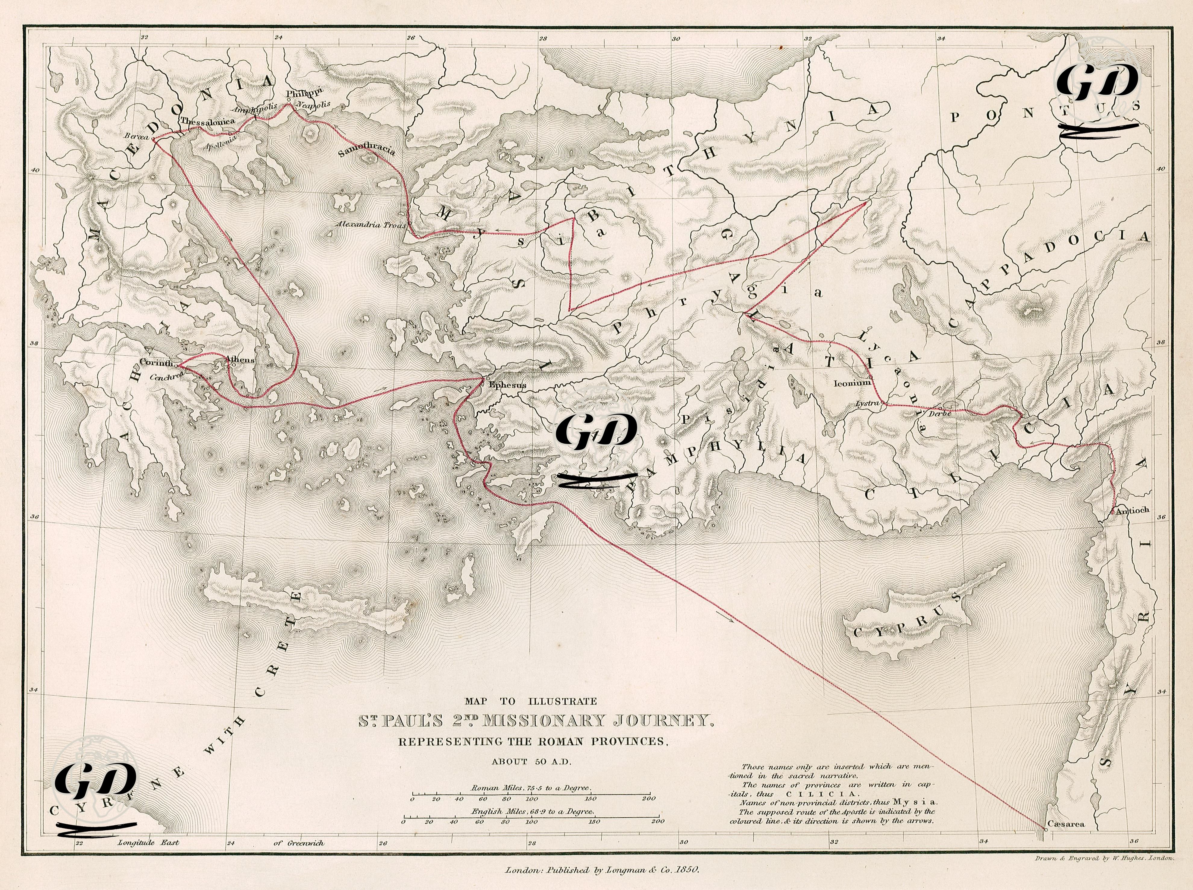
This map provides a geographical depiction of Saint Paul’s second missionary journey, which took place around AD 50 as described in the Acts of the Apostles in the New Testament. It is designed to include the boundaries of Roman provinces, offering both religious and political context. Saint Paul’s journey was a key milestone in the spread of Christianity from Asia Minor and Greece into Europe. During this mission, the foundations of the first Christian communities were laid in important cities such as Philippi, Thessalonica, and Corinth. The map covers a wide area including most of the Anatolian Peninsula, the Aegean Islands, Greece, Cyprus, and the Levantine coast. The route is traced with red lines and arrows, indicating the cities visited by Saint Paul for preaching, teaching, and establishing Christian congregations. The journey begins in Antioch in Syria, proceeding through Tarsus, Derbe, Lystra, Iconium (modern-day Konya), and Antioch in Pisidia, then continues into the regions of Phrygia and Galatia, reaching the Aegean coast via Troas. From there, Paul crosses into Macedonia, visiting Philippi, Amphipolis, Thessalonica, and then travels to Athens and Corinth. The return leg passes through Ephesus, Miletus, and the island of Rhodes. The map clearly marks the names of Roman provinces in large capital letters—such as Asia, Galatia, Cappadocia, Phrygia, Lycia, and Cilicia—and identifies the cities Paul is known to have visited within each. Thanks to these details, the map functions not only as a representation of missionary routes but also as a significant source for understanding the political geography of the Roman Empire during that era. Published in 1850 in London by Longman & Co., the map is an important resource for scholars of Christian history, biblical studies, and ancient Roman geography.