GRAVÜR DÜNYASI
Digital Engraving Library
| Date | 1878 |
| Technique | Lithography-Colored |
| Category | Maps |
| Source | The Collegiate Atlas - William Collins Sons & Co. Limited, Glasgow & London |
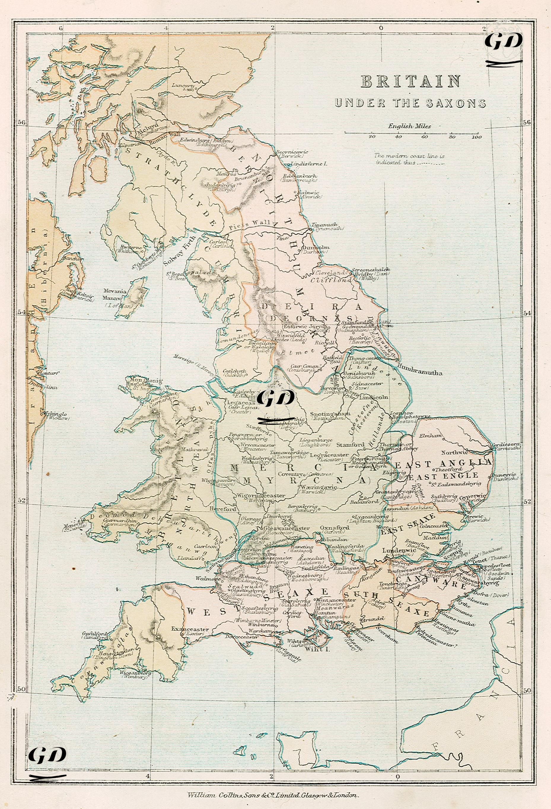
This map details the political geography of the Saxon (Anglo-Saxon) kingdoms that emerged in Britain after the end of Roman rule. This 1878 map, titled "Britain in the Saxon Period," visualizes the independent kingdoms of Saxon, Anglo-Saxon, and Jute origins that emerged on the British Isles from approximately the mid-5th century to the late 9th century. The map identifies kingdoms designated by various colors over modern England, leaving areas such as Scotland in the north and Wales in the west in different shades, clearly indicating that these areas remained outside Saxon rule. The seven major kingdoms prominently displayed on the map reflect what is referred to in historical literature as the "Heptarchy" (the Seven Kingdoms). These include Northumbria (formed by the union of Deira and Bernicia), Mercia, East Anglia, Essex (East Saxons), Sussex (South Saxons), Wessex (West Saxons), and Kent (Jute origin). These kingdoms are named for both their ethnic origins and their geographical features. For example, "East Saxons" refers to the Saxons in the east, "West Saxons" to the Saxons in the west, while names like "Anglia" and "Mercia" represent different origins and regions. The map also details historical cities and settlements: London, Canterbury, Winchester, York (Eoforwic), Lincoln, Exeter, and others were important centers of the Saxon era. These cities played key roles in administration, trade, and early Christianization. Roads like "Watling Street" and similar roads are also depicted on the map; these were often strategic transportation lines inherited from the Roman period and used by the Saxons. Britonic kingdoms such as Strathclyde in the north, indigenous peoples in the west of Cambria (Wales) who maintained their independence (e.g., Gwynedd and Powys), and Irish influence in the west (Hibernia) are clearly defined on the map. Much of Scotland was not yet a unified kingdom; Picts, Scots, and other indigenous communities lived in their own regions.