GRAVÜR DÜNYASI
Digital Engraving Library
| Date | 1878 |
| Technique | Lithography-Colored |
| Category | Maps |
| Source | The Collegiate Atlas - William Collins Sons & Co. Limited, Glasgow & London |
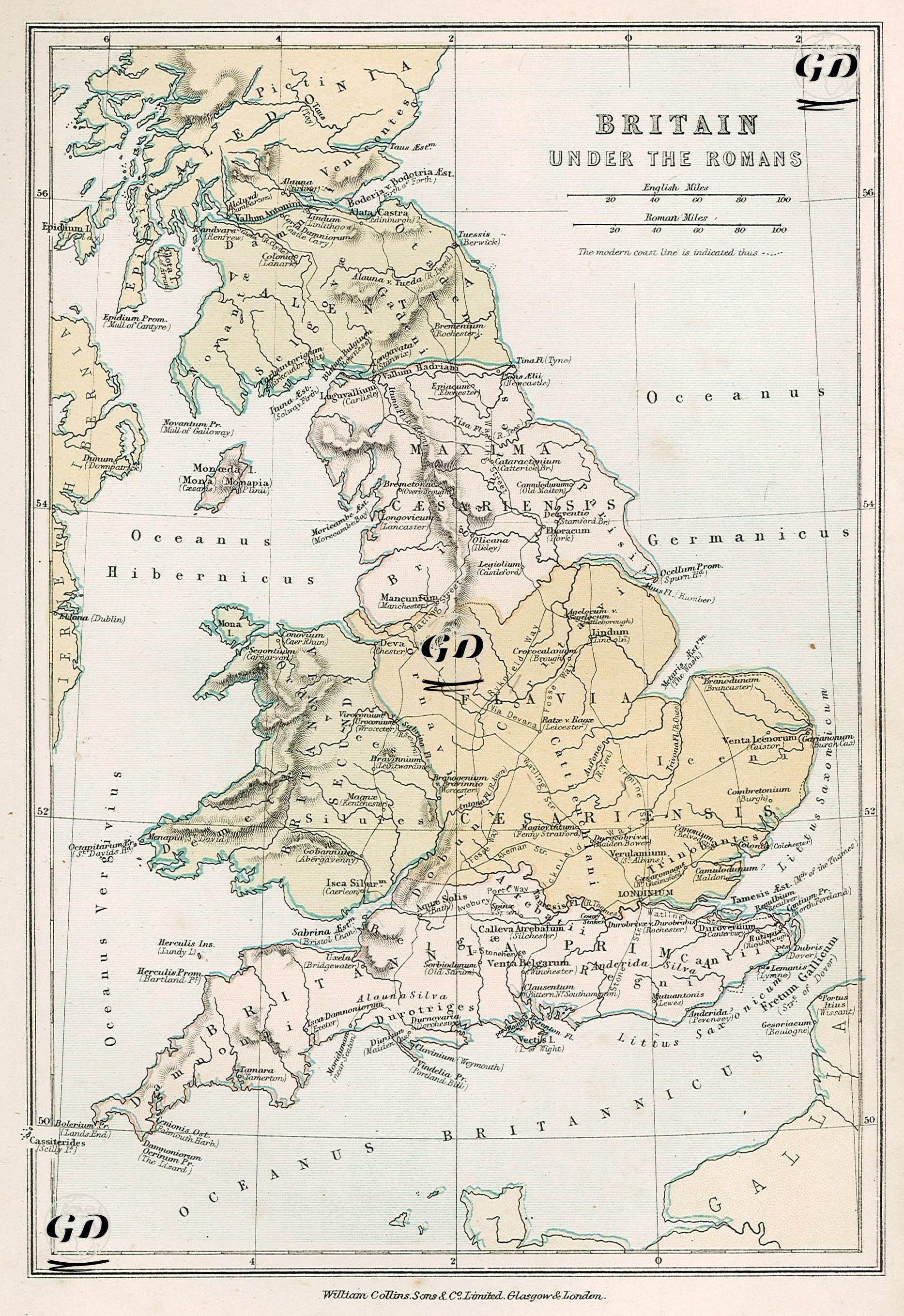
This map shows in detail the administrative and military structures established on the island of Britain during the Roman Empire. Titled "Britain Under the Romans," the 1878 map visualizes how the southern, central, and eastern parts of modern Britain were brought under Roman rule and how they were divided into regions. Roman-era provincial borders are marked on the map with their Latin names: for example, "Britannia Prima," "Britannia Secunda," "Flavia Caesariensis," "Maxima Caesariensis," and "Valentia," reflecting the administrative division of Britain during the late Roman period. These names indicate that Rome administered both military and civil rule to the region, and that this rule was linked to a centralized state structure. Numerous ancient Roman cities are also included on the map. Cities such as Londinium (London), Eboracum (York), Camulodunum (Colchester), Verulamium (St Albans), Glevum (Gloucester), Isca Silurum (Caerleon), and Venta Belgarum (Winchester) served as Roman military bases, trading centers, and local administrative centers. These cities, connected by Roman roads, are clearly marked on the map. These roads provide important information about how Rome organized its military mobility and communication network in Britain. Geographically, the map designates the western part of the British Isles as "Oceanus Hibernicus" (Irish Sea), the eastern part as "Oceanus Germanicus" (Northern Sea), and the southern part as "Oceanus Britannicus" (English Channel). Furthermore, to the north, towards the present-day borders of Scotland, is Hadrian's Wall, representing Roman Britain's northern border and military defense line against barbarian tribes. The map indicates that Roman Britain encompassed all of present-day England and Wales, while only the southern part of Scotland was under its control. The northern parts of Scotland are colored differently on the map, representing areas inhabited by non-Roman tribes such as the "Caledonii" and "Picti." This reveals that Rome was never able to completely break the resistance in the north, and despite establishing garrisons in these regions, it was unable to establish direct administrative control.