GRAVÜR DÜNYASI
Digital Engraving Library
| Artist | Aaron Arrowsmith (1750-1823) |
| Engraver | Sidney Hall (1788-1831) |
| Date | 1821 |
| Technique | Copper Engraving |
| Category | Maps |
| Source | Published For The Society For Promoting Christian Knowledge By Mess. Rivingtons, St.Pauls Church Yard London, April 2 1821 |
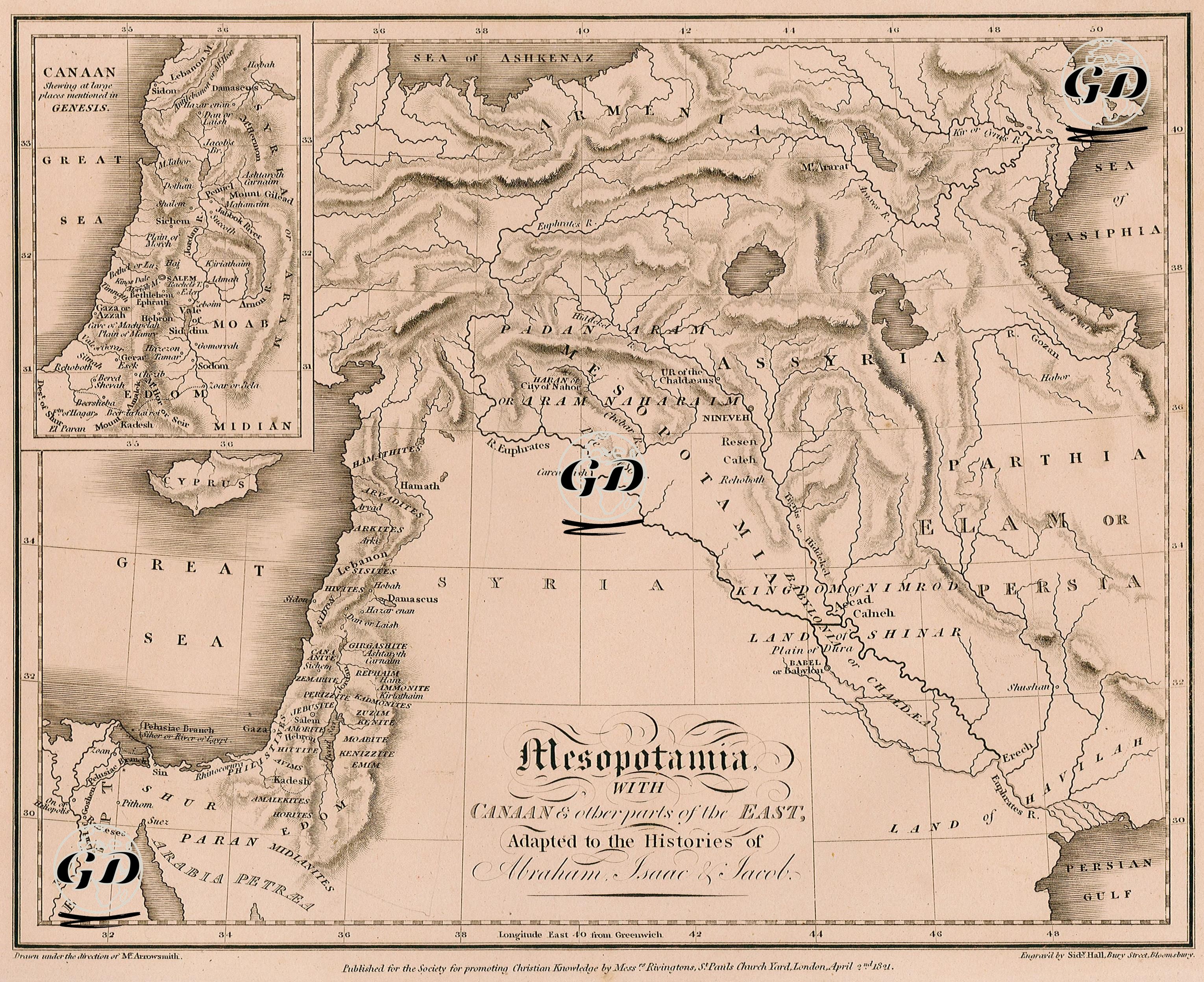
This map is an early example of biblical cartography that interprets the geographies of Mesopotamia and Canaan in the context of the Holy Scriptures, particularly adapted to the time and lives of Abraham, Isaac, and Jacob. At the center of the map lies Mesopotamia, with the fertile lands between the Euphrates and Tigris Rivers—highlighting historically and theologically significant cities such as Chaldea, the Land of Shinar, Ur, Babel (Babylon), Calneh, Erech, and Nineveh. These locations serve as key reference points for the sacred journeys beginning from Ur of the Chaldees, Abraham’s birthplace (located in today’s Dhi Qar province near the city of Nasiriyah, Iraq). In the top-left inset, the map features a separate section for the Land of Canaan, presenting it in detail according to the Book of Genesis, including the territorial divisions of the Twelve Tribes of Israel. Frequently mentioned cities in historical and religious texts such as Tyre, Sidon, and Joppa on the Mediterranean coast, as well as Hebron, Bethel, and Shechem in the interior, are clearly indicated. The map also includes semi-mythological regions and figures such as the "Kingdom of Nimrod", the "Land of Nod", the "Land of Cush", and the "Land of Raamah", indicating that the map carries not only historical but also strong theological significance. Published in the 19th century by the Society for Promoting Christian Knowledge, this map aimed to enhance biblical literacy of the time. It stands as a valuable document in terms of both historical cartography and theological reference.