GRAVÜR DÜNYASI
Digital Engraving Library
| Date | 1878 |
| Technique | Lithography-Colored |
| Category | Maps |
| Source | The Collegiate Atlas - William Collins Sons & Co. Limited, Glasgow & London |
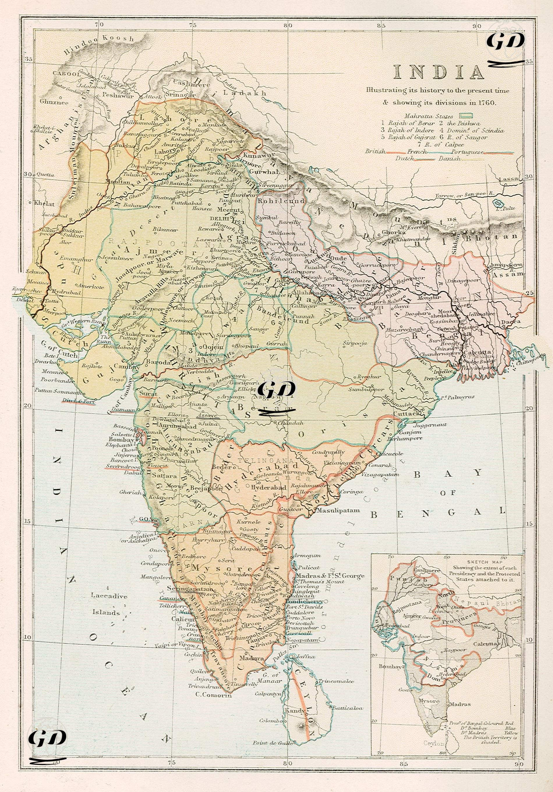
This map reflects the political and administrative structure of the Indian subcontinent in 1760, while also depicting the balance of power at the beginning of the colonial era and the major states of Indian history. The caption in the upper right corner of the map indicates that this map aims to show how India was partitioned among Britain, France, Portugal, the Netherlands, and Denmark in 1760, and its status in 1878. The map depicts numerous native dynasties, distinguished by color and borders; these states are numbered under the heading "Mahatta States" (Maratha States): 1. Rajah of Berar, 2. Holkar, 3. Rajah of Indore, 4. Powar of Scindia, 5. Bhonslah of Nagpur, 6. Rajah of Satara, 7. Gaekwar of Guzerat, 8. Rajah of Cutch. This structure shows how the Maratha Confederacy spread over a wide geographical area in India in the mid-18th century and how its subunits existed at autonomous levels. In addition, the map marks some coastal settlements under British control (such as British trading centers like Calcutta, Bombay, and Madras), along with French, Dutch, Portuguese, and Danish colonial settlements. These bear traces of the early competition and trade networks of European powers in India. The French settlement of Pondicherry in the south and the Portuguese region of Goa in the west are particularly striking examples of this colonial legacy. A small outline map in the lower right corner of the map outlines the expansion of territories under the British East India Company. The map also visualizes the aftermath of the Battle of Plassey in 1757, when Bengal came under direct British influence. The eastern part of Bengal is shown in a different color than the other regions, emphasizing the map's representation of this early colonization process.