GRAVÜR DÜNYASI
Digital Engraving Library
| Date | 1878 |
| Technique | Lithography-Colored |
| Category | Maps |
| Source | The Collegiate Atlas - William Collins Sons & Co. Limited, Glasgow & London |
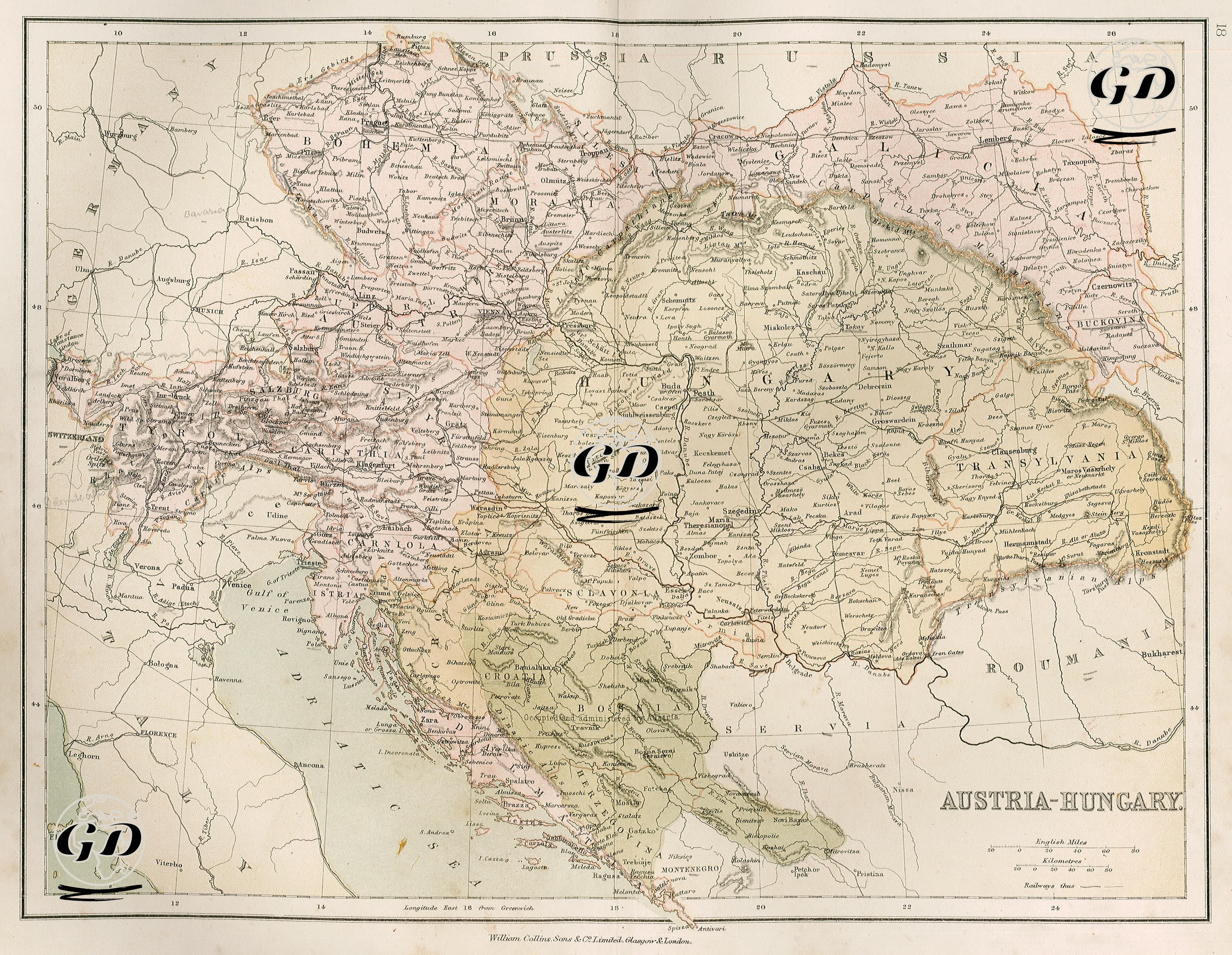
This color map from 1878 depicts the political, geographic, and ethnic structure of the Austro-Hungarian Empire. 1878 coincides with the period following the 1867 Treaty, which transitioned the Austro-Hungarian Empire to a Dual Monarchy. With this system, the empire was divided into two distinct administrative regions: Austria (Cisleithania) and Hungary (Transleithania). The Austrian wing in the west of the map includes Bohemia, Moravia, Lower Austria, Upper Austria, Salzburg, Carinthia, and Styria, with Vienna as its capital. The Hungarian wing in the east, centered on Budapest and Pest, is divided into subregions such as Hungary, Transylvania, Slavonia, and Croatia. Beyond this two-wing structure, Bosnia and Herzegovina was seized from the Ottoman Empire at the 1878 Congress of Berlin and occupied by Austria. While this region is not yet shown in detail on the map, the borders with Serbia (Servia) and Romania (Roumania) are noteworthy. The physical structure of the map is also striking; the Alps chain, starting from the Swiss border in the west and extending eastward into Austria, is highlighted by the shading method, and the mountainous areas are given in detail. The Danube River, originating in Germany and flowing through northern Austria via Budapest, reaches the Romanian border. The map carefully depicts the settlements and transportation network along its course. The Adriatic coast encompasses the regions of present-day Slovenia and Croatia, and the port of Trieste appears to have been a vital point for Austria's maritime trade. Important railway lines and intercity roads are carefully plotted on the map, providing insight into the post-industrial transportation network of the period. Prominent settlements include Vienna, the imperial capital of Austria; Budapest, the cities on both banks of the Danube not yet united, designated as Buda & Pesth; Prague (Praha), the cultural center of Bohemia; Lemberg (present-day Lviv, Ukraine), the important center of Galicia; Trieste, Austria's main maritime gateway; and the strategic Adriatic ports of Zara, Ragusa, and Spalato (present-day Dalmatian coastal cities).