GRAVÜR DÜNYASI
Digital Engraving Library
| Date | 1878 |
| Technique | Lithography-Colored |
| Category | Maps |
| Source | The Collegiate Atlas - William Collins Sons & Co. Limited, Glasgow & London |
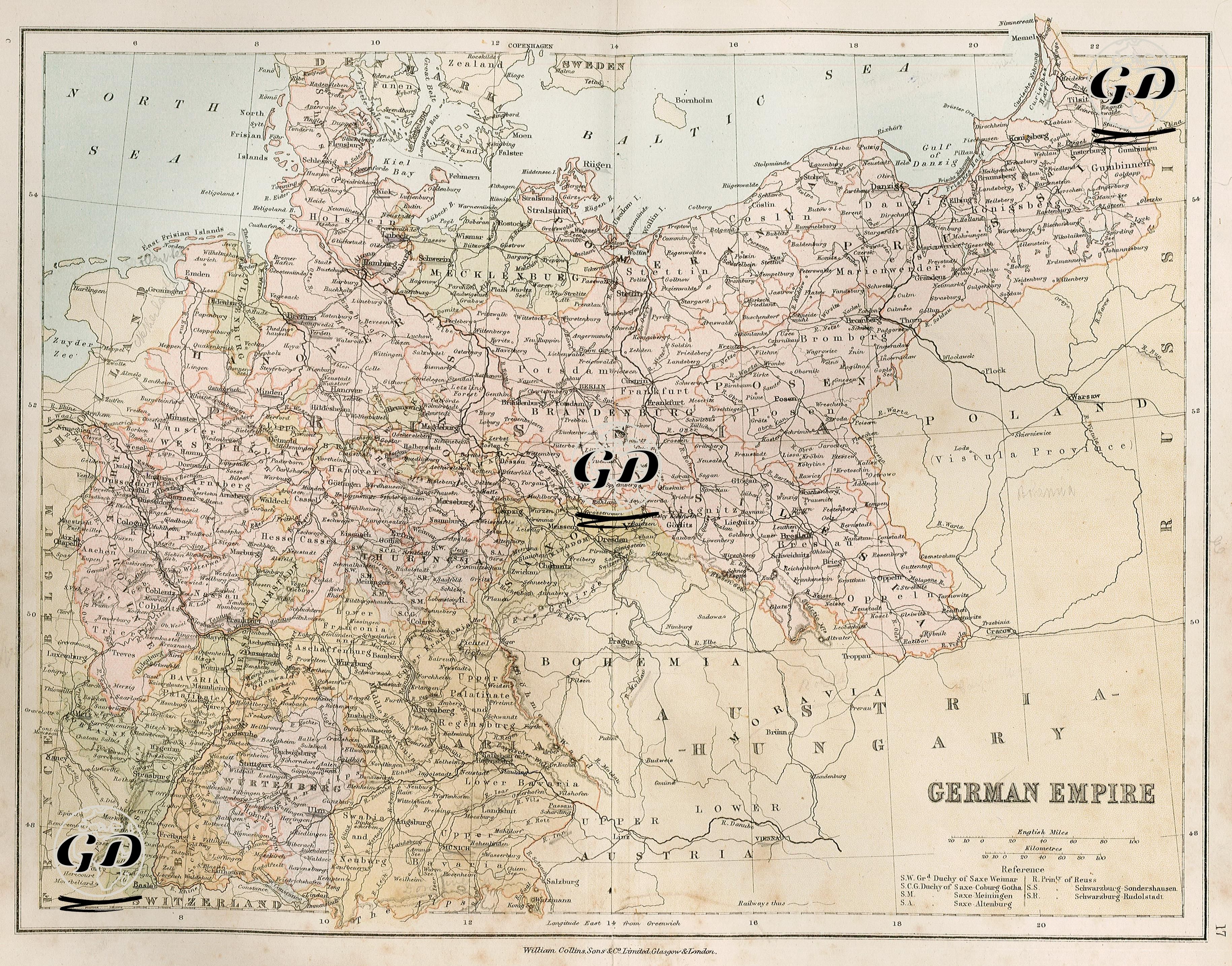
This map is a detailed map of the German Empire, depicting the political and administrative structure of Germany in the late 19th century. The German Empire, founded in 1871 and unified under Prussian leadership, clearly demonstrates both its federal structure and its regional diversity. In the eastern part of the map, Prussia occupies a large area, with Berlin as its capital. Prussia's eastern borders extend to include parts of Poland. In the western and southern parts of the map, independent kingdoms, grand duchies, duchies, and principalities such as Bavaria, Württemberg, Baden, and Hesse are shown as other members of the federal system. The Kingdom of Bavaria, located in southwestern Germany, is particularly concentrated around Munich, while the northern regions of Hanover, Mecklenburg, and Schleswig are also prominent. The legend in the lower right corner of the map provides a reference point for distinguishing complex dynastic structures such as the Duchies of Saxony. The Austro-Hungarian Empire and the Russian Empire, which lie outside the borders of the empire, are notable as Germany's eastern and southeastern border neighbors. In addition, the fact that the Alsace-Lorraine region belongs to Germany indicates the lands taken from France after the Treaty of Frankfurt in 1871.