GRAVÜR DÜNYASI
Digital Engraving Library
| Artist | Jean Baptiste Bourguignon D'Anville (1697-1782) |
| Engraver | Joseph Bye (1779-1817) |
| Date | 1808 |
| Technique | Copper Engraving |
| Category | Maps |
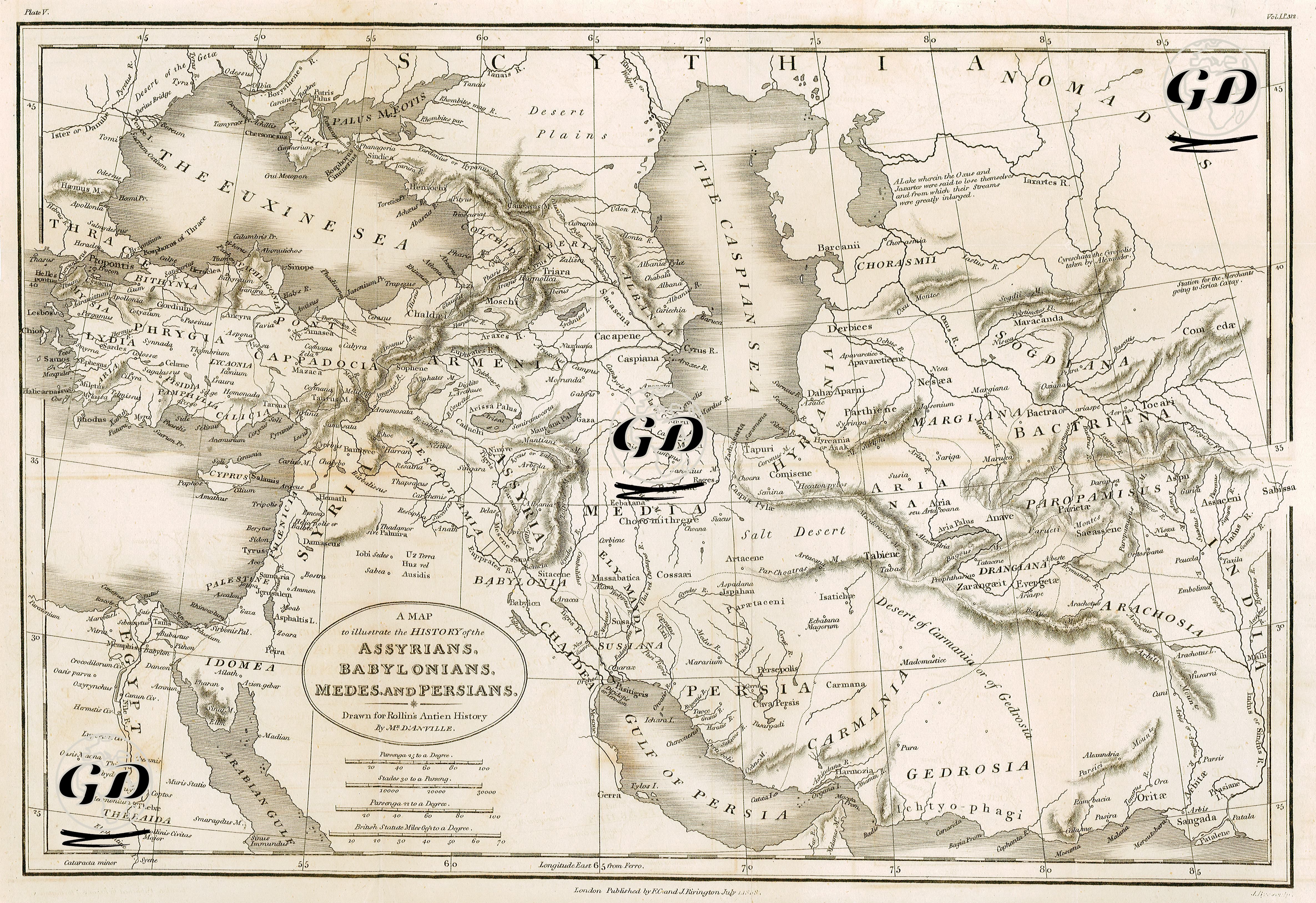
| Source | The ancient history of the Egyptians, Carthaginians, Assyrians, Babylonians, Medes and Persians, Grecians and Macedonians. Translated from the French. 11th ed., rev., corr. and illus. with a set of maps newly engraved by Charles Rollin - London Published By F.C. And J.Rivington July 1 1808 |
This map is a classical representation of the ancient geography of Mesopotamia, Iran, and Central Asia, depicting the territorial layout of the Assyrian, Babylonian, Median, and Persian civilizations. Based on Charles Rollin’s Ancient History, the map illustrates in detail the dominions, capitals, military routes, and neighboring peoples of the great eastern empires that ruled the region between 2000 BCE and 330 BCE. Notable ancient capitals such as Babylon, Nineveh, Susa, Ecbatana, Persepolis, and Pasargadae are prominently marked. The Mesopotamian region, nourished by the Euphrates and Tigris rivers, along with the Elamite and Persian lands east of the Zagros Mountains, are shown as densely populated political and cultural centers. The map also highlights the domain of the Medes and the territorial expansion of the Persians, representing a vision of empire that extended deep into the heart of Asia. Contact with northeastern steppe peoples such as the Scythians, Massagetae, and Sogdians reflects the Persian Empire’s reach into Central Asia. Cities and roads used as axes on the map reveal not only trade routes but also the paths of military campaigns. In addition to its value in ancient geographical knowledge, this map serves as a historically and topographically significant resource for understanding inter-imperial relations in the Ancient Near East.