GRAVÜR DÜNYASI
Digital Engraving Library
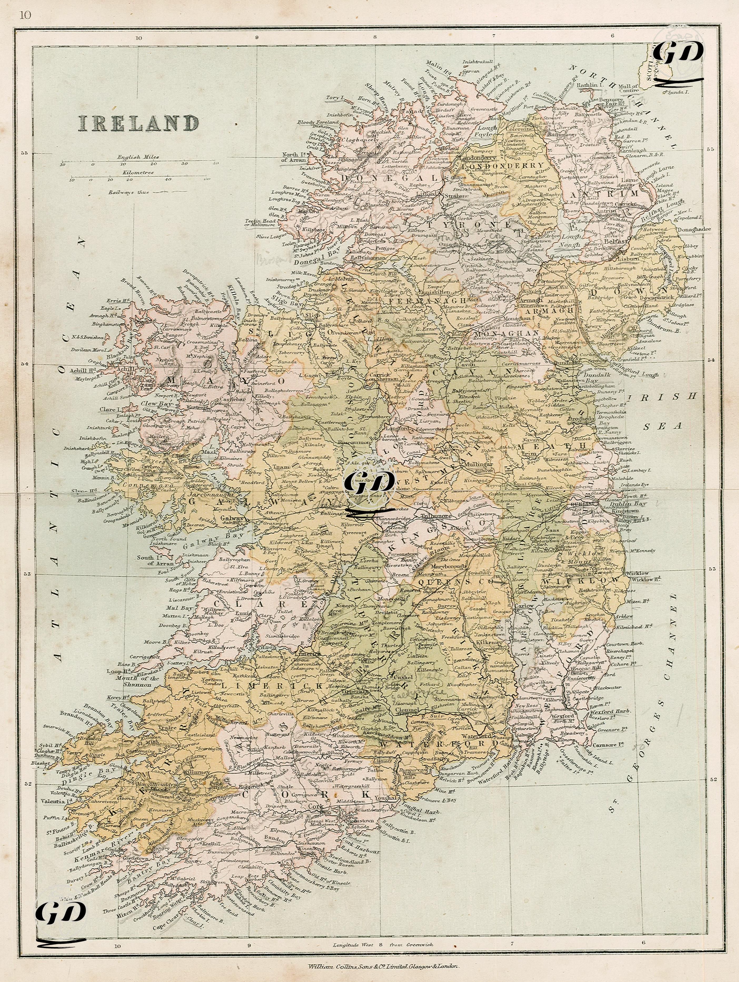
| Date | 1878 |
| Technique | Lithography-Colored |
| Category | Maps |
| Source | The Collegiate Atlas - William Collins Sons & Co. Limited, Glasgow & London |
This 1878 color map of Ireland presents both a physical and administrative view of the island of Ireland. Mountain ranges are shown in relief shading, and colored areas clearly indicate Ireland's 32 counties. It also depicts Ireland as a whole under British rule before the independence movement in the early 20th century. The map depicts the entire island, now divided into Northern Ireland and the Republic of Ireland, as a single political unit. The 32 counties, separated by color, provide a highly detailed geographical and administrative representation, including their capitals, port cities, coastal towns, mountains, and rivers. The map is bordered by the Atlantic Ocean to the west, the Irish Sea and the North Channel to the east, and St. George's Channel to the south. The highlands of the west coast, particularly Connemara, Macgillycuddy's Reeks, and the Donegal Highlands, are prominently depicted on the map. Lough Neagh, Ireland's largest lake, is prominently featured in the northeast, and the River Shannon, the country's most important waterway running from the center to the southwest, is also detailed. The coastlines and islands are also detailed, with islands such as Achill, the Aran Islands, Cape Clear, and Tory appearing on the map. The capital, Dublin, is clearly marked on the east coast, and other major cities such as Cork, Limerick, Galway, Belfast, and Derry (Londonderry) are presented along with their county capitals. Belfast, while prominently featured on the map, reflects its less densely populated state before its modern industrial prominence.